
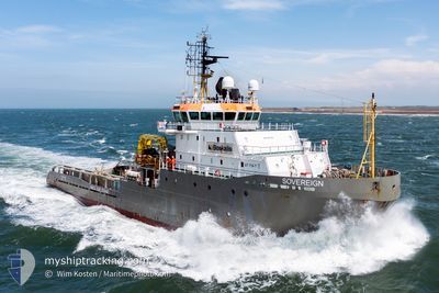
SOVEREIGN
Anchor Handling Vessel
Current Trip
USPVD
| Time Travelled | 7 days |
|---|---|
| Remaining Time | --- |
| Distance Travelled | 198.09 nm |
| Remaining Distance | --- |
| AVG Speed | 8.8 Knots |
| MAX Speed | 11.4 Knots |
| AVG Wind | 12.5 knots |
| MAX Wind | 22 knots |
| MIN Temp | 8°C / 46.4°F |
| MAX Temp | 14.9°C / 58.82°F |
| Draught | 7.5 m |
| Position Received | 7 d ago |
Current Position
| Longitude | -71.29990° |
|---|---|
| Latitude | 41.62783° |
| Status | Under way using engine |
| Speed | 11.3 Knots |
| Course | 160.5° |
| Area | North Atlantic Ocean |
| Station | T-AIS |
| Position Received | 7 d ago |
Info
Information
The current position of SOVEREIGN is in North Atlantic Ocean with coordinates 41.62783° / -71.29990° as reported on 2024-04-27 22:03 by AIS to our vessel tracker app. The vessel's current speed is 11.3 Knots
The vessel SOVEREIGN (IMO: 9262742, MMSI: 205644000) is a Anchor Handling Vessel that was built in 2003 ( 21 years old ). It's sailing under the flag of [BE] Belgium.
In this page you can find informations about the vessels current position, last detected port calls, and current voyage information. If the vessels is not in coverage by AIS you will find the latest position.
The current position of SOVEREIGN is detected by our AIS receivers and we are not responsible for the reliability of the data. The last position was recorded while the vessel was in Coverage by the Ais receivers of our vessel tracking app.
The current draught of SOVEREIGN as reported by AIS is 7.5 meters
Weather
| Temperature | 9.4°C / 48.92°F |
|---|---|
| Wind Speed | 10 knots |
| Direction | 140° SE |
| Pressure | 1025.3 hPa |
| Humidity | 88.1 % |
| Cloud Coverage | 100 % |
Featured Company
Last Port Calls
| Port | Arrival | Departure | Time In Port |
|---|---|---|---|
| 2024-04-25 12:04 | 2024-04-27 21:07 | 2 d | |
| 2024-03-25 23:52 | 2024-04-08 16:11 | 13 d | |
| 2024-03-22 18:39 | 2024-03-24 18:06 | 1 d | |
| 2024-03-21 16:40 | 2024-03-22 07:10 | 14 h | |
| 2024-03-21 09:59 | 2024-03-21 16:19 | 6 h | |
| 2024-03-21 06:17 | 2024-03-21 09:50 | 3 h | |
| 2024-03-13 05:19 | 2024-03-17 14:03 | 4 d | |
| 2024-03-09 05:30 | 2024-03-10 09:33 | 1 d | |
| 2024-03-01 17:13 |
Most Visited Ports (Last year)
| Port | Arrivals | |
|---|---|---|
| 5 | ||
| 4 | ||
| 4 | ||
| 2 | ||
| 2 | ||
| 2 |
Last Trips
| Origin | Departure | Destination | Arrival | Distance | |
|---|---|---|---|---|---|
| 2024-04-08 18:11 | 2024-04-25 08:04 | 3375.22 nm | |||
| 2024-03-24 19:06 | 2024-03-26 00:52 | 206.73 nm | |||
| 2024-03-22 08:10 | 2024-03-22 19:39 | 31.87 nm | |||
| 2024-03-21 17:19 | 2024-03-21 17:40 | 3.03 nm | |||
| 2024-03-21 10:50 | 2024-03-21 10:59 | 1.20 nm | |||
| 2024-03-17 15:03 | 2024-03-21 07:17 | 266.60 nm | |||
| 2024-03-10 10:33 | 2024-03-13 06:19 | 76.32 nm | |||
| 2024-03-01 18:13 | 2024-03-09 06:30 | 475.56 nm |
Events
| Time | Event | Details | Position / Dest | Info |
|---|---|---|---|---|
| 2024-05-02 23:42 | STOP Moving | 8.96 nm, South East of JUDITH POINT |
41.31672 / -71.33185
USPVD
|
Speed: 0.2 kn Course: 296° |
| 2024-05-02 19:51 | START Moving |
40.99492 / -70.97788
USPVD
|
Speed: 8.3 kn Course: 288° |
|
| 2024-05-02 17:37 | STOP Moving |
40.99333 / -70.97500
USPVD
|
Speed: Course: -1° |
|
| 2024-05-02 16:52 | START Moving |
41.04666 / -71.03333
USPVD
|
Speed: 4 kn Course: -1° |
|
| 2024-05-02 13:53 | STOP Moving |
41.05288 / -71.04038
USPVD
|
Speed: Course: 312° |
|
| 2024-05-02 12:19 | START Moving |
40.99500 / -70.95834
USPVD
|
Speed: 4 kn Course: -1° |
|
| 2024-05-01 00:28 | STOP Moving |
41.00667 / -70.98333
USPVD
|
Speed: Course: -1° |
|
| 2024-04-30 20:57 | START Moving | 8.34 nm, South of NEWPORT (RI) |
41.34755 / -71.29087
USPVD
|
Speed: 9.3 kn Course: 195° |
| 2024-04-29 14:53 | STOP Moving | 8.13 nm, South of NEWPORT (RI) |
41.35079 / -71.29268
USPVD
|
Speed: 0.1 kn Course: 61° |
| 2024-04-29 10:54 | START Moving |
40.99665 / -70.99369
USPVD
|
Speed: 9.8 kn Course: 278° |