

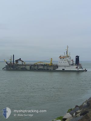
SOSPAN DAU
Trailing Suction Hopper Dredger

Current Trip
Current Position
| Longitude | --- |
|---|---|
| Latitude | --- |
| Status | Restricted manoeuverability |
| Speed | 0.7 Knots |
| Course | 233° |
| Area | English Channel |
| Station | T-AIS |
| Position Received | Now |
Information
The current position of SOSPAN DAU is in English Channel with coordinates 50.78905° / -1.11668° as reported on 2025-03-26 21:05 by AIS to our vessel tracker app. The vessel's current speed is 0.7 Knots and is currently inside the port of GOSPORT.
The vessel SOSPAN DAU (IMO: 7711062, MMSI: 244990000) is a Trailing Suction Hopper Dredger that was built in 1978 ( 47 years old ). It's sailing under the flag of [NL] Netherlands.
In this page you can find informations about the vessels current position, last detected port calls, and current voyage information. If the vessels is not in coverage by AIS you will find the latest position.
The current position of SOSPAN DAU is detected by our AIS receivers and we are not responsible for the reliability of the data. The last position was recorded while the vessel was in Coverage by the Ais receivers of our vessel tracking app.
The current draught of SOSPAN DAU as reported by AIS is 3.5 meters
Weather
| Temperature | 8.7°C / 47.66°F |
|---|---|
| Wind Speed | 3 knots |
| Direction | 261° W |
| Pressure | 1025.1 hPa |
| Humidity | 88.5 % |
| Cloud Coverage | 1 % |


Featured Company
Last Port Calls
| Port | Arrival | Departure | Time In Port |
|---|---|---|---|
| 2025-03-26 20:44 | |||
| 2025-03-26 15:12 | 2025-03-26 16:39 | 1 h | |
| 2025-03-26 14:18 | 2025-03-26 15:07 | 48 m | |
| 2025-03-26 09:53 | 2025-03-26 10:53 | 1 h | |
| 2025-03-25 05:20 | 2025-03-25 06:24 | 1 h | |
| 2025-03-25 00:37 | 2025-03-25 01:42 | 1 h | |
| 2025-03-24 19:45 | 2025-03-24 20:55 | 1 h | |
| 2025-03-24 14:27 | 2025-03-24 15:32 | 1 h | |
| 2025-03-24 09:38 | 2025-03-24 10:52 | 1 h | |
| 2025-03-24 05:02 | 2025-03-24 05:46 | 43 m |
Last Trips
| Origin | Departure | Destination | Arrival | Distance | |
|---|---|---|---|---|---|
| 2025-03-26 16:39 | 2025-03-26 20:44 | 27.38 nm | |||
| 2025-03-26 15:07 | 2025-03-26 15:12 | 0.22 nm | |||
| 2025-03-26 10:53 | 2025-03-26 14:18 | 27.60 nm | |||
| 2025-03-25 06:24 | 2025-03-26 09:53 | 163.46 nm | |||
| 2025-03-25 01:42 | 2025-03-25 05:20 | 26.02 nm | |||
| 2025-03-24 20:55 | 2025-03-25 00:37 | 26.74 nm | |||
| 2025-03-24 15:32 | 2025-03-24 19:45 | 27.31 nm | |||
| 2025-03-24 10:52 | 2025-03-24 14:27 | 26.21 nm | |||
| 2025-03-24 05:46 | 2025-03-24 09:38 | 27.53 nm | |||
| 2025-03-24 01:21 | 2025-03-24 05:02 | 27.20 nm |
Events
| Time | Event | Details | Position / Dest | Info |
|---|---|---|---|---|
| 2025-03-26 20:44 | STOP Moving |
50.78917 / -1.11682
[GB] GOSPORT
|
Speed: 0.2 kn Course: 239° |
|
| 2025-03-26 20:44 | PORT ARRIVAL |
|
50.78917 / -1.11681
[GB] GOSPORT
|
Speed: 0.7 kn Course: 240° |
| 2025-03-26 18:52 | START Moving | 8.04 nm, South East of SANDOWN |
50.59739 / -.96039
PORTSMOUTH
|
Speed: 3.2 kn Course: 318° |
| 2025-03-26 18:35 | STOP Moving | 7.78 nm, South East of SANDOWN |
50.59334 / -.97081
PORTSMOUTH
|
Speed: 0.2 kn Course: 301° |
| 2025-03-26 16:39 | PORT DEPARTURE |
|
50.78919 / -1.10950
PORTSMOUTH
|
Speed: 5.7 kn Course: 153° |
| 2025-03-26 16:36 | START Moving |
50.79145 / -1.11475
[GB] GOSPORT
|
Speed: 5.7 kn Course: 50° |
|
| 2025-03-26 15:13 | STOP Moving |
50.78977 / -1.11619
[GB] GOSPORT
|
Speed: 0.3 kn Course: 217° |
|
| 2025-03-26 15:12 | PORT ARRIVAL |
|
50.78987 / -1.11610
[GB] GOSPORT
|
Speed: 0.8 kn Course: 209° |
| 2025-03-26 15:07 | PORT DEPARTURE |
|
50.79300 / -1.11328
PORTSMOUTH
|
Speed: 4.6 kn Course: 207° |
| 2025-03-26 14:59 | START Moving |
50.80786 / -1.10878
[GB] PORTSMOUTH
|
Speed: 5.8 kn Course: 265° |