

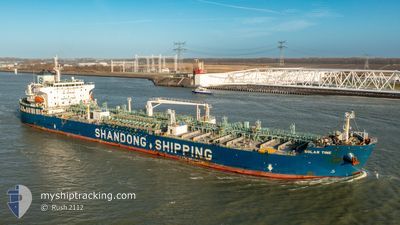
SOLAR TINE
Tanker

Current Trip
| Time Travelled | 11 h, 27 mins |
|---|---|
| Remaining Time | 4 days |
| Distance Travelled | 128.40 nm |
| Remaining Distance | 1160.58 nm |
| AVG Speed | 11.4 Knots |
| MAX Speed | 12.4 Knots |
| AVG Wind | 8.8 knots |
| MAX Wind | 17 knots |
| MIN Temp | 14.6°C / 58.28°F |
| MAX Temp | 16.2°C / 61.16°F |
| Draught | 11.5 m |
| Position Received | 1 h, 50 m ago |
Current Position
| Longitude | --- |
|---|---|
| Latitude | --- |
| Status | Under way using engine |
| Speed | 11.4 Knots |
| Course | 269.3° |
| Area | North Atlantic Ocean |
| Station | T-AIS |
| Position Received | 1 h, 50 m ago |
Information
The current position of SOLAR TINE is in North Atlantic Ocean with coordinates 36.62976° / -8.90780° as reported on 2025-02-15 10:56 by AIS to our vessel tracker app. The vessel's current speed is 11.4 Knots and is heading at the port of THAMES. The estimated time of arrival as calculated by MyShipTracking vessel tracking app is 2025-02-19 17:44 LT
The vessel SOLAR TINE (IMO: 9898527, MMSI: 636019990) is a Tanker It's sailing under the flag of [LR] Liberia.
In this page you can find informations about the vessels current position, last detected port calls, and current voyage information. If the vessels is not in coverage by AIS you will find the latest position.
The current position of SOLAR TINE is detected by our AIS receivers and we are not responsible for the reliability of the data. The last position was recorded while the vessel was in Coverage by the Ais receivers of our vessel tracking app.
The current draught of SOLAR TINE as reported by AIS is 11.5 meters
Weather
| Temperature | 16.2°C / 61.16°F |
|---|---|
| Wind Speed | 16 knots |
| Direction | 166° SSE |
| Pressure | 1010 hPa |
| Humidity | 84.1 % |
| Cloud Coverage | 100 % |


Featured Company
Last Port Calls
| Port | Arrival | Departure | Time In Port |
|---|---|---|---|
| 2025-02-13 01:56 | 2025-02-15 01:20 | 1 d | |
| 2025-01-15 20:39 | 2025-01-27 00:44 | 11 d | |
| 2024-12-26 14:52 | 2024-12-26 15:45 | 53 m | |
| 2024-12-25 07:33 | 2024-12-26 13:46 | 1 d | |
| 2024-12-25 06:04 | 2024-12-25 06:45 | 40 m | |
| 2024-12-23 17:08 | 2024-12-24 20:26 | 1 d | |
| 2024-12-21 08:13 | 2024-12-23 14:43 | 2 d | |
| 2024-12-19 14:35 | 2024-12-20 17:02 | 1 d | |
| 2024-12-13 11:51 | 2024-12-14 21:20 | 1 d |
Most Visited Ports (Last year)
| Port | Arrivals | |
|---|---|---|
| 6 | ||
| 4 | ||
| 4 | ||
| 3 | ||
| 3 | ||
| 2 |
Last Trips
| Origin | Departure | Destination | Arrival | Distance | |
|---|---|---|---|---|---|
| 2025-01-26 18:44 | 2025-02-13 02:56 | 4701.11 nm | |||
| 2024-12-26 16:45 | 2025-01-15 14:39 | 5858.57 nm | |||
| 2024-12-26 14:46 | 2024-12-26 15:52 | 4.31 nm | |||
| 2024-12-25 07:45 | 2024-12-25 08:33 | 5.45 nm | |||
| 2024-12-24 21:26 | 2024-12-25 07:04 | 68.19 nm | |||
| 2024-12-23 15:43 | 2024-12-23 18:08 | 19.10 nm | |||
| 2024-12-20 17:02 | 2024-12-21 09:13 | 160.46 nm | |||
| 2024-12-14 22:20 | 2024-12-19 14:35 | 1388.65 nm | |||
| 2024-11-21 06:35 | 2024-12-13 12:51 | 4803.25 nm |
Events
| Time | Event | Details | Position / Dest | Info |
|---|---|---|---|---|
| 2025-02-15 11:03 | Status Changed | Default Under way using engine |
36.62920 / -8.93696
THAMES,UK
|
Speed: 11.4 kn Course: 269.3° |
| 2025-02-15 10:56 | Status Changed | Under way using engine Default |
36.62976 / -8.90780
THAMES,UK
|
Speed: 11.6 kn Course: 270° |
| 2025-02-15 10:56 | OUT of Coverage |
36.62976 / -8.90780
North Atlantic Ocean
THAMES,UK
|
Speed: 11.4 kn Course: 269.3° |
|
| 2025-02-15 10:55 | Status Changed | Default Under way using engine |
36.62983 / -8.90564
THAMES,UK
|
Speed: 11.5 kn Course: 268.1° |
| 2025-02-15 10:43 | Status Changed | Under way using engine Default |
36.63150 / -8.85667
THAMES,UK
|
Speed: 11.5 kn Course: 267° |
| 2025-02-15 10:39 | Status Changed | Default Under way using engine |
36.63211 / -8.84220
THAMES,UK
|
Speed: 11.6 kn Course: 267.2° |
| 2025-02-15 10:32 | Status Changed | Under way using engine Default |
36.63322 / -8.81212
THAMES,UK
|
Speed: 11.4 kn Course: 268° |
| 2025-02-15 10:27 | Status Changed | Default Under way using engine |
36.63394 / -8.79432
THAMES,UK
|
Speed: 11.4 kn Course: 267.1° |
| 2025-02-15 10:27 | Status Changed | Under way using engine Default |
36.63397 / -8.79299
THAMES,UK
|
Speed: 11.6 kn Course: 268° |
| 2025-02-15 10:23 | Status Changed | Default Under way using engine |
36.63434 / -8.77829
THAMES,UK
|
Speed: 11.6 kn Course: 269.6° |