
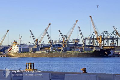
SOFIA R
Bulk Carrier
Current Trip
| Time Travelled | 5 days |
|---|---|
| Remaining Time | --- |
| Distance Travelled | 657.76 nm |
| Remaining Distance | --- |
| AVG Speed | 6.7 Knots |
| MAX Speed | 13.1 Knots |
| AVG Wind | 20.5 knots |
| MAX Wind | 28.9 knots |
| MIN Temp | -4.1°C / 24.62°F |
| MAX Temp | 4.6°C / 40.28°F |
| Draught | 6.1 m |
| Position Received | 3 m ago |
Current Position
| Longitude | --- |
|---|---|
| Latitude | --- |
| Status | At anchor |
| Speed | 0.1 Knots |
| Course | 58° |
| Area | Kattegat |
| Station | T-AIS |
| Position Received | 3 m ago |
Info
Information
The current position of SOFIA R is in Kattegat with coordinates 57.58937° / 11.67164° as reported on 2026-01-10 07:49 by AIS to our vessel tracker app. The vessel's current speed is 0.1 Knots
The vessel SOFIA R (IMO: 9530967, MMSI: 636015406) is a Bulk Carrier that was built in 2012 ( 14 years old ). It's sailing under the flag of [LR] Liberia.
In this page you can find informations about the vessels current position, last detected port calls, and current voyage information. If the vessels is not in coverage by AIS you will find the latest position.
The current position of SOFIA R is detected by our AIS receivers and we are not responsible for the reliability of the data. The last position was recorded while the vessel was in Coverage by the Ais receivers of our vessel tracking app.
The current draught of SOFIA R as reported by AIS is 6.1 meters
Weather
| Temperature | -3.9°C / 24.98°F |
|---|---|
| Wind Speed | 17 knots |
| Direction | 42° NE |
| Pressure | 1019.8 hPa |
| Humidity | 78 % |
| Cloud Coverage | 6 % |
Featured Company
Last Port Calls
| Port | Arrival | Departure | Time In Port |
|---|---|---|---|
| 2025-12-31 00:37 | 2026-01-04 16:40 | 4 d | |
| 2025-12-22 21:08 | 2025-12-23 19:28 | 22 h | |
| 2025-12-07 16:31 | 2025-12-12 17:33 | 5 d | |
| 2025-11-21 01:00 | 2025-11-27 16:34 | 6 d | |
| 2025-11-05 07:27 | 2025-11-10 03:02 | 4 d | |
| 2025-11-03 18:45 |
Last Trips
| Origin | Departure | Destination | Arrival | Distance | |
|---|---|---|---|---|---|
| 2025-12-23 19:28 | 2025-12-31 00:37 | 1830.12 nm | |||
| 2025-12-12 17:33 | 2025-12-22 21:08 | 1265.12 nm | |||
| 2025-11-27 16:34 | 2025-12-07 16:31 | 2088.47 nm | |||
| 2025-11-10 03:02 | 2025-11-21 01:00 | 1407.44 nm | |||
| 2025-11-03 18:45 | 2025-11-05 07:27 | 320.35 nm |
Events
| Time | Event | Details | Position / Dest | Info |
|---|---|---|---|---|
| 2026-01-10 02:02 | Destination Changed | SE GOT TO ORDER |
57.58942 / 11.67148
SE GOT
|
Speed: 0.2 kn Course: 53° |
| 2026-01-10 02:01 | Status Changed | At anchor Under way using engine |
57.58939 / 11.67160
TO ORDER
|
Speed: 0.4 kn Course: 45° |
| 2026-01-10 01:44 | STOP Moving | 3.49 nm, West of VRANGO |
57.59061 / 11.67361
TO ORDER
|
Speed: 0.3 kn Course: 53° |
| 2026-01-09 22:40 | START Moving | 11.59 nm, West of RORO |
57.76277 / 11.26020
TO ORDER
|
Speed: 3.2 kn Course: 139° |
| 2026-01-09 21:09 | STOP Moving | 11.34 nm, West of RORO |
57.77451 / 11.26782
TO ORDER
|
Speed: 0.3 kn Course: 146° |
| 2026-01-09 18:07 | START Moving | 13.82 nm, West of RORO |
57.75216 / 11.19194
TO ORDER
|
Speed: 3.1 kn Course: 151° |
| 2026-01-09 14:27 | STOP Moving | 9.81 nm, West of RORO |
57.74176 / 11.32018
TO ORDER
|
Speed: 0.3 kn Course: 134° |
| 2026-01-09 13:07 | Change Sea Area | Swedish part of the Kattegat Danish part of the Kattegat |
57.77886 / 11.09177
Kattegat
|
Speed: 6.9 kn Course: 106.3° |
| 2026-01-09 11:49 | Change Sea Area | Danish part of the Kattegat Swedish part of the Kattegat |
57.79172 / 11.07136
Kattegat
|
Speed: 1.7 kn Course: 293.4° |
| 2026-01-09 05:54 | Change Sea Area | Swedish part of the Kattegat Danish part of the Kattegat |
57.78274 / 11.08314
Kattegat
|
Speed: 6.2 kn Course: 102° |