
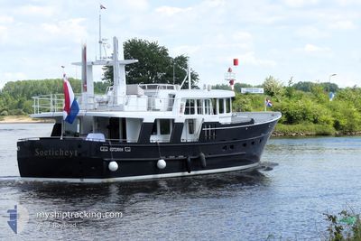
SOETICHEYT
Pleasure Craft
Current Trip
Unknown
| Time Travelled | 8 days |
|---|---|
| Remaining Time | --- |
| Distance Travelled | 46.49 nm |
| Remaining Distance | --- |
| AVG Speed | 7.9 Knots |
| MAX Speed | 9.2 Knots |
| AVG Wind | 3.4 knots |
| MAX Wind | 5 knots |
| MIN Temp | 5.1°C / 41.18°F |
| MAX Temp | 10°C / 50°F |
| Draught | 0 m |
| Position Received | 1 m ago |
Current Position
| Longitude | --- |
|---|---|
| Latitude | --- |
| Status | Moored |
| Speed | 0.1 Knots |
| Course | 217° |
| Area | North Sea |
| Station | T-AIS |
| Position Received | 1 m ago |
Info
Information
The current position of SOETICHEYT is in North Sea with coordinates 51.82125° / 4.13551° as reported on 2025-03-11 21:23 by AIS to our vessel tracker app. The vessel's current speed is 0.1 Knots
The vessel SOETICHEYT (MMSI: 244810127) is a Pleasure Craft It's sailing under the flag of [NL] Netherlands.
In this page you can find informations about the vessels current position, last detected port calls, and current voyage information. If the vessels is not in coverage by AIS you will find the latest position.
The current position of SOETICHEYT is detected by our AIS receivers and we are not responsible for the reliability of the data. The last position was recorded while the vessel was in Coverage by the Ais receivers of our vessel tracking app.
Weather
| Temperature | 5.3°C / 41.54°F |
|---|---|
| Wind Speed | 7 knots |
| Direction | 331° NNW |
| Pressure | 1003.8 hPa |
| Humidity | 75.6 % |
| Cloud Coverage | 73 % |
Featured Company
Last Port Calls
| Port | Arrival | Departure | Time In Port |
|---|---|---|---|
| 2025-03-03 08:20 |
Most Visited Ports (Last year)
| Port | Arrivals | |
|---|---|---|
| 5 | ||
| 4 | ||
| 2 | ||
| 2 | ||
| 2 | ||
| 2 |
Last Trips
| Origin | Departure | Destination | Arrival | Distance |
|---|
Events
| Time | Event | Details | Position / Dest | Info |
|---|---|---|---|---|
| 2025-03-03 14:50 | STOP Moving | 0.31 nm, South East of HELLEVOETSLUIS |
51.82124 / 4.13549
|
Speed: 0.3 kn Course: 219° |
| 2025-03-03 09:02 | IN Coverage |
51.73113 / 5.25635
North Sea
|
Speed: 4 kn Course: 302.1° |
|
| 2025-03-03 08:20 | PORT DEPARTURE |
|
51.73113 / 5.25635
|
Speed: Course: 511° |
| 2025-03-03 05:41 | OUT of Coverage |
51.69457 / 5.30133
North Sea
[NL] S-HERTOGENBOSCH
|
Speed: Course: 193.8° |
|
| 2025-03-03 05:41 | IN Coverage |
51.69457 / 5.30133
North Sea
[NL] S-HERTOGENBOSCH
|
Speed: Course: 193.8° |