
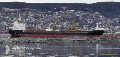
SLETRINGEN
Cargo
Current Trip
| Time Travelled | 3 days |
|---|---|
| Remaining Time | 1 h, 58 mins |
| Distance Travelled | 683.29 nm |
| Remaining Distance | 21.34 nm |
| AVG Speed | 10.3 Knots |
| MAX Speed | 15.3 Knots |
| AVG Wind | 9 knots |
| MAX Wind | 25 knots |
| MIN Temp | -7°C / 19.4°F |
| MAX Temp | 7.6°C / 45.68°F |
| Draught | 7 m |
| Position Received | 1 m ago |
Current Position
| Longitude | --- |
|---|---|
| Latitude | --- |
| Status | Under way using engine |
| Speed | 9.8 Knots |
| Course | 208.9° |
| Area | Norwegian Sea |
| Station | T-AIS |
| Position Received | 1 m ago |
Info
Information
The current position of SLETRINGEN is in Norwegian Sea with coordinates 62.24900° / 5.11248° as reported on 2025-12-06 22:39 by AIS to our vessel tracker app. The vessel's current speed is 9.8 Knots and is heading at the port of MALOY. The estimated time of arrival as calculated by MyShipTracking vessel tracking app is 2025-12-07 01:38 LT
The vessel SLETRINGEN (IMO: 9911927, MMSI: 257796000) is a Cargo It's sailing under the flag of [NO] Norway.
In this page you can find informations about the vessels current position, last detected port calls, and current voyage information. If the vessels is not in coverage by AIS you will find the latest position.
The current position of SLETRINGEN is detected by our AIS receivers and we are not responsible for the reliability of the data. The last position was recorded while the vessel was in Coverage by the Ais receivers of our vessel tracking app.
The current draught of SLETRINGEN as reported by AIS is 7 meters
Weather
| Temperature | 8°C / 46.4°F |
|---|---|
| Wind Speed | 3 knots |
| Direction | 207° SSW |
| Pressure | 1004.3 hPa |
| Humidity | 56.6 % |
| Cloud Coverage | 100 % |
Featured Company
Last Port Calls
| Port | Arrival | Departure | Time In Port |
|---|---|---|---|
| 2025-12-02 14:24 | 2025-12-03 12:56 | 22 h | |
| 2025-11-22 20:26 | 2025-11-24 13:51 | 1 d | |
| 2025-11-21 19:07 | 2025-11-21 19:56 | 49 m | |
| 2025-11-20 04:18 | 2025-11-21 17:32 | 1 d | |
| 2025-11-13 03:30 | 2025-11-14 08:51 | 1 d | |
| 2025-11-03 23:16 | 2025-11-04 19:05 | 19 h | |
| 2025-10-29 13:51 | 2025-10-30 17:54 | 1 d | |
| 2025-10-25 23:13 | 2025-10-26 01:27 | 2 h | |
| 2025-10-24 23:52 | 2025-10-25 00:02 | 10 m | |
| 2025-10-23 06:49 | 2025-10-24 13:10 | 1 d |
Last Trips
| Origin | Departure | Destination | Arrival | Distance | |
|---|---|---|---|---|---|
| 2025-11-24 13:51 | 2025-12-02 14:24 | 1253.38 nm | |||
| 2025-11-21 19:56 | 2025-11-22 20:26 | 235.63 nm | |||
| 2025-11-21 17:32 | 2025-11-21 19:07 | 10.06 nm | |||
| 2025-11-14 08:51 | 2025-11-20 04:18 | 1339.71 nm | |||
| 2025-11-04 19:05 | 2025-11-13 03:30 | 1239.52 nm | |||
| 2025-10-30 17:54 | 2025-11-03 23:16 | 367.41 nm | |||
| 2025-10-26 01:27 | 2025-10-29 13:51 | 694.13 nm | |||
| 2025-10-25 00:02 | 2025-10-25 23:13 | 261.12 nm | |||
| 2025-10-24 13:10 | 2025-10-24 23:52 | 123.78 nm | |||
| 2025-10-18 16:14 | 2025-10-23 06:49 | 1097.62 nm |
Events
| Time | Event | Details | Position / Dest | Info |
|---|---|---|---|---|
| 2025-12-05 02:20 | Status Changed | Under way using engine Moored |
67.40536 / 15.55442
NOMAY
|
Speed: 7.3 kn Course: 4.9° |
| 2025-12-05 02:19 | Draught Changed | 7 4.6 |
67.40084 / 15.55341
NOMAY
|
Speed: 7.3 kn Course: 4.9° |
| 2025-12-05 02:19 | Destination Changed | NOMAY NOHFL |
67.40084 / 15.55341
NOMAY
|
Speed: 7.3 kn Course: 4.9° |
| 2025-12-05 02:19 | ETA Changed | 2025/12/07 01:00 2025/12/03 08:00 |
67.40084 / 15.55341
NOMAY
|
Speed: 7.3 kn Course: 4.9° |
| 2025-12-05 02:12 | START Moving | 1.88 nm, North West of SALTEN |
67.39367 / 15.54683
NOHFL
|
Speed: 3.2 kn Course: 74° |
| 2025-12-04 14:22 | Status Changed | Moored Default |
67.39544 / 15.54297
NOHFL
|
Speed: Course: -1° |
| 2025-12-04 14:19 | Status Changed | Default Moored |
67.39500 / 15.54167
NOHFL
|
Speed: Course: 180° |
| 2025-12-04 09:46 | Status Changed | Moored Under way using engine |
67.39543 / 15.54304
NOHFL
|
Speed: 0.1 kn Course: 183° |
| 2025-12-04 09:42 | STOP Moving | 2.02 nm, North West of SALTEN |
67.39557 / 15.54312
NOHFL
|
Speed: 0.3 kn Course: 185° |
| 2025-12-03 11:56 | START Moving | 0.19 nm, North of BERGNESET |
69.24124 / 19.35918
NOHFL
|
Speed: 5.9 kn Course: 6° |