

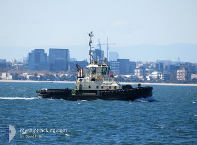
SL DAINTREE
Tug

Current Trip
AULAU
| Time Travelled | 8 days |
|---|---|
| Remaining Time | --- |
| Distance Travelled | 27.04 nm |
| Remaining Distance | --- |
| AVG Speed | 8.4 Knots |
| MAX Speed | 11.2 Knots |
| AVG Wind | 7.6 knots |
| MAX Wind | 10 knots |
| MIN Temp | 20.2°C / 68.36°F |
| MAX Temp | 22.4°C / 72.32°F |
| Draught | 5 m |
| Position Received | 8 d ago |
Current Position
| Longitude | --- |
|---|---|
| Latitude | --- |
| Status | Moored |
| Speed | |
| Course | --- |
| Area | Bass Strait |
| Station | T-AIS |
| Position Received | 8 d ago |
Information
The current position of SL DAINTREE is in Bass Strait with coordinates -41.42822° / 147.12357° as reported on 2025-02-05 07:58 by AIS to our vessel tracker app. The vessel's current speed is 0 Knots
The vessel SL DAINTREE (IMO: 9530474, MMSI: 503384100) is a Tug that was built in 2010 ( 15 years old ). It's sailing under the flag of [AU] Australia.
In this page you can find informations about the vessels current position, last detected port calls, and current voyage information. If the vessels is not in coverage by AIS you will find the latest position.
The current position of SL DAINTREE is detected by our AIS receivers and we are not responsible for the reliability of the data. The last position was recorded while the vessel was in Coverage by the Ais receivers of our vessel tracking app.
The current draught of SL DAINTREE as reported by AIS is 5 meters
Weather
| Temperature | 22.4°C / 72.32°F |
|---|---|
| Wind Speed | 10 knots |
| Direction | 334° NNW |
| Pressure | 1014.2 hPa |
| Humidity | 44.5 % |
| Cloud Coverage | 66 % |


Featured Company
Last Port Calls
| Port | Arrival | Departure | Time In Port |
|---|---|---|---|
| 2025-02-05 03:58 | 2025-02-05 04:12 | 13 m | |
| 2025-01-29 06:11 | 2025-02-01 21:46 | 3 d | |
| 2025-01-28 18:38 | 2025-01-29 05:44 | 11 h | |
| 2025-01-28 14:41 | 2025-01-28 18:30 | 3 h | |
| 2025-01-28 06:47 | 2025-01-28 14:08 | 7 h | |
| 2025-01-26 19:15 | 2025-01-28 06:23 | 1 d | |
| 2025-01-24 16:40 | 2025-01-26 19:03 | 2 d | |
| 2025-01-24 12:49 | 2025-01-24 16:32 | 3 h | |
| 2025-01-23 20:39 | 2025-01-24 12:39 | 16 h | |
| 2025-01-22 21:26 | 2025-01-23 20:21 | 22 h |
Last Trips
| Origin | Departure | Destination | Arrival | Distance | |
|---|---|---|---|---|---|
| 2025-02-02 08:46 | 2025-02-05 14:58 | 247.30 nm | |||
| 2025-01-29 16:44 | 2025-01-29 17:11 | 2.66 nm | |||
| 2025-01-29 05:30 | 2025-01-29 05:38 | 0.56 nm | |||
| 2025-01-29 01:08 | 2025-01-29 01:41 | 2.71 nm | |||
| 2025-01-28 17:23 | 2025-01-28 17:47 | 1.69 nm | |||
| 2025-01-27 06:03 | 2025-01-27 06:15 | 1.06 nm | |||
| 2025-01-25 03:32 | 2025-01-25 03:40 | 0.98 nm | |||
| 2025-01-24 23:39 | 2025-01-24 23:49 | 1.05 nm | |||
| 2025-01-24 07:21 | 2025-01-24 07:39 | 1.95 nm | |||
| 2025-01-23 07:58 | 2025-01-23 08:26 | 1.91 nm |
Events
| Time | Event | Details | Position / Dest | Info |
|---|---|---|---|---|
| 2025-02-05 07:58 | OUT of Coverage |
-41.42822 / 147.12357
Bass Strait
AULAU
|
Speed: Course: 14.8° |
|
| 2025-02-05 07:58 | Status Changed | Moored Under way using engine |
-41.42822 / 147.12357
AULAU
|
Speed: Course: 511° |
| 2025-02-05 07:45 | STOP Moving | 21.05 nm, South East of BELL BAY |
-41.42826 / 147.12356
AULAU
|
Speed: 0.2 kn Course: 511° |
| 2025-02-05 07:19 | Status Changed | Under way using engine Default |
-41.39455 / 147.09909
AULAU
|
Speed: 9.6 kn Course: 180° |
| 2025-02-05 07:16 | Status Changed | Default Under way using engine |
-41.38706 / 147.09004
AULAU
|
Speed: 9.6 kn Course: 182.8° |
| 2025-02-05 07:15 | Status Changed | Under way using engine Default |
-41.38532 / 147.09005
AULAU
|
Speed: 9.8 kn Course: 172° |
| 2025-02-05 07:12 | Status Changed | Default Under way using engine |
-41.37907 / 147.09047
AULAU
|
Speed: 9.9 kn Course: 150.1° |
| 2025-02-05 07:01 | Status Changed | Under way using engine Default |
-41.35288 / 147.07095
AULAU
|
Speed: 10 kn Course: 226° |
| 2025-02-05 06:56 | Status Changed | Default Under way using engine |
-41.34326 / 147.08072
AULAU
|
Speed: 6.4 kn Course: 81.9° |
| 2025-02-05 06:22 | START Moving | 12.73 nm, South East of BELL BAY |
-41.31967 / 147.00734
AULAU
|
Speed: 6.7 kn Course: 127.4° |