
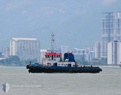
SINARAN PUTERA
Tug
Current Trip
| Time Travelled | --- |
|---|---|
| Remaining Time | --- |
| Distance Travelled | --- |
| Remaining Distance | --- |
| AVG Speed | --- |
| MAX Speed | --- |
| AVG Wind | --- |
| MAX Wind | --- |
| MIN Temp | --- |
| MAX Temp | --- |
| Draught | 3.2 m |
| Position Received | 13 h, 29 m ago |
Current Position
| Longitude | 104.12121° |
|---|---|
| Latitude | 1.03079° |
| Status | Towing Astern |
| Speed | |
| Course | --- |
| Area | South China Sea |
| Station | T-AIS |
| Position Received | 13 h, 29 m ago |
Info
Information
The current position of SINARAN PUTERA is in South China Sea with coordinates 1.03079° / 104.12121° as reported on 2024-05-16 13:08 by AIS to our vessel tracker app. The vessel's current speed is 0 Knots
The vessel SINARAN PUTERA (IMO: 9745744, MMSI: 563029560) is a Tug It's sailing under the flag of [SG] Singapore.
In this page you can find informations about the vessels current position, last detected port calls, and current voyage information. If the vessels is not in coverage by AIS you will find the latest position.
The current position of SINARAN PUTERA is detected by our AIS receivers and we are not responsible for the reliability of the data. The last position was recorded while the vessel was in Coverage by the Ais receivers of our vessel tracking app.
The current draught of SINARAN PUTERA as reported by AIS is 3.2 meters
Weather
| Temperature | 27.4°C / 81.32°F |
|---|---|
| Wind Speed | 4 knots |
| Direction | 163° SSE |
| Pressure | 1007.8 hPa |
| Humidity | 82.7 % |
| Cloud Coverage | 100 % |
Featured Company
Last Port Calls
Most Visited Ports (Last year)
| Port | Arrivals | |
|---|---|---|
| 5 | ||
| 1 |
Last Trips
| Origin | Departure | Destination | Arrival | Distance |
|---|
Events
| Time | Event | Details | Position / Dest | Info |
|---|---|---|---|---|
| 2024-05-16 13:08 | OUT of Coverage |
1.03079 / 104.12121
South China Sea
|
Speed: Course: 36.4° |
|
| 2024-05-16 12:55 | IN Coverage |
1.03070 / 104.12118
South China Sea
|
Speed: Course: 8.2° |
|
| 2024-05-16 11:41 | OUT of Coverage |
1.03068 / 104.12122
South China Sea
|
Speed: 0.1 kn Course: 333.4° |
|
| 2024-05-16 11:41 | IN Coverage |
1.03068 / 104.12122
South China Sea
|
Speed: 0.1 kn Course: 333.4° |
|
| 2024-05-16 00:54 | OUT of Coverage |
1.03094 / 104.12143
South China Sea
|
Speed: Course: 0° |
|
| 2024-05-16 00:46 | IN Coverage |
1.03093 / 104.12141
South China Sea
|
Speed: Course: 0° |
|
| 2024-05-14 17:23 | OUT of Coverage |
1.03097 / 104.12143
South China Sea
|
Speed: Course: 359.7° |
|
| 2024-05-14 16:15 | IN Coverage |
1.03100 / 104.12140
South China Sea
|
Speed: Course: 359.7° |
|
| 2024-05-14 09:12 | STOP Moving | 3.49 nm, South West of KABIL |
1.02798 / 104.11865
LUMUT
|
Speed: 0.2 kn Course: -1° |
| 2024-05-14 09:07 | START Moving | 3.38 nm, South of KABIL |
1.02889 / 104.12122
LUMUT
|
Speed: 4.5 kn Course: -1° |