

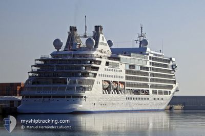
SILVER MOON
Passenger

Current Trip
AG SJO
| Time Travelled | 13 h, 33 mins |
|---|---|
| Remaining Time | --- |
| Distance Travelled | 79.69 nm |
| Remaining Distance | --- |
| AVG Speed | 9.9 Knots |
| MAX Speed | 10.7 Knots |
| AVG Wind | 17.4 knots |
| MAX Wind | 19 knots |
| MIN Temp | 25.7°C / 78.26°F |
| MAX Temp | 26.6°C / 79.88°F |
| Draught | 6.7 m |
| Position Received | 3 m ago |
Current Position
| Longitude | --- |
|---|---|
| Latitude | --- |
| Status | At anchor |
| Speed | 0.1 Knots |
| Course | 111° |
| Area | Caribbean Sea |
| Station | T-AIS |
| Position Received | 3 m ago |
Information
The current position of SILVER MOON is in Caribbean Sea with coordinates 17.90483° / -62.86734° as reported on 2025-03-27 16:28 by AIS to our vessel tracker app. The vessel's current speed is 0.1 Knots
The vessel SILVER MOON (IMO: 9838618, MMSI: 311000719) is a Passenger It's sailing under the flag of [BS] Bahamas.
In this page you can find informations about the vessels current position, last detected port calls, and current voyage information. If the vessels is not in coverage by AIS you will find the latest position.
The current position of SILVER MOON is detected by our AIS receivers and we are not responsible for the reliability of the data. The last position was recorded while the vessel was in Coverage by the Ais receivers of our vessel tracking app.
The current draught of SILVER MOON as reported by AIS is 6.7 meters
Weather
| Temperature | 26.3°C / 79.34°F |
|---|---|
| Wind Speed | 17 knots |
| Direction | 117° ESE |
| Pressure | 1017.9 hPa |
| Humidity | 74.6 % |
| Cloud Coverage | 51 % |


Featured Company
Last Port Calls
| Port | Arrival | Departure | Time In Port |
|---|---|---|---|
| 2025-03-26 06:57 | 2025-03-26 22:58 | 16 h | |
| 2025-03-25 11:12 | 2025-03-25 22:40 | 11 h | |
| 2025-03-24 07:11 | 2025-03-24 17:07 | 9 h | |
| 2025-03-23 05:58 | 2025-03-23 22:33 | 16 h | |
| 2025-03-21 04:46 | 2025-03-21 23:34 | 18 h | |
| 2025-03-20 07:07 | 2025-03-20 17:59 | 10 h | |
| 2025-03-18 07:11 | 2025-03-18 18:48 | 11 h | |
| 2025-03-13 06:14 | 2025-03-13 22:49 | 16 h | |
| 2025-03-12 07:18 | 2025-03-12 17:52 | 10 h | |
| 2025-03-11 07:19 | 2025-03-11 17:50 | 10 h |
Most Visited Ports (Last year)
| Port | Arrivals | |
|---|---|---|
| 7 | ||
| 6 | ||
| 6 | ||
| 6 | ||
| 5 | ||
| 5 |
Last Trips
| Origin | Departure | Destination | Arrival | Distance | |
|---|---|---|---|---|---|
| 2025-03-25 22:40 | 2025-03-26 06:57 | 91.06 nm | |||
| 2025-03-24 17:07 | 2025-03-25 11:12 | 245.10 nm | |||
| 2025-03-23 22:33 | 2025-03-24 07:11 | 65.85 nm | |||
| 2025-03-21 23:34 | 2025-03-23 05:58 | 180.64 nm | |||
| 2025-03-20 17:59 | 2025-03-21 04:46 | 113.59 nm | |||
| 2025-03-18 18:48 | 2025-03-20 07:07 | 488.37 nm | |||
| 2025-03-13 22:49 | 2025-03-18 07:11 | 810.67 nm | |||
| 2025-03-12 17:52 | 2025-03-13 06:14 | 130.65 nm | |||
| 2025-03-11 17:50 | 2025-03-12 07:18 | 193.11 nm | |||
| 2025-03-09 18:49 | 2025-03-11 07:19 | 196.89 nm |
Events
| Time | Event | Details | Position / Dest | Info |
|---|---|---|---|---|
| 2025-03-27 13:01 | Status Changed | At anchor Default |
17.90469 / -62.86861
AG SJO
|
Speed: 0.1 kn Course: 85° |
| 2025-03-27 12:58 | Status Changed | Default At anchor |
17.90469 / -62.86864
AG SJO
|
Speed: 0.2 kn Course: 86° |
| 2025-03-27 12:40 | Status Changed | At anchor Default |
17.90357 / -62.86908
AG SJO
|
Speed: 0.8 kn Course: 133° |
| 2025-03-27 12:31 | Status Changed | Default At anchor |
17.90311 / -62.86892
AG SJO
|
Speed: 0.2 kn Course: 108° |
| 2025-03-27 11:12 | Status Changed | At anchor Under way using engine |
17.90362 / -62.86813
AG SJO
|
Speed: 0.3 kn Course: 123° |
| 2025-03-27 11:09 | STOP Moving | 0.83 nm, West of GUSTAVIA |
17.90319 / -62.86763
AG SJO
|
Speed: 0.3 kn Course: 123° |
| 2025-03-27 08:57 | Status Changed | Under way using engine Default |
17.70900 / -62.71422
AG SJO
|
Speed: 9.8 kn Course: 306° |
| 2025-03-27 08:52 | Status Changed | Default Under way using engine |
17.70086 / -62.70256
AG SJO
|
Speed: 10 kn Course: 308.8° |
| 2025-03-27 08:16 | Detected in Sea | Saint-Martin part of the Caribbean Sea |
17.64512 / -62.61536
Caribbean Sea
|
Speed: 10.2 kn Course: 303.7° |
| 2025-03-27 08:13 | Detected in Sea | Saint Kitts and Nevis part of the Caribbean Sea |
17.64100 / -62.60878
Caribbean Sea
|
Speed: 10.2 kn Course: 301° |