
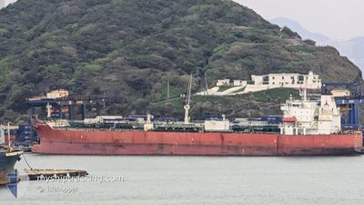
SILVER HESSA
Tanker
Current Trip
| Time Travelled | 2 days |
|---|---|
| Remaining Time | 2 days |
| Distance Travelled | 639.99 nm |
| Remaining Distance | 831.34 nm |
| AVG Speed | 10.9 Knots |
| MAX Speed | 13.2 Knots |
| AVG Wind | 18.1 knots |
| MAX Wind | 25 knots |
| MIN Temp | 21.9°C / 71.42°F |
| MAX Temp | 26.5°C / 79.7°F |
| Draught | 8.8 m |
| Position Received | 20 d ago |
Current Position
| Longitude | --- |
|---|---|
| Latitude | --- |
| Status | Under way using engine |
| Speed | 10.9 Knots |
| Course | 241.3° |
| Area | Eastern China Sea |
| Station | T-AIS |
| Position Received | 20 d ago |
Info
Information
The current position of SILVER HESSA is in Eastern China Sea with coordinates 25.55653° / 121.40134° as reported on 2025-11-19 16:43 by AIS to our vessel tracker app. The vessel's current speed is 10.9 Knots and is heading at the port of KEELUNG. The estimated time of arrival as calculated by MyShipTracking vessel tracking app is 2025-12-13 04:49 LT
The vessel SILVER HESSA (IMO: 9718868, MMSI: 477854400) is a Tanker It's sailing under the flag of [HK] Hong Kong.
In this page you can find informations about the vessels current position, last detected port calls, and current voyage information. If the vessels is not in coverage by AIS you will find the latest position.
The current position of SILVER HESSA is detected by our AIS receivers and we are not responsible for the reliability of the data. The last position was recorded while the vessel was in Coverage by the Ais receivers of our vessel tracking app.
The current draught of SILVER HESSA as reported by AIS is 8.8 meters
Weather
| Temperature | 26.3°C / 79.34°F |
|---|---|
| Wind Speed | 17 knots |
| Direction | 53° NE |
| Pressure | 1010.5 hPa |
| Humidity | 88.5 % |
| Cloud Coverage | 98 % |
Featured Company
Last Port Calls
| Port | Arrival | Departure | Time In Port |
|---|---|---|---|
| 2025-12-06 14:17 | 2025-12-07 15:13 | 1 d | |
| 2025-11-28 11:09 | 2025-11-30 12:05 | 2 d | |
| 2025-11-17 01:59 | 2025-11-19 21:19 | 2 d | |
| 2025-10-30 14:12 | 2025-11-02 18:45 | 3 d | |
| 2025-10-18 16:17 | 2025-10-20 22:06 | 2 d | |
| 2025-10-09 00:39 | 2025-10-10 11:04 | 1 d |
Most Visited Ports (Last year)
| Port | Arrivals | |
|---|---|---|
| 9 | ||
| 8 | ||
| 6 | ||
| 4 | ||
| 2 | ||
| 2 |
Last Trips
| Origin | Departure | Destination | Arrival | Distance | |
|---|---|---|---|---|---|
| 2025-11-30 12:05 | 2025-12-06 14:17 | 327.31 nm | |||
| 2025-11-19 21:19 | 2025-11-28 11:09 | 910.74 nm | |||
| 2025-11-02 18:45 | 2025-11-17 01:59 | 2294.80 nm | |||
| 2025-10-20 22:06 | 2025-10-30 14:12 | 579.12 nm | |||
| 2025-10-10 11:04 | 2025-10-18 16:17 | 972.23 nm | |||
| 2025-09-27 03:47 | 2025-10-09 00:39 | 1144.60 nm |
Events
| Time | Event | Details | Position / Dest | Info |
|---|---|---|---|---|
| 2025-12-07 07:13 | PORT DEPARTURE |
|
23.77606 / 120.14785
KEELUNG TAIWAN
|
Speed: 7.4 kn Course: 236° |
| 2025-12-07 06:57 | START Moving |
23.78636 / 120.17216
[TW] MAILIAO
|
Speed: 3.1 kn Course: 283° |
|
| 2025-12-06 06:45 | STOP Moving |
23.78121 / 120.17502
[TW] MAILIAO
|
Speed: 0.1 kn Course: 28° |
|
| 2025-12-06 06:17 | PORT ARRIVAL |
|
23.78325 / 120.16006
[TW] MAILIAO
|
Speed: 7.3 kn Course: 53° |
| 2025-12-05 20:49 | START Moving | 13.75 nm, West of MAILIAO |
23.77664 / 119.91962
KEELUNG TAIWAN
|
Speed: 3.4 kn Course: 51° |
| 2025-12-05 15:17 | STOP Moving | 12.09 nm, North East of LUNG MEN |
23.67623 / 119.84927
KEELUNG TAIWAN
|
Speed: 0.2 kn Course: 29° |
| 2025-12-05 11:13 | START Moving | 13.38 nm, West of MAILIAO |
23.80311 / 119.92710
KEELUNG TAIWAN
|
Speed: 3.5 kn Course: 22° |
| 2025-12-05 05:37 | STOP Moving | 14.71 nm, West of MAILIAO |
23.69132 / 119.92187
KEELUNG TAIWAN
|
Speed: 0.2 kn Course: 20° |
| 2025-12-04 21:49 | START Moving | 13.79 nm, East of LUNG MEN |
23.60938 / 119.91592
KEELUNG TAIWAN
|
Speed: 3.1 kn Course: 3° |
| 2025-12-04 18:49 | STOP Moving | 13.13 nm, East of LUNG MEN |
23.52622 / 119.90813
KEELUNG TAIWAN
|
Speed: 0.3 kn Course: 11° |