

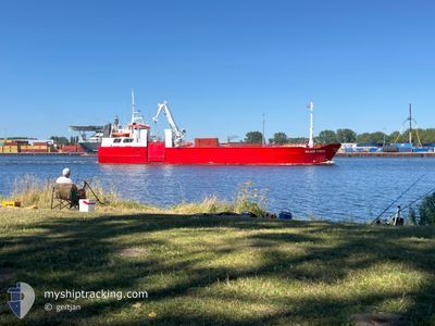
SILVER FIRDA
General Cargo

Current Trip
| Time Travelled | 12 h, 20 mins |
|---|---|
| Remaining Time | --- |
| Distance Travelled | 106.10 nm |
| Remaining Distance | --- |
| AVG Speed | 8.9 Knots |
| MAX Speed | 9.9 Knots |
| AVG Wind | 13.1 knots |
| MAX Wind | 17 knots |
| MIN Temp | 4.4°C / 39.92°F |
| MAX Temp | 4.8°C / 40.64°F |
| Draught | 3.8 m |
| Position Received | 11 h, 40 m ago |
Current Position
| Longitude | --- |
|---|---|
| Latitude | --- |
| Status | Under way using engine |
| Speed | 9.2 Knots |
| Course | 261.5° |
| Area | Baltic Sea |
| Station | T-AIS |
| Position Received | 11 h, 40 m ago |
Information
The current position of SILVER FIRDA is in Baltic Sea with coordinates 55.75109° / 20.91171° as reported on 2025-03-27 16:44 by AIS to our vessel tracker app. The vessel's current speed is 9.2 Knots and is heading at the port of FUGLAFJORDUR. The estimated time of arrival as calculated by MyShipTracking vessel tracking app is 2025-04-02 07:00 LT
The vessel SILVER FIRDA (IMO: 7638519, MMSI: 258407000) is a General Cargo that was built in 1978 ( 47 years old ). It's sailing under the flag of [NO] Norway.
In this page you can find informations about the vessels current position, last detected port calls, and current voyage information. If the vessels is not in coverage by AIS you will find the latest position.
The current position of SILVER FIRDA is detected by our AIS receivers and we are not responsible for the reliability of the data. The last position was recorded while the vessel was in Coverage by the Ais receivers of our vessel tracking app.
The current draught of SILVER FIRDA as reported by AIS is 3.8 meters
Weather
| Temperature | 4.6°C / 40.28°F |
|---|---|
| Wind Speed | 16 knots |
| Direction | 223° SW |
| Pressure | 1015.3 hPa |
| Humidity | 91.5 % |
| Cloud Coverage | 86 % |


Featured Company
Last Port Calls
| Port | Arrival | Departure | Time In Port |
|---|---|---|---|
| 2025-03-27 07:19 | 2025-03-27 18:04 | 10 h | |
| 2025-03-26 18:44 | 2025-03-26 19:26 | 42 m | |
| 2025-03-24 18:57 | 2025-03-26 17:33 | 1 d | |
| 2025-03-16 08:01 | 2025-03-18 12:00 | 2 d | |
| 2025-03-10 15:21 | 2025-03-11 15:55 | 1 d | |
| 2025-02-22 15:05 | 2025-03-03 17:55 | 9 d | |
| 2025-02-06 13:00 | 2025-02-07 17:00 | 1 d | |
| 2025-02-01 15:48 | 2025-02-02 01:48 | 9 h | |
| 2025-01-31 13:08 | 2025-02-01 12:15 | 23 h | |
| 2025-01-25 11:19 | 2025-01-26 19:27 | 1 d |
Last Trips
| Origin | Departure | Destination | Arrival | Distance | |
|---|---|---|---|---|---|
| 2025-03-26 19:26 | 2025-03-27 07:19 | 97.97 nm | |||
| 2025-03-26 17:33 | 2025-03-26 18:44 | 5.58 nm | |||
| 2025-03-18 12:00 | 2025-03-24 18:57 | 1099.47 nm | |||
| 2025-03-11 15:55 | 2025-03-16 08:01 | 924.06 nm | |||
| 2025-03-03 17:55 | 2025-03-10 15:21 | 981.11 nm | |||
| 2025-02-07 17:00 | 2025-02-22 15:05 | 2335.08 nm | |||
| 2025-02-02 01:48 | 2025-02-06 13:00 | 731.15 nm | |||
| 2025-02-01 12:15 | 2025-02-01 15:48 | 30.71 nm | |||
| 2025-01-26 19:27 | 2025-01-31 13:08 | 894.31 nm | |||
| 2025-01-21 17:15 | 2025-01-25 11:19 | 850.61 nm |
Events
| Time | Event | Details | Position / Dest | Info |
|---|---|---|---|---|
| 2025-03-27 16:48 | Status Changed | Default Under way using engine |
55.74934 / 20.89080
FUGLAFJORDUR
|
Speed: 9.2 kn Course: 261.5° |
| 2025-03-27 16:44 | OUT of Coverage |
55.75109 / 20.91171
Baltic Sea
FUGLAFJORDUR
|
Speed: 9.2 kn Course: 261.5° |
|
| 2025-03-27 16:41 | Status Changed | Under way using engine Default |
55.75219 / 20.92442
FUGLAFJORDUR
|
Speed: 9.3 kn Course: 285° |
| 2025-03-27 16:35 | Status Changed | Default Under way using engine |
55.75070 / 20.94976
FUGLAFJORDUR
|
Speed: 9.3 kn Course: 284.8° |
| 2025-03-27 16:04 | PORT DEPARTURE |
|
55.72575 / 21.09036
FUGLAFJORDUR
|
Speed: 8.5 kn Course: 299° |
| 2025-03-27 15:31 | Status Changed | Under way using engine Moored |
55.65999 / 21.14986
[LT] KLAIPEDA
|
Speed: 3.8 kn Course: 329° |
| 2025-03-27 15:31 | Status Changed | Moored Default |
55.65938 / 21.15055
[LT] KLAIPEDA
|
Speed: 1.5 kn Course: 69° |
| 2025-03-27 15:31 | START Moving |
55.65938 / 21.15055
[LT] KLAIPEDA
|
Speed: 3.4 kn Course: 328° |
|
| 2025-03-27 15:20 | Status Changed | Default Moored |
55.65856 / 21.15632
[LT] KLAIPEDA
|
Speed: Course: 101° |
| 2025-03-27 14:11 | Destination Changed | FUGLAFJORDUR TORSHAVN |
55.65833 / 21.15630
[LT] KLAIPEDA
|
Speed: Course: 102° |