
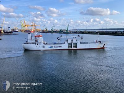
SILVER CRYSTAL
General Cargo
Current Trip
| Time Travelled | 16 days |
|---|---|
| Remaining Time | --- |
| Distance Travelled | 2051.29 nm |
| Remaining Distance | --- |
| AVG Speed | 10.1 Knots |
| MAX Speed | 13.2 Knots |
| AVG Wind | 15.9 knots |
| MAX Wind | 27 knots |
| MIN Temp | 3.7°C / 38.66°F |
| MAX Temp | 19.7°C / 67.46°F |
| Draught | 4.4 m |
| Position Received | 1 d ago |
Current Position
| Longitude | --- |
|---|---|
| Latitude | --- |
| Status | Restricted manoeuverability |
| Speed | 0.9 Knots |
| Course | 297° |
| Area | North Atlantic Ocean |
| Station | T-AIS |
| Position Received | 1 d ago |
Info
Information
The current position of SILVER CRYSTAL is in North Atlantic Ocean with coordinates 30.44153° / -9.76175° as reported on 2025-02-26 17:07 by AIS to our vessel tracker app. The vessel's current speed is 0.9 Knots
The vessel SILVER CRYSTAL (IMO: 8915536, MMSI: 257308000) is a General Cargo that was built in 1991 ( 34 years old ). It's sailing under the flag of [NO] Norway.
In this page you can find informations about the vessels current position, last detected port calls, and current voyage information. If the vessels is not in coverage by AIS you will find the latest position.
The current position of SILVER CRYSTAL is detected by our AIS receivers and we are not responsible for the reliability of the data. The last position was recorded while the vessel was in Coverage by the Ais receivers of our vessel tracking app.
The current draught of SILVER CRYSTAL as reported by AIS is 4.4 meters
Weather
| Temperature | 13.8°C / 56.84°F |
|---|---|
| Wind Speed | 5 knots |
| Direction | 132° SE |
| Pressure | 1018.1 hPa |
| Humidity | 79.8 % |
| Cloud Coverage | 100 % |
Featured Company
Last Port Calls
| Port | Arrival | Departure | Time In Port |
|---|---|---|---|
| 2025-02-10 06:57 | 2025-02-11 13:33 | 1 d | |
| 2025-02-03 06:45 | 2025-02-03 07:21 | 35 m | |
| 2025-01-31 23:15 | 2025-02-02 17:00 | 1 d | |
| 2025-01-26 18:01 | 2025-01-26 19:33 | 1 h | |
| 2025-01-23 07:26 | 2025-01-24 11:07 | 1 d | |
| 2025-01-16 08:06 | 2025-01-18 09:44 | 2 d | |
| 2025-01-11 00:32 | 2025-01-11 20:51 | 20 h | |
| 2024-12-20 11:23 | 2024-12-24 11:22 | 3 d | |
| 2024-12-17 10:29 | 2024-12-18 20:14 | 1 d | |
| 2024-12-10 23:36 | 2024-12-13 04:41 | 2 d |
Most Visited Ports (Last year)
| Port | Arrivals | |
|---|---|---|
| 9 | ||
| 4 | ||
| 4 | ||
| 3 | ||
| 3 | ||
| 3 |
Last Trips
| Origin | Departure | Destination | Arrival | Distance | |
|---|---|---|---|---|---|
| 2025-02-03 09:21 | 2025-02-10 06:57 | 1131.91 nm | |||
| 2025-02-02 19:00 | 2025-02-03 08:45 | 63.00 nm | |||
| 2025-01-26 20:33 | 2025-02-01 01:15 | 991.23 nm | |||
| 2025-01-24 12:07 | 2025-01-26 19:01 | 412.97 nm | |||
| 2025-01-18 11:44 | 2025-01-23 08:26 | 1326.95 nm | |||
| 2025-01-11 20:51 | 2025-01-16 10:06 | 1092.69 nm | |||
| 2024-12-24 12:22 | 2025-01-11 00:32 | 942.22 nm | |||
| 2024-12-18 20:14 | 2024-12-20 12:23 | 404.84 nm | |||
| 2024-12-13 06:41 | 2024-12-17 10:29 | 884.57 nm | |||
| 2024-12-04 11:22 | 2024-12-11 01:36 | 1346.63 nm |
Events
| Time | Event | Details | Position / Dest | Info |
|---|---|---|---|---|
| 2025-02-26 17:09 | Status Changed | Default Restricted manoeuverability |
30.44111 / -9.76188
MAAGA
|
Speed: 0.9 kn Course: 297° |
| 2025-02-26 17:07 | OUT of Coverage |
30.44153 / -9.76175
North Atlantic Ocean
|
Speed: 0.9 kn Course: 198.5° |
|
| 2025-02-26 16:54 | Status Changed | Restricted manoeuverability Default |
30.44348 / -9.76028
MAAGA
|
Speed: 0.7 kn Course: 294° |
| 2025-02-26 16:12 | Status Changed | Default Restricted manoeuverability |
30.44681 / -9.75649
MAAGA
|
Speed: 0.1 kn Course: 303° |
| 2025-02-26 16:07 | Status Changed | Restricted manoeuverability Default |
30.44685 / -9.75676
MAAGA
|
Speed: 0.1 kn Course: 301° |
| 2025-02-26 15:55 | IN Coverage |
30.44682 / -9.75665
North Atlantic Ocean
|
Speed: 0.1 kn Course: 101° |
|
| 2025-02-25 23:20 | STOP Moving | 8.8 nm, North West of AGADIR |
30.48090 / -9.78706
MAAGA
|
Speed: 0.3 kn Course: 121° |
| 2025-02-25 22:04 | Status Changed | Default Restricted manoeuverability |
30.47592 / -9.76810
MAAGA
|
Speed: 1.7 kn Course: 322° |
| 2025-02-25 21:57 | Status Changed | Restricted manoeuverability Default |
30.47330 / -9.76524
MAAGA
|
Speed: 1.7 kn Course: 321° |
| 2025-02-25 21:57 | OUT of Coverage |
30.47330 / -9.76524
North Atlantic Ocean
|
Speed: 1.7 kn Course: 319.7° |