
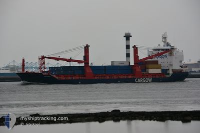
SIGYN W
Cargo
Current Trip
| Time Travelled | 1 day |
|---|---|
| Remaining Time | --- |
| Distance Travelled | 586.01 nm |
| Remaining Distance | 221.42 nm |
| AVG Speed | 13.3 Knots |
| MAX Speed | 15.5 Knots |
| AVG Wind | 12.7 knots |
| MAX Wind | 31 knots |
| MIN Temp | 3.5°C / 38.3°F |
| MAX Temp | 9.3°C / 48.74°F |
| Draught | 8 m |
| Position Received | 13 h, 6 m ago |
Current Position
| Longitude | --- |
|---|---|
| Latitude | --- |
| Status | Under way using engine |
| Speed | 13.1 Knots |
| Course | 186.6° |
| Area | North Sea |
| Station | T-AIS |
| Position Received | 13 h, 6 m ago |
Info
Information
The current position of SIGYN W is in North Sea with coordinates 57.32484° / 4.79456° as reported on 2025-12-13 17:49 by AIS to our vessel tracker app. The vessel's current speed is 13.1 Knots and is heading at the port of ROTTERDAM. The estimated time of arrival as calculated by MyShipTracking vessel tracking app is 2025-12-15 07:00 LT
The vessel SIGYN W (IMO: 9754446, MMSI: 209318000) is a Cargo It's sailing under the flag of [CY] Cyprus.
In this page you can find informations about the vessels current position, last detected port calls, and current voyage information. If the vessels is not in coverage by AIS you will find the latest position.
The current position of SIGYN W is detected by our AIS receivers and we are not responsible for the reliability of the data. The last position was recorded while the vessel was in Coverage by the Ais receivers of our vessel tracking app.
The current draught of SIGYN W as reported by AIS is 8 meters
Weather
| Temperature | 9.3°C / 48.74°F |
|---|---|
| Wind Speed | 30 knots |
| Direction | 228° SW |
| Pressure | 1014.5 hPa |
| Humidity | 84.2 % |
| Cloud Coverage | 95 % |
Featured Company
Last Port Calls
| Port | Arrival | Departure | Time In Port |
|---|---|---|---|
| 2025-12-12 07:03 | 2025-12-12 08:42 | 1 h | |
| 2025-12-07 10:15 | 2025-12-11 12:05 | 4 d | |
| 2025-12-06 11:43 | 2025-12-06 12:55 | 1 h | |
| 2025-12-01 12:25 | 2025-12-04 01:33 | 2 d | |
| 2025-11-28 02:05 | 2025-11-29 00:14 | 22 h | |
| 2025-11-21 12:31 | 2025-11-21 22:36 | 10 h | |
| 2025-11-17 00:56 | 2025-11-19 22:00 | 2 d | |
| 2025-11-13 16:49 | 2025-11-13 22:04 | 5 h | |
| 2025-11-09 10:32 | 2025-11-12 20:21 | 3 d | |
| 2025-11-08 07:30 | 2025-11-08 13:17 | 5 h |
Most Visited Ports (Last year)
| Port | Arrivals | |
|---|---|---|
| 27 | ||
| 26 | ||
| 14 | ||
| 12 | ||
| 4 | ||
| 3 |
Last Trips
| Origin | Departure | Destination | Arrival | Distance | |
|---|---|---|---|---|---|
| 2025-12-11 12:05 | 2025-12-12 07:03 | 251.55 nm | |||
| 2025-12-06 12:55 | 2025-12-07 10:15 | 253.78 nm | |||
| 2025-12-04 01:33 | 2025-12-06 11:43 | 799.96 nm | |||
| 2025-11-29 00:14 | 2025-12-01 12:25 | 747.41 nm | |||
| 2025-11-21 22:36 | 2025-11-28 02:05 | 1047.82 nm | |||
| 2025-11-19 22:00 | 2025-11-21 12:31 | 308.03 nm | |||
| 2025-11-13 22:04 | 2025-11-17 00:56 | 808.50 nm | |||
| 2025-11-12 20:21 | 2025-11-13 16:49 | 249.63 nm | |||
| 2025-11-08 13:17 | 2025-11-09 10:32 | 258.48 nm | |||
| 2025-11-07 21:26 | 2025-11-08 07:30 | 131.69 nm |
Events
| Time | Event | Details | Position / Dest | Info |
|---|---|---|---|---|
| 2025-12-13 17:51 | Status Changed | Default Under way using engine |
57.31884 / 4.79275
ROTTERDAM
|
Speed: 13.1 kn Course: 186.6° |
| 2025-12-13 17:49 | Status Changed | Under way using engine Default |
57.32484 / 4.79456
ROTTERDAM
|
Speed: 12 kn Course: 189° |
| 2025-12-13 17:49 | OUT of Coverage |
57.32484 / 4.79456
North Sea
ROTTERDAM
|
Speed: 13.1 kn Course: 186.6° |
|
| 2025-12-13 17:38 | Status Changed | Default Under way using engine |
57.36260 / 4.80556
ROTTERDAM
|
Speed: 13.1 kn Course: 190.3° |
| 2025-12-13 00:41 | Change Sea Area | Norwegian part of the North Sea Norwegian part of the Norwegian Sea |
60.98714 / 4.74250
North Sea
ROTTERDAM
|
Speed: 12.9 kn Course: 224.6° |
| 2025-12-12 08:23 | Status Changed | Under way using engine Default |
63.11995 / 7.67326
ROTTERDAM
|
Speed: 15.2 kn Course: 348° |
| 2025-12-12 08:21 | Status Changed | Default Under way using engine |
63.11407 / 7.68022
ROTTERDAM
|
Speed: 15.3 kn Course: 352.6° |
| 2025-12-12 08:10 | Status Changed | Under way using engine Default |
63.06946 / 7.68499
ROTTERDAM
|
Speed: 15.3 kn Course: 2° |
| 2025-12-12 08:09 | Status Changed | Default Under way using engine |
63.06404 / 7.68460
ROTTERDAM
|
Speed: 15.2 kn Course: 1.2° |
| 2025-12-12 07:42 | PORT DEPARTURE |
|
62.97500 / 7.73130
ROTTERDAM
|
Speed: 4.3 kn Course: 11° |