
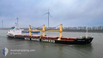
SIDER LUCK
Bulk Carrier
Current Trip
| Time Travelled | 3 days |
|---|---|
| Remaining Time | 1 day |
| Distance Travelled | 718.96 nm |
| Remaining Distance | 330.84 nm |
| AVG Speed | 10.4 Knots |
| MAX Speed | 12 Knots |
| AVG Wind | 14.8 knots |
| MAX Wind | 33 knots |
| MIN Temp | 11.5°C / 52.7°F |
| MAX Temp | 18.3°C / 64.94°F |
| Draught | 8.1 m |
| Position Received | 1 d ago |
Current Position
| Longitude | --- |
|---|---|
| Latitude | --- |
| Status | Under way using engine |
| Speed | 10.6 Knots |
| Course | 283.3° |
| Area | Mediterranean Sea - Western Basin |
| Station | T-AIS |
| Position Received | 1 d ago |
Info
Information
The current position of SIDER LUCK is in Mediterranean Sea - Western Basin with coordinates 37.52519° / 10.85399° as reported on 2026-01-04 09:58 by AIS to our vessel tracker app. The vessel's current speed is 10.6 Knots and is heading at the port of CEUTA. The estimated time of arrival as calculated by MyShipTracking vessel tracking app is 2026-01-07 14:28 LT
The vessel SIDER LUCK (IMO: 9495595, MMSI: 255779000) is a Bulk Carrier that was built in 2012 ( 14 years old ). It's sailing under the flag of [PT] Portugal.
In this page you can find informations about the vessels current position, last detected port calls, and current voyage information. If the vessels is not in coverage by AIS you will find the latest position.
The current position of SIDER LUCK is detected by our AIS receivers and we are not responsible for the reliability of the data. The last position was recorded while the vessel was in Coverage by the Ais receivers of our vessel tracking app.
The current draught of SIDER LUCK as reported by AIS is 8.1 meters
Weather
| Temperature | 10.3°C / 50.54°F |
|---|---|
| Wind Speed | 16 knots |
| Direction | 34° NE |
| Pressure | 1010.2 hPa |
| Humidity | 81.7 % |
| Cloud Coverage | 100 % |
Featured Company
Last Port Calls
| Port | Arrival | Departure | Time In Port |
|---|---|---|---|
| 2025-12-30 10:12 | 2026-01-03 09:44 | 3 d | |
| 2025-12-16 12:32 | 2025-12-24 17:17 | 8 d | |
| 2025-12-02 20:09 | 2025-12-04 19:40 | 1 d | |
| 2025-11-19 08:37 | 2025-11-28 10:07 | 9 d | |
| 2025-11-13 08:36 | 2025-11-17 08:04 | 3 d |
Last Trips
| Origin | Departure | Destination | Arrival | Distance | |
|---|---|---|---|---|---|
| 2025-12-24 17:17 | 2025-12-30 10:12 | 962.34 nm | |||
| 2025-12-04 19:40 | 2025-12-16 12:32 | 1801.56 nm | |||
| 2025-11-28 10:07 | 2025-12-02 20:09 | 1218.26 nm | |||
| 2025-11-17 08:04 | 2025-11-19 08:37 | 478.80 nm | |||
| 2025-10-29 17:43 | 2025-11-13 08:36 | 3353.73 nm |
Events
| Time | Event | Details | Position / Dest | Info |
|---|---|---|---|---|
| 2026-01-04 10:05 | Status Changed | Default Under way using engine |
37.52987 / 10.82932
ESCEU
|
Speed: 10.6 kn Course: 283.3° |
| 2026-01-04 09:58 | Status Changed | Under way using engine Default |
37.52519 / 10.85399
ESCEU
|
Speed: 10.6 kn Course: 284° |
| 2026-01-04 09:58 | OUT of Coverage |
37.52519 / 10.85399
Mediterranean Sea - Western Basin
ESCEU
|
Speed: 10.6 kn Course: 283.3° |
|
| 2026-01-04 09:45 | IN Coverage |
37.52519 / 10.85399
Mediterranean Sea - Western Basin
ESCEU
|
Speed: 10.6 kn Course: 283.3° |
|
| 2026-01-04 08:10 | Status Changed | Default Under way using engine |
37.44380 / 11.23831
ESCEU
|
Speed: 10.7 kn Course: 303.3° |
| 2026-01-04 08:04 | OUT of Coverage |
37.43512 / 11.25581
Mediterranean Sea - Western Basin
ESCEU
|
Speed: 10.7 kn Course: 303.3° |
|
| 2026-01-04 07:21 | Draught Changed | 8.1 9.5 |
37.37293 / 11.38976
ESCEU
|
Speed: 10.2 kn Course: 297.5° |
| 2026-01-04 07:21 | Destination Changed | ESCEU FRSET |
37.37293 / 11.38976
ESCEU
|
Speed: 10.2 kn Course: 297.5° |
| 2026-01-04 07:21 | ETA Changed | 2026/01/07 11:00 2025/12/15 07:00 |
37.37293 / 11.38976
ESCEU
|
Speed: 10.2 kn Course: 297.5° |
| 2026-01-04 07:11 | Detected in Sea | Tunisian part of the Mediterranean Sea - Western Basin |
37.35904 / 11.42210
Mediterranean Sea - Western Basin
|
Speed: 10.8 kn Course: 301.4° |