
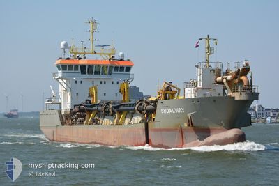
SHOALWAY
Trailing Suction Hopper Dredger
Current Trip
| Time Travelled | 17 h, 43 mins |
|---|---|
| Remaining Time | --- |
| Distance Travelled | 122.73 nm |
| Remaining Distance | --- |
| AVG Speed | 9.1 Knots |
| MAX Speed | 14 Knots |
| AVG Wind | 4.6 knots |
| MAX Wind | 10 knots |
| MIN Temp | 10.1°C / 50.18°F |
| MAX Temp | 17.3°C / 63.14°F |
| Draught | 4.8 m |
| Position Received | Now |
Current Position
| Longitude | -6.95506° |
|---|---|
| Latitude | 52.13913° |
| Status | Restricted manoeuverability |
| Speed | 11.6 Knots |
| Course | 33.2° |
| Area | Celtic Sea |
| Station | T-AIS |
| Position Received | Now |
Info
Information
The current position of SHOALWAY is in Celtic Sea with coordinates 52.13913° / -6.95506° as reported on 2024-05-11 05:09 by AIS to our vessel tracker app. The vessel's current speed is 11.6 Knots
The vessel SHOALWAY (IMO: 9556337, MMSI: 212115000) is a Trailing Suction Hopper Dredger that was built in 2010 ( 14 years old ). It's sailing under the flag of [CY] Cyprus.
In this page you can find informations about the vessels current position, last detected port calls, and current voyage information. If the vessels is not in coverage by AIS you will find the latest position.
The current position of SHOALWAY is detected by our AIS receivers and we are not responsible for the reliability of the data. The last position was recorded while the vessel was in Coverage by the Ais receivers of our vessel tracking app.
The current draught of SHOALWAY as reported by AIS is 4.8 meters
Weather
| Temperature | 9.8°C / 49.64°F |
|---|---|
| Wind Speed | 4 knots |
| Direction | 64° ENE |
| Pressure | 1019.3 hPa |
| Humidity | 90.7 % |
| Cloud Coverage | 100 % |
Featured Company
Last Port Calls
| Port | Arrival | Departure | Time In Port |
|---|---|---|---|
| 2024-05-10 10:29 | 2024-05-10 11:27 | 57 m | |
| 2024-05-08 10:51 | 2024-05-08 12:41 | 1 h | |
| 2024-05-04 11:13 | 2024-05-04 11:25 | 11 m | |
| 2024-05-04 07:38 | 2024-05-04 07:49 | 10 m | |
| 2024-05-01 05:31 | 2024-05-01 12:11 | 6 h | |
| 2024-04-30 08:45 | 2024-04-30 09:45 | 1 h | |
| 2024-04-30 05:40 | 2024-04-30 08:01 | 2 h | |
| 2024-04-30 02:38 | 2024-04-30 03:01 | 22 m | |
| 2024-04-30 01:39 | 2024-04-30 02:07 | 27 m | |
| 2024-04-29 23:52 | 2024-04-30 00:18 | 26 m |
Most Visited Ports (Last year)
| Port | Arrivals | |
|---|---|---|
| 733 | ||
| 178 | ||
| 162 | ||
| 124 | ||
| 59 | ||
| 30 |
Last Trips
| Origin | Departure | Destination | Arrival | Distance | |
|---|---|---|---|---|---|
| 2024-05-08 13:41 | 2024-05-10 11:29 | 318.39 nm | |||
| 2024-05-04 12:25 | 2024-05-08 11:51 | 683.39 nm | |||
| 2024-05-04 08:49 | 2024-05-04 12:13 | 26.10 nm | |||
| 2024-05-01 13:11 | 2024-05-04 08:38 | 466.94 nm | |||
| 2024-04-30 10:45 | 2024-05-01 06:31 | 191.14 nm | |||
| 2024-04-30 09:01 | 2024-04-30 09:45 | 1.74 nm | |||
| 2024-04-30 04:01 | 2024-04-30 06:40 | 3.98 nm | |||
| 2024-04-30 03:07 | 2024-04-30 03:38 | 3.05 nm | |||
| 2024-04-30 01:18 | 2024-04-30 02:39 | 1.53 nm | |||
| 2024-04-30 00:22 | 2024-04-30 00:52 | 2.96 nm |
Events
| Time | Event | Details | Position / Dest | Info |
|---|---|---|---|---|
| 2024-05-11 03:32 | START Moving | 1.55 nm, South of DUNMORE EAST |
52.12389 / -6.97687
WATERFORD
|
Speed: 7.9 kn Course: 31.7° |
| 2024-05-11 03:30 | STOP Moving | 1.65 nm, South of DUNMORE EAST |
52.12199 / -6.97788
WATERFORD
|
Speed: 0.3 kn Course: 30° |
| 2024-05-11 01:54 | START Moving | 1.74 nm, South of DUNMORE EAST |
52.12047 / -6.97774
WATERFORD
|
Speed: 7.9 kn Course: 32.6° |
| 2024-05-11 01:51 | STOP Moving | 1.83 nm, South of DUNMORE EAST |
52.11862 / -6.97870
WATERFORD
|
Speed: 0.2 kn Course: 36° |
| 2024-05-11 00:14 | START Moving | 1.81 nm, South of DUNMORE EAST |
52.12043 / -6.97151
WATERFORD
|
Speed: 7.8 kn Course: 35.4° |
| 2024-05-11 00:10 | STOP Moving | 1.86 nm, South of DUNMORE EAST |
52.11900 / -6.97373
WATERFORD
|
Speed: 0.3 kn Course: 65° |
| 2024-05-10 22:41 | START Moving | 1.65 nm, South East of DUNMORE EAST |
52.12363 / -6.97068
WATERFORD
|
Speed: 7.9 kn Course: 30.5° |
| 2024-05-10 22:38 | STOP Moving | 1.72 nm, South East of DUNMORE EAST |
52.12189 / -6.97198
WATERFORD
|
Speed: 0.3 kn Course: 17° |
| 2024-05-10 21:57 | START Moving | 3.05 nm, South East of PASSAGE EAST |
52.19413 / -6.93854
WATERFORD
|
Speed: 3.1 kn Course: 180° |
| 2024-05-10 21:52 | STOP Moving | 2.9 nm, South East of PASSAGE EAST |
52.19685 / -6.93881
WATERFORD
|
Speed: 0.3 kn Course: 112° |