
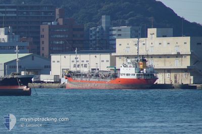
SHIN TAIYO MARU
Tanker
Current Trip
| Time Travelled | 7 h, 10 mins |
|---|---|
| Remaining Time | 23 h, 22 mins |
| Distance Travelled | 92.18 nm |
| Remaining Distance | 299.67 nm |
| AVG Speed | 13.2 Knots |
| MAX Speed | 14.8 Knots |
| AVG Wind | 5.8 knots |
| MAX Wind | 8.8 knots |
| MIN Temp | 16.6°C / 61.88°F |
| MAX Temp | 22.5°C / 72.5°F |
| Draught | 5 m |
| Position Received | 4 d ago |
Current Position
| Longitude | 134.37879° |
|---|---|
| Latitude | 34.35118° |
| Status | Under way using engine |
| Speed | 12.1 Knots |
| Course | 292.1° |
| Area | Inland Sea |
| Station | T-AIS |
| Position Received | 4 d ago |
Info
Information
The current position of SHIN TAIYO MARU is in Inland Sea with coordinates 34.35118° / 134.37879° as reported on 2024-04-28 22:54 by AIS to our vessel tracker app. The vessel's current speed is 12.1 Knots and is heading at the port of HIROSHIMA. The estimated time of arrival as calculated by MyShipTracking vessel tracking app is 2024-05-04 04:56 LT
The vessel SHIN TAIYO MARU (IMO: 9672662, MMSI: 431004516) is a Tanker It's sailing under the flag of [JP] Japan.
In this page you can find informations about the vessels current position, last detected port calls, and current voyage information. If the vessels is not in coverage by AIS you will find the latest position.
The current position of SHIN TAIYO MARU is detected by our AIS receivers and we are not responsible for the reliability of the data. The last position was recorded while the vessel was in Coverage by the Ais receivers of our vessel tracking app.
The current draught of SHIN TAIYO MARU as reported by AIS is 5 meters
Weather
| Temperature | 21.2°C / 70.16°F |
|---|---|
| Wind Speed | 6 knots |
| Direction | 101° E |
| Pressure | 1016 hPa |
| Humidity | 75.3 % |
| Cloud Coverage | 100 % |
Featured Company
Last Port Calls
| Port | Arrival | Departure | Time In Port |
|---|---|---|---|
| 2024-05-02 07:27 | 2024-05-02 22:24 | 14 h | |
| 2024-04-30 22:04 | 2024-05-01 02:00 | 3 h | |
| 2024-04-29 22:24 | 2024-04-30 01:52 | 3 h | |
| 2024-04-27 01:39 | 2024-04-28 01:48 | 1 d | |
| 2024-04-26 03:36 | 2024-04-26 10:12 | 6 h | |
| 2024-04-25 04:04 | 2024-04-25 08:56 | 4 h | |
| 2024-04-24 00:52 | 2024-04-24 09:25 | 8 h | |
| 2024-04-23 06:16 | 2024-04-24 00:09 | 17 h | |
| 2024-04-22 23:24 | 2024-04-23 05:03 | 5 h | |
| 2024-04-21 00:00 | 2024-04-22 05:28 | 1 d |
Last Trips
| Origin | Departure | Destination | Arrival | Distance | |
|---|---|---|---|---|---|
| 2024-05-01 11:00 | 2024-05-02 16:27 | 253.36 nm | |||
| 2024-04-30 10:52 | 2024-05-01 07:04 | 88.87 nm | |||
| 2024-04-28 10:48 | 2024-04-30 07:24 | 348.68 nm | |||
| 2024-04-26 19:12 | 2024-04-27 10:39 | 188.87 nm | |||
| 2024-04-25 17:56 | 2024-04-26 12:36 | 193.15 nm | |||
| 2024-04-24 18:25 | 2024-04-25 13:04 | 193.13 nm | |||
| 2024-04-24 09:09 | 2024-04-24 09:52 | 5.73 nm | |||
| 2024-04-23 14:03 | 2024-04-23 15:16 | 14.88 nm | |||
| 2024-04-22 14:28 | 2024-04-23 08:24 | 191.53 nm | |||
| 2024-04-17 17:20 | 2024-04-21 09:00 | 651.32 nm |
Events
| Time | Event | Details | Position / Dest | Info |
|---|---|---|---|---|
| 2024-05-02 22:24 | PORT DEPARTURE |
|
32.50500 / 130.51500
JP HIJ
|
Speed: 12.5 kn Course: 298° |
| 2024-05-02 22:10 | START Moving |
32.51239 / 130.55898
[JP] YATSUSHIRO
|
Speed: 6.9 kn Course: 310° |
|
| 2024-05-02 07:27 | PORT ARRIVAL |
|
32.50957 / 130.56169
[JP] YATSUSHIRO
|
Speed: 11 kn Course: 12° |
| 2024-05-02 07:00 | START Moving | 3.72 nm, South East of AMURA |
32.46933 / 130.48254
JP HIJ
|
Speed: 12.5 kn Course: 93° |
| 2024-05-02 06:48 | STOP Moving | 3.28 nm, South of AMURA |
32.47167 / 130.46500
JP HIJ
|
Speed: Course: -1° |
| 2024-05-02 01:36 | START Moving | 3.03 nm, South West of YATSUSHIRO |
32.48500 / 130.50333
JP HIJ
|
Speed: 11 kn Course: 14° |
| 2024-05-01 22:03 | STOP Moving | 4.58 nm, South East of AMURA |
32.45500 / 130.48666
JP HIJ
|
Speed: Course: -1° |
| 2024-05-01 02:00 | PORT DEPARTURE |
|
33.92213 / 131.19547
JP HIJ
|
Speed: 5.9 kn Course: 141° |
| 2024-05-01 01:56 | START Moving |
33.93112 / 131.19151
[JP] UBE
|
Speed: 5.9 kn Course: 141° |
|
| 2024-04-30 22:16 | STOP Moving |
33.93397 / 131.18642
[JP] UBE
|
Speed: 0.2 kn Course: 279° |