

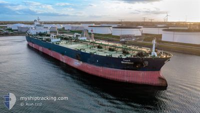
SHAYBAH
Crude Oil Tanker

Current Trip
| Time Travelled | 4 days |
|---|---|
| Remaining Time | 1 day |
| Distance Travelled | 771.28 nm |
| Remaining Distance | 386.88 nm |
| AVG Speed | 11.9 Knots |
| MAX Speed | 14.2 Knots |
| AVG Wind | 9.9 knots |
| MAX Wind | 21 knots |
| MIN Temp | 12.4°C / 54.32°F |
| MAX Temp | 22.9°C / 73.22°F |
| Draught | 10.8 m |
| Position Received | 7 m ago |
Current Position
| Longitude | --- |
|---|---|
| Latitude | --- |
| Status | Under way using engine |
| Speed | 12.1 Knots |
| Course | 143° |
| Area | Red Sea |
| Station | T-AIS |
| Position Received | 7 m ago |
Information
The current position of SHAYBAH is in Red Sea with coordinates 26.54558° / 34.84998° as reported on 2025-02-18 07:55 by AIS to our vessel tracker app. The vessel's current speed is 12.1 Knots and is heading at the port of JEDDAH. The estimated time of arrival as calculated by MyShipTracking vessel tracking app is 2025-02-19 15:58 LT
The vessel SHAYBAH (IMO: 9384203, MMSI: 403561000) is a Crude Oil Tanker that was built in 2008 ( 17 years old ). It's sailing under the flag of [SA] Saudi Arabia.
In this page you can find informations about the vessels current position, last detected port calls, and current voyage information. If the vessels is not in coverage by AIS you will find the latest position.
The current position of SHAYBAH is detected by our AIS receivers and we are not responsible for the reliability of the data. The last position was recorded while the vessel was in Coverage by the Ais receivers of our vessel tracking app.
The current draught of SHAYBAH as reported by AIS is 10.8 meters
Weather
| Temperature | 21.1°C / 69.98°F |
|---|---|
| Wind Speed | 15 knots |
| Direction | 351° N |
| Pressure | 1018.3 hPa |
| Humidity | 49.2 % |
| Cloud Coverage | --- |


Featured Company
Last Port Calls
| Port | Arrival | Departure | Time In Port |
|---|---|---|---|
| 2025-02-12 06:54 | 2025-02-13 18:20 | 1 d | |
| 2025-01-29 17:11 | 2025-01-31 03:42 | 1 d | |
| 2025-01-15 22:56 | 2025-01-17 10:18 | 1 d | |
| 2025-01-01 21:53 | 2025-01-03 11:28 | 1 d | |
| 2024-12-24 02:39 | 2024-12-25 13:16 | 1 d | |
| 2024-12-08 05:52 | 2024-12-09 22:07 | 1 d |
Most Visited Ports (Last year)
| Port | Arrivals | |
|---|---|---|
| 17 | ||
| 6 | ||
| 1 |
Last Trips
| Origin | Departure | Destination | Arrival | Distance | |
|---|---|---|---|---|---|
| 2025-01-31 06:42 | 2025-02-12 09:54 | 1579.56 nm | |||
| 2025-01-17 13:18 | 2025-01-29 20:11 | 1477.53 nm | |||
| 2025-01-03 14:28 | 2025-01-16 01:56 | 1370.01 nm | |||
| 2024-12-25 16:16 | 2025-01-02 00:53 | 1155.75 nm | |||
| 2024-12-10 01:07 | 2024-12-24 05:39 | 1076.95 nm | |||
| 2024-11-26 02:45 | 2024-12-08 08:52 | 1237.93 nm |
Events
| Time | Event | Details | Position / Dest | Info |
|---|---|---|---|---|
| 2025-02-18 07:24 | Status Changed | Under way using engine Default |
26.63165 / 34.77922
SAJED
|
Speed: 12.5 kn Course: 142° |
| 2025-02-18 07:24 | IN Coverage |
26.62605 / 34.78383
Red Sea
SAJED
|
Speed: 12.4 kn Course: 143° |
|
| 2025-02-18 04:21 | Status Changed | Default Under way using engine |
27.13690 / 34.36580
SAJED
|
Speed: 11.1 kn Course: 142° |
| 2025-02-18 04:15 | OUT of Coverage |
27.15098 / 34.35260
Red Sea
SAJED
|
Speed: 11.1 kn Course: 142° |
|
| 2025-02-18 04:13 | Status Changed | Under way using engine Default |
27.15668 / 34.34765
SAJED
|
Speed: 11.3 kn Course: 145° |
| 2025-02-18 03:34 | Status Changed | Default Under way using engine |
27.25542 / 34.26812
SAJED
|
Speed: 11.5 kn Course: 144° |
| 2025-02-18 02:41 | Draught Changed | 10.8 21.7 |
27.39680 / 34.15645
SAJED
|
Speed: 11.6 kn Course: 144° |
| 2025-02-18 02:41 | Destination Changed | SAJED EGAIS |
27.39680 / 34.15645
SAJED
|
Speed: 11.6 kn Course: 144° |
| 2025-02-18 02:41 | ETA Changed | 2025/02/19 16:00 2025/02/15 14:00 |
27.39680 / 34.15645
SAJED
|
Speed: 11.6 kn Course: 144° |
| 2025-02-18 02:38 | Status Changed | Under way using engine Default |
27.40520 / 34.14983
EGAIS
|
Speed: 11.5 kn Course: 144° |