
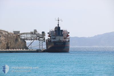
SEREF KURU
Cargo
Current Trip
| Time Travelled | 10 days |
|---|---|
| Remaining Time | 1 day |
| Distance Travelled | 2580.89 nm |
| Remaining Distance | 415.92 nm |
| AVG Speed | 10.3 Knots |
| MAX Speed | 11.8 Knots |
| AVG Wind | 13.6 knots |
| MAX Wind | 36 knots |
| MIN Temp | 10.4°C / 50.72°F |
| MAX Temp | 17.3°C / 63.14°F |
| Draught | 9 m |
| Position Received | 42 m ago |
Current Position
| Longitude | --- |
|---|---|
| Latitude | --- |
| Status | Under way using engine |
| Speed | 10.6 Knots |
| Course | 58.7° |
| Area | English Channel |
| Station | T-AIS |
| Position Received | 42 m ago |
Information
The current position of SEREF KURU is in English Channel with coordinates 49.64421° / -3.35604° as reported on 2025-03-10 04:50 by AIS to our vessel tracker app. The vessel's current speed is 10.6 Knots and is heading at the port of HULL. The estimated time of arrival as calculated by MyShipTracking vessel tracking app is 2025-03-11 20:37 LT
The vessel SEREF KURU (IMO: 860611100, MMSI: 352001957) is a Cargo It's sailing under the flag of [PA] Panama.
In this page you can find informations about the vessels current position, last detected port calls, and current voyage information. If the vessels is not in coverage by AIS you will find the latest position.
The current position of SEREF KURU is detected by our AIS receivers and we are not responsible for the reliability of the data. The last position was recorded while the vessel was in Coverage by the Ais receivers of our vessel tracking app.
The current draught of SEREF KURU as reported by AIS is 9 meters
Weather
| Temperature | 10.9°C / 51.62°F |
|---|---|
| Wind Speed | 12 knots |
| Direction | 61° ENE |
| Pressure | 998.6 hPa |
| Humidity | 90.1 % |
| Cloud Coverage | 100 % |
Featured Company
Most Visited Ports (Last year)
| Port | Arrivals | |
|---|---|---|
| 7 | ||
| 3 | ||
| 3 | ||
| 2 | ||
| 1 | ||
| 1 |
Last Trips
Events
| Time | Event | Details | Position / Dest | Info |
|---|---|---|---|---|
| 2025-03-10 04:56 | Status Changed | Default Under way using engine |
49.65245 / -3.33536
GBHUL
|
Speed: 10.6 kn Course: 58.7° |
| 2025-03-10 04:50 | Detected in Sea | Guernsey part of the English Channel |
49.64421 / -3.35604
English Channel
GBHUL
|
Speed: 10.6 kn Course: 58.7° |
| 2025-03-10 04:50 | Status Changed | Under way using engine Default |
49.64421 / -3.35604
GBHUL
|
Speed: 10.5 kn Course: 59° |
| 2025-03-10 04:44 | IN Coverage |
49.64421 / -3.35604
English Channel
GBHUL
|
Speed: 10.6 kn Course: 58.7° |
|
| 2025-03-10 03:28 | Status Changed | Default Under way using engine |
49.51845 / -3.67943
GBHUL
|
Speed: 10.7 kn Course: 60.3° |
| 2025-03-10 03:23 | OUT of Coverage |
49.51098 / -3.69917
English Channel
GBHUL
|
Speed: 10.7 kn Course: 60.3° |
|
| 2025-03-10 03:14 | Status Changed | Under way using engine Default |
49.49899 / -3.73197
GBHUL
|
Speed: 10.7 kn Course: 61° |
| 2025-03-10 03:07 | Status Changed | Default Under way using engine |
49.48879 / -3.75992
GBHUL
|
Speed: 10.7 kn Course: 62.2° |
| 2025-03-10 03:01 | Status Changed | Under way using engine Default |
49.47996 / -3.78447
GBHUL
|
Speed: 10.7 kn Course: 62° |
| 2025-03-10 02:52 | Status Changed | Default Under way using engine |
49.46634 / -3.82295
GBHUL
|
Speed: 10.9 kn Course: 61.1° |