
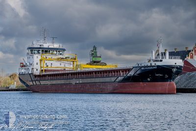
SELVAAGSUND
Cargo
Current Trip
| Trip Time | 1 day |
|---|---|
| Trip Distance | 346.86 nm |
| AVG Speed | 8.3 Knots |
| MAX Speed | 10.7 Knots |
| Draught | 7.1 m |
| AVG Wind | 17.2 knots |
| MAX Wind | 40 knots |
| MIN Temp | 6°C / 42.8°F |
| MAX Temp | 10.1°C / 50.18°F |
| Position Received | 3 m ago |
Current Position
| Longitude | --- |
|---|---|
| Latitude | --- |
| Status | Moored |
| Speed | |
| Course | 312° |
| Area | Skaggerak |
| Station | T-AIS |
| Position Received | 3 m ago |
Info
Information
The current position of SELVAAGSUND is in Skaggerak with coordinates 58.24614° / 8.38046° as reported on 2025-12-16 08:10 by AIS to our vessel tracker app. The vessel's current speed is 0 Knots and is currently inside the port of LILLESAND.
The vessel SELVAAGSUND (IMO: 9956862, MMSI: 257935000) is a Cargo It's sailing under the flag of [NO] Norway.
In this page you can find informations about the vessels current position, last detected port calls, and current voyage information. If the vessels is not in coverage by AIS you will find the latest position.
The current position of SELVAAGSUND is detected by our AIS receivers and we are not responsible for the reliability of the data. The last position was recorded while the vessel was in Coverage by the Ais receivers of our vessel tracking app.
The current draught of SELVAAGSUND as reported by AIS is 7.1 meters
Weather
| Temperature | 8.2°C / 46.76°F |
|---|---|
| Wind Speed | 14 knots |
| Direction | 209° SSW |
| Pressure | 1008.2 hPa |
| Humidity | 92.9 % |
| Cloud Coverage | 100 % |
Featured Company
Last Port Calls
| Port | Arrival | Departure | Time In Port |
|---|---|---|---|
| 2025-12-16 08:00 | |||
| 2025-12-14 12:33 | 2025-12-14 14:42 | 2 h | |
| 2025-12-10 18:09 | 2025-12-12 14:06 | 1 d | |
| 2025-12-06 05:43 | 2025-12-06 12:28 | 6 h | |
| 2025-12-03 05:11 | 2025-12-03 16:48 | 11 h | |
| 2025-11-28 23:13 | 2025-11-30 15:49 | 1 d | |
| 2025-11-27 05:21 | 2025-11-28 11:55 | 1 d | |
| 2025-11-24 17:37 | 2025-11-25 23:28 | 1 d | |
| 2025-11-20 12:24 | 2025-11-21 18:06 | 1 d | |
| 2025-11-19 22:13 | 2025-11-20 00:50 | 2 h |
Last Trips
| Origin | Departure | Destination | Arrival | Distance | |
|---|---|---|---|---|---|
| 2025-12-14 14:42 | 2025-12-16 08:00 | 346.86 nm | |||
| 2025-12-12 14:06 | 2025-12-14 12:33 | 390.45 nm | |||
| 2025-12-06 12:28 | 2025-12-10 18:09 | 820.92 nm | |||
| 2025-12-03 16:48 | 2025-12-06 05:43 | 674.15 nm | |||
| 2025-11-30 15:49 | 2025-12-03 05:11 | 606.25 nm | |||
| 2025-11-28 11:55 | 2025-11-28 23:13 | 123.11 nm | |||
| 2025-11-25 23:28 | 2025-11-27 05:21 | 293.99 nm | |||
| 2025-11-21 18:06 | 2025-11-24 17:37 | 652.60 nm | |||
| 2025-11-20 00:50 | 2025-11-20 12:24 | 124.63 nm | |||
| 2025-11-18 10:58 | 2025-11-19 22:13 | 365.07 nm |
Events
| Time | Event | Details | Position / Dest | Info |
|---|---|---|---|---|
| 2025-12-16 07:49 | Status Changed | Moored Under way using engine |
58.24615 / 8.38044
[NO] LILLESAND
|
Speed: Course: 311° |
| 2025-12-16 07:21 | STOP Moving |
58.24618 / 8.38055
[NO] LILLESAND
|
Speed: 0.2 kn Course: 310° |
|
| 2025-12-16 07:00 | PORT ARRIVAL |
|
58.23936 / 8.39359
[NO] LILLESAND
|
Speed: 4.3 kn Course: 320° |
| 2025-12-16 02:01 | Detected in Sea | Norwegian part of the Skaggerak |
57.92669 / 7.14359
Skaggerak
NOLIL
|
Speed: 10.2 kn Course: 83.8° |
| 2025-12-15 09:51 | ETA Changed | 2025/12/16 04:00 2025/12/16 02:00 |
59.54453 / 4.90368
NOLIL
|
Speed: 7.7 kn Course: 175.4° |
| 2025-12-15 00:35 | Status Changed | Under way using engine Default |
60.64614 / 4.86047
NOLIL
|
Speed: 9.1 kn Course: 159° |
| 2025-12-15 00:34 | Status Changed | Default Under way using engine |
60.64926 / 4.85799
NOLIL
|
Speed: 9 kn Course: 158.9° |
| 2025-12-15 00:17 | Status Changed | Under way using engine Moored |
60.68832 / 4.82768
NOLIL
|
Speed: 8.7 kn Course: 158.3° |
| 2025-12-14 21:37 | Detected in Sea | Norwegian part of the North Sea |
60.99802 / 4.63611
North Sea
NOLIL
|
Speed: 7.4 kn Course: 165.2° |
| 2025-12-14 13:42 | PORT DEPARTURE |
|
61.92429 / 5.11945
NOLIL
|
Speed: 7.7 kn Course: 190° |