
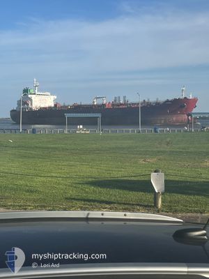
SEAWAYS WHEAT
Tanker C
Current Trip
CRISTABOL
| Time Travelled | 15 days |
|---|---|
| Remaining Time | --- |
| Distance Travelled | 3779.30 nm |
| Remaining Distance | --- |
| AVG Speed | 11.2 Knots |
| MAX Speed | 16.1 Knots |
| AVG Wind | 9.3 knots |
| MAX Wind | 19 knots |
| MIN Temp | 17.7°C / 63.86°F |
| MAX Temp | 30.9°C / 87.62°F |
| Draught | 12 m |
| Position Received | 9 d ago |
Current Position
| Longitude | --- |
|---|---|
| Latitude | --- |
| Status | Under way using engine |
| Speed | 10.6 Knots |
| Course | 172.4° |
| Area | North Pacific Ocean |
| Station | T-AIS |
| Position Received | 9 d ago |
Info
Information
The current position of SEAWAYS WHEAT is in North Pacific Ocean with coordinates 8.45358° / -79.51505° as reported on 2025-12-30 14:24 by AIS to our vessel tracker app. The vessel's current speed is 10.6 Knots
The vessel SEAWAYS WHEAT (IMO: 9681168, MMSI: 538006177) is a Tanker C It's sailing under the flag of [MH] Marshall Is.
In this page you can find informations about the vessels current position, last detected port calls, and current voyage information. If the vessels is not in coverage by AIS you will find the latest position.
The current position of SEAWAYS WHEAT is detected by our AIS receivers and we are not responsible for the reliability of the data. The last position was recorded while the vessel was in Coverage by the Ais receivers of our vessel tracking app.
The current draught of SEAWAYS WHEAT as reported by AIS is 12 meters
Weather
| Temperature | 20.9°C / 69.62°F |
|---|---|
| Wind Speed | 10 knots |
| Direction | 164° SSE |
| Pressure | 1009.5 hPa |
| Humidity | 88.8 % |
| Cloud Coverage | 100 % |
Featured Company
Last Port Calls
| Port | Arrival | Departure | Time In Port |
|---|---|---|---|
| 2025-12-19 11:39 | 2025-12-23 18:35 | 4 d | |
| 2025-12-04 14:06 | 2025-12-07 16:46 | 3 d | |
| 2025-11-14 08:04 | 2025-11-16 01:07 | 1 d |
Last Trips
| Origin | Departure | Destination | Arrival | Distance | |
|---|---|---|---|---|---|
| 2025-12-07 16:46 | 2025-12-19 11:39 | 794.15 nm | |||
| 2025-11-16 01:07 | 2025-12-04 14:06 | 4249.68 nm | |||
| 2025-10-28 21:54 | 2025-11-14 08:04 | 366.16 nm |
Events
| Time | Event | Details | Position / Dest | Info |
|---|---|---|---|---|
| 2026-01-07 15:33 | START Moving | 6.19 nm, South East of MATARANI |
-17.04530 / -72.01144
CRISTABOL
|
Speed: 4.5 kn Course: 220° |
| 2026-01-05 07:14 | STOP Moving | 6.33 nm, South East of MATARANI |
-17.04286 / -72.00745
CRISTABOL
|
Speed: 0.3 kn Course: 177° |
| 2026-01-05 05:31 | START Moving | 1.67 nm, North West of MATARANI |
-16.97951 / -72.12939
CRISTABOL
|
Speed: 3.4 kn Course: 175° |
| 2026-01-05 01:22 | STOP Moving | 1.79 nm, North West of MATARANI |
-16.97887 / -72.13152
CRISTABOL
|
Speed: 0.3 kn Course: 95° |
| 2025-12-30 14:29 | Status Changed | Default Under way using engine |
8.43540 / -79.51308
CRISTABOL
|
Speed: 10.6 kn Course: 172.4° |
| 2025-12-30 14:24 | Status Changed | Under way using engine Default |
8.45358 / -79.51505
CRISTABOL
|
Speed: 10.6 kn Course: 173° |
| 2025-12-30 14:24 | OUT of Coverage |
8.45358 / -79.51505
North Pacific Ocean
|
Speed: 10.6 kn Course: 172.4° |
|
| 2025-12-30 14:21 | Status Changed | Default Under way using engine |
8.45661 / -79.51542
CRISTABOL
|
Speed: 10.5 kn Course: 175.7° |
| 2025-12-30 12:06 | START Moving | 1.77 nm, North West of TABOGA |
8.81238 / -79.57952
CRISTABOL
|
Speed: 4.5 kn Course: 203° |
| 2025-12-30 11:55 | Status Changed | Under way using engine Default |
8.81590 / -79.57930
CRISTABOL
|
Speed: Course: 105° |