
SEAWAYS WATCH HILL
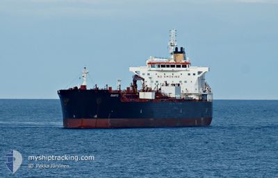
Tanker
Current Trip
KR USN
| Time Travelled | 7 days |
|---|---|
| Remaining Time | --- |
| Distance Travelled | 717.37 nm |
| Remaining Distance | --- |
| AVG Speed | 9.1 Knots |
| MAX Speed | 15 Knots |
| AVG Wind | 13.3 knots |
| MAX Wind | 25.7 knots |
| MIN Temp | 0.5°C / 32.9°F |
| MAX Temp | 11.6°C / 52.88°F |
| Draught | 9.4 m |
| Position Received | 26 d ago |
Current Position
| Longitude | --- |
|---|---|
| Latitude | --- |
| Status | Under way using engine |
| Speed | 13.9 Knots |
| Course | 272° |
| Area | North Pacific Ocean |
| Station | T-AIS |
| Position Received | 26 d ago |
Info
Information
The current position of SEAWAYS WATCH HILL is in North Pacific Ocean with coordinates 21.13708° / -158.24959° as reported on 2025-12-15 00:52 by AIS to our vessel tracker app. The vessel's current speed is 13.9 Knots
The vessel SEAWAYS WATCH HILL (IMO: 9681170, MMSI: 538006178) is a Tanker It's sailing under the flag of [MH] Marshall Is.
In this page you can find informations about the vessels current position, last detected port calls, and current voyage information. If the vessels is not in coverage by AIS you will find the latest position.
The current position of SEAWAYS WATCH HILL is detected by our AIS receivers and we are not responsible for the reliability of the data. The last position was recorded while the vessel was in Coverage by the Ais receivers of our vessel tracking app.
The current draught of SEAWAYS WATCH HILL as reported by AIS is 9.4 meters
Weather
| Temperature | 1.9°C / 35.42°F |
|---|---|
| Wind Speed | 2 knots |
| Direction | 301° WNW |
| Pressure | 1030.4 hPa |
| Humidity | 27.6 % |
| Cloud Coverage | 20 % |
Featured Company
Last Port Calls
| Port | Arrival | Departure | Time In Port |
|---|---|---|---|
| 2026-01-01 08:15 | 2026-01-04 00:38 | 2 d | |
| 2025-12-30 09:36 | 2026-01-01 07:24 | 1 d | |
| 2025-12-13 00:24 | 2025-12-14 12:54 | 1 d | |
| 2025-11-27 13:00 | 2025-11-28 06:42 | 17 h | |
| 2025-11-25 00:21 | 2025-11-26 01:01 | 1 d | |
| 2025-11-24 08:16 | 2025-11-24 23:11 | 14 h | |
| 2025-11-05 17:11 | 2025-11-06 15:19 | 22 h | |
| 2025-11-04 05:14 | 2025-11-04 19:38 | 14 h |
Last Trips
| Origin | Departure | Destination | Arrival | Distance | |
|---|---|---|---|---|---|
| 2026-01-01 07:24 | 2026-01-01 08:15 | 8.95 nm | |||
| 2025-12-14 12:54 | 2025-12-30 09:36 | 4494.79 nm | |||
| 2025-11-28 06:42 | 2025-12-13 00:24 | 4049.20 nm | |||
| 2025-11-26 01:01 | 2025-11-27 13:00 | 17.01 nm | |||
| 2025-11-24 23:11 | 2025-11-25 00:21 | 9.39 nm | |||
| 2025-11-06 15:19 | 2025-11-24 08:16 | 5667.17 nm | |||
| 2025-11-04 19:38 | 2025-11-05 17:11 | 114.42 nm | |||
| 2025-10-28 22:33 | 2025-11-04 05:14 | 374.52 nm |
Events
| Time | Event | Details | Position / Dest | Info |
|---|---|---|---|---|
| 2026-01-08 09:16 | STOP Moving | 6.37 nm, South East of NANJING |
32.18390 / 118.91149
KR USN
|
Speed: Course: 284° |
| 2026-01-08 00:32 | START Moving | 2.91 nm, East of CHANGZHOU |
31.95777 / 120.07252
KR USN
|
Speed: 7.4 kn Course: 282° |
| 2026-01-07 14:35 | STOP Moving | 3.48 nm, East of CHANGZHOU |
31.95741 / 120.08378
KR USN
|
Speed: 0.2 kn Course: 292° |
| 2026-01-06 23:20 | START Moving | 20.35 nm, North East of SHENGSI |
31.00320 / 122.67258
KR USN
|
Speed: 7.7 kn Course: 180° |
| 2026-01-06 00:44 | STOP Moving | 20.82 nm, North East of SHENGSI |
31.01225 / 122.67435
KR USN
|
Speed: 0.3 kn Course: 13° |
| 2026-01-03 15:38 | PORT DEPARTURE |
|
35.41185 / 129.37735
KR USN
|
Speed: 9.1 kn Course: 182° |
| 2026-01-03 15:32 | START Moving |
35.42657 / 129.37541
[KR] ONSAN
|
Speed: 9.1 kn Course: 182° |
|
| 2025-12-31 23:33 | STOP Moving |
35.44060 / 129.37814
[KR] ONSAN
|
Speed: 0.3 kn Course: 22° |
|
| 2025-12-31 23:15 | PORT ARRIVAL |
|
35.42992 / 129.37616
[KR] ONSAN
|
Speed: 7.6 kn Course: 350° |
| 2025-12-31 22:24 | PORT DEPARTURE |
|
35.46236 / 129.39685
KR USN
|
Speed: 10.9 kn Course: 173° |