
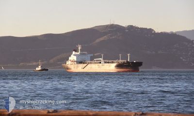
SEABULK PRIDE
Crude Oil Tanker
Current Trip
| Time Travelled | 3 days |
|---|---|
| Remaining Time | --- |
| Distance Travelled | 1103.83 nm |
| Remaining Distance | 12.66 nm |
| AVG Speed | 10 Knots |
| MAX Speed | 16.4 Knots |
| AVG Wind | 16.2 knots |
| MAX Wind | 25 knots |
| MIN Temp | 19.7°C / 67.46°F |
| MAX Temp | 25.8°C / 78.44°F |
| Draught | 11.1 m |
| Position Received | 1 m ago |
Current Position
| Longitude | --- |
|---|---|
| Latitude | --- |
| Status | Under way using engine |
| Speed | 2.1 Knots |
| Course | 312° |
| Area | North Atlantic Ocean |
| Station | T-AIS |
| Position Received | 1 m ago |
Info
Information
The current position of SEABULK PRIDE is in North Atlantic Ocean with coordinates 26.12875° / -79.88137° as reported on 2025-12-22 20:14 by AIS to our vessel tracker app. The vessel's current speed is 2.1 Knots and is heading at the port of PORT EVERGLADES. The estimated time of arrival as calculated by MyShipTracking vessel tracking app is 2025-12-21 17:00 LT
The vessel SEABULK PRIDE (IMO: 9118630, MMSI: 367455580) is a Crude Oil Tanker that was built in 1998 ( 27 years old ). It's sailing under the flag of [US] USA.
In this page you can find informations about the vessels current position, last detected port calls, and current voyage information. If the vessels is not in coverage by AIS you will find the latest position.
The current position of SEABULK PRIDE is detected by our AIS receivers and we are not responsible for the reliability of the data. The last position was recorded while the vessel was in Coverage by the Ais receivers of our vessel tracking app.
The current draught of SEABULK PRIDE as reported by AIS is 11.1 meters
Weather
| Temperature | 24.7°C / 76.46°F |
|---|---|
| Wind Speed | 18 knots |
| Direction | 64° ENE |
| Pressure | 1022 hPa |
| Humidity | 58.6 % |
| Cloud Coverage | 35 % |
Featured Company
Last Port Calls
| Port | Arrival | Departure | Time In Port |
|---|---|---|---|
| 2025-12-16 22:03 | 2025-12-18 19:16 | 1 d | |
| 2025-11-23 07:52 | 2025-11-30 06:36 | 6 d | |
| 2025-11-05 23:12 | 2025-11-07 13:59 | 1 d | |
| 2025-11-02 18:38 | 2025-11-04 08:58 | 1 d | |
| 2025-11-01 20:02 | 2025-11-02 18:30 | 23 h | |
| 2025-11-01 15:38 | 2025-11-01 19:38 | 4 h | |
| 2025-10-27 14:13 | 2025-10-30 07:05 | 2 d | |
| 2025-10-21 09:54 | 2025-10-23 11:15 | 2 d | |
| 2025-10-16 12:18 | 2025-10-18 10:00 | 1 d | |
| 2025-10-10 12:46 | 2025-10-12 21:49 | 2 d |
Most Visited Ports (Last year)
| Port | Arrivals | |
|---|---|---|
| 14 | ||
| 11 | ||
| 6 | ||
| 5 | ||
| 5 | ||
| 3 |
Last Trips
| Origin | Departure | Destination | Arrival | Distance | |
|---|---|---|---|---|---|
| 2025-11-30 06:36 | 2025-12-16 22:03 | 4708.80 nm | |||
| 2025-11-07 13:59 | 2025-11-23 07:52 | 4604.69 nm | |||
| 2025-11-04 08:58 | 2025-11-05 23:12 | 426.96 nm | |||
| 2025-11-02 18:30 | 2025-11-02 18:38 | 1.66 nm | |||
| 2025-11-01 19:38 | 2025-11-01 20:02 | 2.09 nm | |||
| 2025-10-30 07:05 | 2025-11-01 15:38 | 767.07 nm | |||
| 2025-10-23 11:15 | 2025-10-27 14:13 | 1046.32 nm | |||
| 2025-10-18 10:00 | 2025-10-21 09:54 | 953.58 nm | |||
| 2025-10-12 21:49 | 2025-10-16 12:18 | 1082.52 nm | |||
| 2025-10-06 19:00 | 2025-10-10 12:46 | 1064.00 nm |
Events
| Time | Event | Details | Position / Dest | Info |
|---|---|---|---|---|
| 2025-12-22 17:52 | Status Changed | Under way using engine Default |
26.12687 / -79.99812
PORT EVERGLADES, FL
|
Speed: 6.3 kn Course: 246° |
| 2025-12-22 17:52 | Status Changed | Default Under way using engine |
26.12721 / -79.99725
PORT EVERGLADES, FL
|
Speed: 6.3 kn Course: 246.6° |
| 2025-12-22 14:26 | START Moving | 6.98 nm, East of HALLANDALE |
25.96195 / -79.99532
PORT EVERGLADES, FL
|
Speed: 3.1 kn Course: 181° |
| 2025-12-22 12:54 | STOP Moving | 7.85 nm, East of HALLANDALE |
26.02927 / -79.98569
PORT EVERGLADES, FL
|
Speed: 0.3 kn Course: 178° |
| 2025-12-22 12:17 | START Moving | 7.03 nm, East of HALLANDALE |
25.98907 / -79.99207
PORT EVERGLADES, FL
|
Speed: 3.1 kn Course: 78° |
| 2025-12-22 11:48 | STOP Moving | 6.82 nm, East of HALLANDALE |
26.00136 / -79.99725
PORT EVERGLADES, FL
|
Speed: 0.3 kn Course: 173° |
| 2025-12-22 07:10 | Draught Changed | 11.1 7.6 |
25.66518 / -79.89333
PORT EVERGLADES, FL
|
Speed: 16.2 kn Course: 4° |
| 2025-12-22 07:10 | Destination Changed | PORT EVERGLADES, FL BALBOA PA |
25.66518 / -79.89333
PORT EVERGLADES, FL
|
Speed: 16.2 kn Course: 4° |
| 2025-12-22 07:10 | ETA Changed | 2025/12/21 22:00 2025/12/09 10:00 |
25.66518 / -79.89333
PORT EVERGLADES, FL
|
Speed: 16.2 kn Course: 4° |
| 2025-12-22 07:03 | Change Sea Area | United States part of the North Atlantic Ocean Panamanian part of the Caribbean Sea |
25.63522 / -79.89545
North Atlantic Ocean
|
Speed: 16.3 kn Course: 4.1° |