
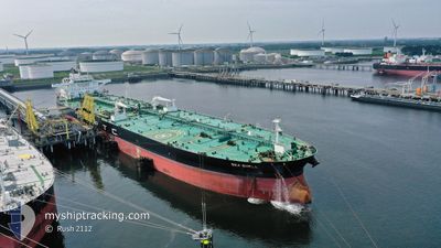
SEA SHELL
Tanker
Current Trip
| Time Travelled | 29 days |
|---|---|
| Remaining Time | 4 days |
| Distance Travelled | 8515.77 nm |
| Remaining Distance | 1270.56 nm |
| AVG Speed | 11.6 Knots |
| MAX Speed | 17.9 Knots |
| AVG Wind | 11.4 knots |
| MAX Wind | 38.2 knots |
| MIN Temp | 4.4°C / 39.92°F |
| MAX Temp | 30°C / 86°F |
| Draught | 9.5 m |
| Position Received | 1 h, 31 m ago |
Current Position
| Longitude | --- |
|---|---|
| Latitude | --- |
| Status | Under way using engine |
| Speed | 11.8 Knots |
| Course | 28.1° |
| Area | North Sea |
| Station | T-AIS |
| Position Received | 1 h, 31 m ago |
Info
Information
The current position of SEA SHELL is in North Sea with coordinates 52.24742° / 2.76644° as reported on 2024-11-21 07:53 by AIS to our vessel tracker app. The vessel's current speed is 11.8 Knots and is heading at the port of UST-LUGA. The estimated time of arrival as calculated by MyShipTracking vessel tracking app is 2024-11-25 21:31 LT
The vessel SEA SHELL (IMO: 9773947, MMSI: 373834000) is a Tanker It's sailing under the flag of [PA] Panama.
In this page you can find informations about the vessels current position, last detected port calls, and current voyage information. If the vessels is not in coverage by AIS you will find the latest position.
The current position of SEA SHELL is detected by our AIS receivers and we are not responsible for the reliability of the data. The last position was recorded while the vessel was in Coverage by the Ais receivers of our vessel tracking app.
The current draught of SEA SHELL as reported by AIS is 9.5 meters
Weather
| Temperature | 4.8°C / 40.64°F |
|---|---|
| Wind Speed | 16 knots |
| Direction | 274° W |
| Pressure | 1000.4 hPa |
| Humidity | 65.2 % |
| Cloud Coverage | 89 % |
Featured Company
Last Port Calls
| Port | Arrival | Departure | Time In Port |
|---|---|---|---|
| 2024-11-09 05:57 | 2024-11-09 15:20 | 9 h | |
| 2024-10-15 07:29 | 2024-10-23 07:13 | 7 d | |
| 2024-10-05 06:14 | 2024-10-08 10:51 | 3 d |
Events
| Time | Event | Details | Position / Dest | Info |
|---|---|---|---|---|
| 2024-11-21 08:00 | Status Changed | Default Under way using engine |
52.26913 / 2.78484
UST-LUGA
|
Speed: 11.8 kn Course: 28.1° |
| 2024-11-21 07:53 | Status Changed | Under way using engine Default |
52.24742 / 2.76644
UST-LUGA
|
Speed: 11.8 kn Course: 24° |
| 2024-11-21 07:53 | OUT of Coverage |
52.24742 / 2.76644
North Sea
UST-LUGA
|
Speed: 11.8 kn Course: 28.1° |
|
| 2024-11-21 07:44 | Status Changed | Default Under way using engine |
52.22155 / 2.74522
UST-LUGA
|
Speed: 12 kn Course: 26.4° |
| 2024-11-21 07:37 | Change Sea Area | United Kingdom part of the North Sea Dutch part of the North Sea |
52.19948 / 2.72738
North Sea
UST-LUGA
|
Speed: 12 kn Course: 26.4° |
| 2024-11-21 07:37 | Status Changed | Under way using engine Default |
52.19948 / 2.72738
UST-LUGA
|
Speed: 11.9 kn Course: 27° |
| 2024-11-21 06:48 | Status Changed | Default Under way using engine |
52.04735 / 2.70177
UST-LUGA
|
Speed: 11.6 kn Course: 355.9° |
| 2024-11-21 05:37 | Change Sea Area | Dutch part of the North Sea Belgian part of the North Sea |
51.82626 / 2.62415
North Sea
UST-LUGA
|
Speed: 12 kn Course: 27.4° |
| 2024-11-21 03:47 | Change Sea Area | Belgian part of the North Sea French part of the North Sea |
51.52954 / 2.26232
North Sea
UST-LUGA
|
Speed: 11.9 kn Course: 38.4° |
| 2024-11-21 02:52 | Change Sea Area | French part of the North Sea United Kingdom part of the North Sea |
51.39397 / 2.07075
North Sea
UST-LUGA
|
Speed: 11.9 kn Course: 41° |