
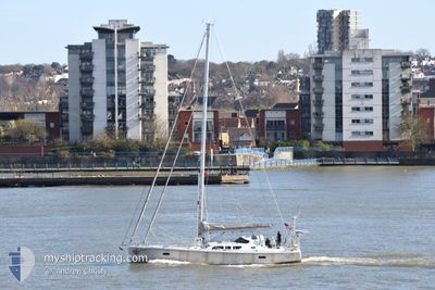
SCOUT
Sailing
Current Trip
Unknown
| Time Travelled | 10 days |
|---|---|
| Remaining Time | --- |
| Distance Travelled | 138.14 nm |
| Remaining Distance | --- |
| AVG Speed | 5.7 Knots |
| MAX Speed | 7 Knots |
| AVG Wind | 6.6 knots |
| MAX Wind | 11 knots |
| MIN Temp | 5.7°C / 42.26°F |
| MAX Temp | 10.1°C / 50.18°F |
| Draught | --- |
| Position Received | 1 d ago |
Current Position
| Longitude | --- |
|---|---|
| Latitude | --- |
| Status | Default |
| Speed | 4.5 Knots |
| Course | 24.1° |
| Area | Inner Seas off the West Coast of Scotland |
| Station | T-AIS |
| Position Received | 1 d ago |
Information
The current position of SCOUT is in Inner Seas off the West Coast of Scotland with coordinates 56.60302° / -5.48112° as reported on 2025-04-21 11:48 by AIS to our vessel tracker app. The vessel's current speed is 4.5 Knots
The vessel SCOUT (MMSI: 368398710) is a Sailing It's sailing under the flag of [US] USA.
In this page you can find informations about the vessels current position, last detected port calls, and current voyage information. If the vessels is not in coverage by AIS you will find the latest position.
The current position of SCOUT is detected by our AIS receivers and we are not responsible for the reliability of the data. The last position was recorded while the vessel was in Coverage by the Ais receivers of our vessel tracking app.
Weather
| Temperature | 8.1°C / 46.58°F |
|---|---|
| Wind Speed | 1 knots |
| Direction | 214° SW |
| Pressure | 1006.8 hPa |
| Humidity | 84.7 % |
| Cloud Coverage | 100 % |
Featured Company
Last Port Calls
| Port | Arrival | Departure | Time In Port |
|---|---|---|---|
| 2025-04-10 17:56 | 2025-04-12 07:51 | 1 d | |
| 2025-04-04 15:57 | 2025-04-05 08:14 | 16 h | |
| 2025-04-03 14:38 | 2025-04-04 06:55 | 16 h | |
| 2025-04-02 15:41 | 2025-04-03 05:11 | 13 h | |
| 2025-04-01 11:47 | 2025-04-02 05:31 | 17 h | |
| 2025-03-31 14:56 |
Most Visited Ports (Last year)
| Port | Arrivals | |
|---|---|---|
| 1 | ||
| 1 | ||
| 1 | ||
| 1 | ||
| 1 |
Last Trips
| Origin | Departure | Destination | Arrival | Distance | |
|---|---|---|---|---|---|
| 2025-04-05 09:14 | 2025-04-10 18:56 | 420.34 nm | |||
| 2025-04-04 07:55 | 2025-04-04 16:57 | 46.09 nm | |||
| 2025-04-03 06:11 | 2025-04-03 15:38 | 49.26 nm | |||
| 2025-04-02 06:31 | 2025-04-02 16:41 | 75.65 nm | |||
| 2025-03-31 15:56 | 2025-04-01 12:47 | 74.58 nm |
Events
| Time | Event | Details | Position / Dest | Info |
|---|---|---|---|---|
| 2025-04-21 11:48 | OUT of Coverage |
56.60302 / -5.48112
Inner Seas off the West Coast of Scotland
|
Speed: 4.5 kn Course: 24.1° |
|
| 2025-04-21 09:51 | IN Coverage |
56.51743 / -5.61060
Inner Seas off the West Coast of Scotland
|
Speed: 4.7 kn Course: 54.5° |
|
| 2025-04-18 10:07 | OUT of Coverage |
56.45167 / -5.61693
Inner Seas off the West Coast of Scotland
|
Speed: 5.8 kn Course: 295° |
|
| 2025-04-18 09:28 | IN Coverage |
56.42534 / -5.49182
Inner Seas off the West Coast of Scotland
|
Speed: 6.3 kn Course: 304.5° |
|
| 2025-04-17 08:44 | OUT of Coverage |
56.44404 / -5.49860
Inner Seas off the West Coast of Scotland
|
Speed: 5.4 kn Course: 180.6° |
|
| 2025-04-17 07:31 | START Moving | 0.89 nm, South West of PORT APPIN PIER |
56.54104 / -5.42790
|
Speed: 5 kn Course: 238.6° |
| 2025-04-17 07:11 | IN Coverage |
56.54603 / -5.41688
Inner Seas off the West Coast of Scotland
|
Speed: 0.1 kn Course: 96.4° |
|
| 2025-04-16 07:42 | OUT of Coverage |
56.54565 / -5.41729
Inner Seas off the West Coast of Scotland
|
Speed: 0.2 kn Course: 108.7° |
|
| 2025-04-16 07:34 | STOP Moving | 0.49 nm, South of PORT APPIN PIER |
56.54595 / -5.41674
|
Speed: 0.2 kn Course: 511° |
| 2025-04-16 06:08 | START Moving | 0.67 nm, North West of OBAN |
56.42336 / -5.48831
|
Speed: 4.3 kn Course: 329.3° |