
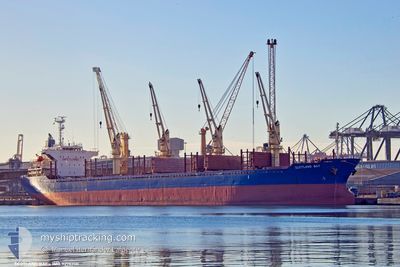
SCOTLAND BAY
Bulk Carrier
Current Trip
EGALY
| Time Travelled | 5 h, 44 mins |
|---|---|
| Remaining Time | --- |
| Distance Travelled | 17.74 nm |
| Remaining Distance | --- |
| AVG Speed | 9 Knots |
| MAX Speed | 11.3 Knots |
| AVG Wind | 10.1 knots |
| MAX Wind | 10.8 knots |
| MIN Temp | 19.8°C / 67.64°F |
| MAX Temp | 19.9°C / 67.82°F |
| Draught | 10.3 m |
| Position Received | 9 d ago |
Current Position
| Longitude | --- |
|---|---|
| Latitude | --- |
| Status | Under way using engine |
| Speed | 9.9 Knots |
| Course | 162.4° |
| Area | Mediterranean Sea - Eastern Basin |
| Station | T-AIS |
| Position Received | 9 d ago |
Info
Information
The current position of SCOTLAND BAY is in Mediterranean Sea - Eastern Basin with coordinates 35.44901° / 27.87731° as reported on 2025-11-26 20:27 by AIS to our vessel tracker app. The vessel's current speed is 9.9 Knots
The vessel SCOTLAND BAY (IMO: 9276200, MMSI: 511101118) is a Bulk Carrier that was built in 2004 ( 21 years old ). It's sailing under the flag of [PW] Palau.
In this page you can find informations about the vessels current position, last detected port calls, and current voyage information. If the vessels is not in coverage by AIS you will find the latest position.
The current position of SCOTLAND BAY is detected by our AIS receivers and we are not responsible for the reliability of the data. The last position was recorded while the vessel was in Coverage by the Ais receivers of our vessel tracking app.
The current draught of SCOTLAND BAY as reported by AIS is 10.3 meters
Weather
| Temperature | 19.6°C / 67.28°F |
|---|---|
| Wind Speed | 8 knots |
| Direction | 254° WSW |
| Pressure | 1013.5 hPa |
| Humidity | 53 % |
| Cloud Coverage | 91 % |
Featured Company
Last Port Calls
| Port | Arrival | Departure | Time In Port |
|---|---|---|---|
| 2025-12-01 14:09 | 2025-12-05 17:17 | 4 d | |
| 2025-11-28 02:27 | 2025-11-28 17:05 | 14 h | |
| 2025-11-24 19:42 | 2025-11-24 21:07 | 1 h | |
| 2025-10-25 13:20 | 2025-10-31 23:08 | 6 d | |
| 2025-09-30 20:57 |
Last Trips
| Origin | Departure | Destination | Arrival | Distance | |
|---|---|---|---|---|---|
| 2025-11-28 17:05 | 2025-12-01 14:09 | 18.80 nm | |||
| 2025-11-24 21:07 | 2025-11-28 02:27 | 754.50 nm | |||
| 2025-10-31 23:08 | 2025-11-24 19:42 | 2004.94 nm | |||
| 2025-09-30 20:57 | 2025-10-25 13:20 | 5035.66 nm |
Events
| Time | Event | Details | Position / Dest | Info |
|---|---|---|---|---|
| 2025-12-05 15:17 | PORT DEPARTURE |
|
31.15931 / 29.83659
EGALY
|
Speed: 8.5 kn Course: 242° |
| 2025-12-05 14:53 | START Moving |
31.19160 / 29.87401
[EG] ALEXANDRIA
|
Speed: 4.9 kn Course: 270° |
|
| 2025-12-01 13:07 | STOP Moving |
31.18929 / 29.87704
[EG] ALEXANDRIA
|
Speed: Course: 145° |
|
| 2025-12-01 12:09 | PORT ARRIVAL |
|
31.16159 / 29.84578
[EG] ALEXANDRIA
|
Speed: 5.5 kn Course: 78° |
| 2025-12-01 11:00 | START Moving | 4.92 nm, North West of EL DEKHEILA |
31.19524 / 29.72907
EGALY
|
Speed: 3.7 kn Course: 111° |
| 2025-12-01 08:14 | STOP Moving | 5.02 nm, North West of EL DEKHEILA |
31.20018 / 29.73135
EGALY
|
Speed: 0.1 kn Course: 284° |
| 2025-12-01 07:18 | START Moving | 4.95 nm, North West of EL DEKHEILA |
31.19745 / 29.73051
EGALY
|
Speed: 3.9 kn Course: 129° |
| 2025-11-28 16:36 | STOP Moving | 5.09 nm, North West of EL DEKHEILA |
31.19844 / 29.72786
EGALY
|
Speed: 0.2 kn Course: 41° |
| 2025-11-28 15:05 | PORT DEPARTURE |
|
31.16024 / 29.83549
EGALY
|
Speed: 5.7 kn Course: 252° |
| 2025-11-28 14:33 | START Moving |
31.19168 / 29.87043
[EG] ALEXANDRIA
|
Speed: 3.5 kn Course: 212° |