
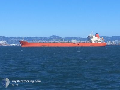
SCHWYZ
Tanker
Current Trip
| Trip Time | 7 days |
|---|---|
| Trip Distance | 2151.60 nm |
| AVG Speed | 11.4 Knots |
| MAX Speed | 13.9 Knots |
| Draught | 7.7 m |
| AVG Wind | 13.1 knots |
| MAX Wind | 21 knots |
| MIN Temp | 19.4°C / 66.92°F |
| MAX Temp | 28.2°C / 82.76°F |
| Position Received | 11 d ago |
Current Position
| Longitude | --- |
|---|---|
| Latitude | --- |
| Status | Under way using engine |
| Speed | 11.3 Knots |
| Course | 144.5° |
| Area | Caribbean Sea |
| Station | T-AIS |
| Position Received | 11 d ago |
Info
Information
The current position of SCHWYZ is in Caribbean Sea with coordinates 10.50305° / -61.72687° as reported on 2024-12-15 07:54 by AIS to our vessel tracker app. The vessel's current speed is 11.3 Knots and is currently inside the port of NEW ORLEANS.
The vessel SCHWYZ (IMO: 9905605, MMSI: 374188000) is a Tanker It's sailing under the flag of [PA] Panama.
In this page you can find informations about the vessels current position, last detected port calls, and current voyage information. If the vessels is not in coverage by AIS you will find the latest position.
The current position of SCHWYZ is detected by our AIS receivers and we are not responsible for the reliability of the data. The last position was recorded while the vessel was in Coverage by the Ais receivers of our vessel tracking app.
The current draught of SCHWYZ as reported by AIS is 7.7 meters
Weather
| Temperature | 20.1°C / 68.18°F |
|---|---|
| Wind Speed | 9 knots |
| Direction | 146° SE |
| Pressure | 1014.2 hPa |
| Humidity | 93.9 % |
| Cloud Coverage | 2 % |
Featured Company
Last Port Calls
| Port | Arrival | Departure | Time In Port |
|---|---|---|---|
| 2024-12-27 02:27 | |||
| 2024-12-18 02:51 | 2024-12-19 11:31 | 1 d | |
| 2024-12-06 03:55 | 2024-12-07 16:19 | 1 d | |
| 2024-12-03 02:32 | 2024-12-03 07:18 | 4 h | |
| 2024-11-24 05:26 | 2024-11-25 12:34 | 1 d | |
| 2024-11-04 00:29 | 2024-11-05 05:43 | 1 d | |
| 2024-10-09 19:51 | 2024-10-11 03:23 | 1 d |
Most Visited Ports (Last year)
| Port | Arrivals | |
|---|---|---|
| 8 | ||
| 6 | ||
| 2 | ||
| 1 | ||
| 1 | ||
| 1 |
Last Trips
| Origin | Departure | Destination | Arrival | Distance | |
|---|---|---|---|---|---|
| 2024-12-19 07:31 | 2024-12-26 20:27 | 2151.60 nm | |||
| 2024-12-07 10:19 | 2024-12-17 22:51 | 2147.15 nm | |||
| 2024-12-03 01:18 | 2024-12-05 21:55 | 311.39 nm | |||
| 2024-11-25 08:34 | 2024-12-02 20:32 | 2151.29 nm | |||
| 2024-11-04 21:43 | 2024-11-24 01:26 | 4925.22 nm | |||
| 2024-10-10 23:23 | 2024-11-03 16:29 | 5454.50 nm | |||
| 2024-09-18 07:06 | 2024-10-09 15:51 | 5032.83 nm |
Events
| Time | Event | Details | Position / Dest | Info |
|---|---|---|---|---|
| 2024-12-27 02:27 | STOP Moving |
29.77420 / -90.02308
[US] NEW ORLEANS
|
Speed: 0.3 kn Course: 21° |
|
| 2024-12-27 02:27 | PORT ARRIVAL |
|
29.77420 / -90.02308
[US] NEW ORLEANS
|
Speed: 1.6 kn Course: 19° |
| 2024-12-26 00:05 | START Moving |
25.88787 / -88.00018
US TEO> TT PTS
|
Speed: 7.5 kn Course: 340° |
|
| 2024-12-25 23:34 | STOP Moving |
25.87392 / -87.99341
US TEO> TT PTS
|
Speed: 0.3 kn Course: 69° |
|
| 2024-12-19 11:31 | PORT DEPARTURE |
|
10.39852 / -61.49974
US TEO> TT PTS
|
Speed: 3.4 kn Course: 260° |
| 2024-12-19 11:27 | START Moving |
10.40065 / -61.49549
[TT] POINT LISAS
|
Speed: 3.4 kn Course: 260° |
|
| 2024-12-18 03:03 | STOP Moving |
10.39983 / -61.49148
[TT] POINT LISAS
|
Speed: 0.3 kn Course: 254° |
|
| 2024-12-18 02:51 | PORT ARRIVAL |
|
10.40205 / -61.49404
[TT] POINT LISAS
|
Speed: 2.6 kn Course: 67° |
| 2024-12-18 01:51 | START Moving | 3.7 nm, West of POINT LISAS |
10.38215 / -61.55710
US TEO> TT PTS
|
Speed: 3.2 kn Course: 142° |
| 2024-12-17 16:03 | STOP Moving | 4.18 nm, West of POINT LISAS |
10.39479 / -61.56622
US TEO> TT PTS
|
Speed: 0.3 kn Course: 176° |