
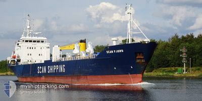
SCAN FJORD
General Cargo
Current Trip
STORSTEINES
| Time Travelled | 21 h, 34 mins |
|---|---|
| Remaining Time | --- |
| Distance Travelled | 224.00 nm |
| Remaining Distance | --- |
| AVG Speed | 11.8 Knots |
| MAX Speed | 13.4 Knots |
| AVG Wind | 5.2 knots |
| MAX Wind | 9 knots |
| MIN Temp | -14.5°C / 5.9°F |
| MAX Temp | -1.2°C / 29.84°F |
| Draught | 4.8 m |
| Position Received | 1 m ago |
Current Position
| Longitude | --- |
|---|---|
| Latitude | --- |
| Status | Under way using engine |
| Speed | 12.8 Knots |
| Course | 68.4° |
| Area | Norwegian Sea |
| Station | T-AIS |
| Position Received | 1 m ago |
Info
Information
The current position of SCAN FJORD is in Norwegian Sea with coordinates 69.52932° / 18.51745° as reported on 2024-12-21 16:13 by AIS to our vessel tracker app. The vessel's current speed is 12.8 Knots
The vessel SCAN FJORD (IMO: 8015879, MMSI: 314318000) is a General Cargo that was built in 1981 ( 43 years old ). It's sailing under the flag of [BB] Barbados.
In this page you can find informations about the vessels current position, last detected port calls, and current voyage information. If the vessels is not in coverage by AIS you will find the latest position.
The current position of SCAN FJORD is detected by our AIS receivers and we are not responsible for the reliability of the data. The last position was recorded while the vessel was in Coverage by the Ais receivers of our vessel tracking app.
The current draught of SCAN FJORD as reported by AIS is 4.8 meters
Weather
| Temperature | -11.2°C / 11.84°F |
|---|---|
| Wind Speed | 4 knots |
| Direction | 158° SSE |
| Pressure | 992.6 hPa |
| Humidity | 97.2 % |
| Cloud Coverage | 94 % |
Featured Company
Last Port Calls
| Port | Arrival | Departure | Time In Port |
|---|---|---|---|
| 2024-12-20 05:02 | 2024-12-20 18:40 | 13 h | |
| 2024-12-17 22:48 | 2024-12-18 01:23 | 2 h | |
| 2024-12-15 12:29 | 2024-12-16 11:58 | 23 h | |
| 2024-12-15 08:13 | 2024-12-15 09:09 | 55 m | |
| 2024-12-13 04:35 | 2024-12-13 21:22 | 16 h | |
| 2024-12-11 22:04 | 2024-12-12 00:38 | 2 h | |
| 2024-12-11 17:14 | 2024-12-11 18:06 | 52 m | |
| 2024-12-11 06:27 | 2024-12-11 14:46 | 8 h | |
| 2024-12-10 15:51 | 2024-12-10 17:09 | 1 h | |
| 2024-12-09 15:55 | 2024-12-09 16:26 | 30 m |
Last Trips
| Origin | Departure | Destination | Arrival | Distance | |
|---|---|---|---|---|---|
| 2024-12-18 02:23 | 2024-12-20 06:02 | 336.52 nm | |||
| 2024-12-16 12:58 | 2024-12-17 23:48 | 309.62 nm | |||
| 2024-12-15 10:09 | 2024-12-15 13:29 | 36.93 nm | |||
| 2024-12-13 22:22 | 2024-12-15 09:13 | 366.27 nm | |||
| 2024-12-12 01:38 | 2024-12-13 05:35 | 327.18 nm | |||
| 2024-12-11 19:06 | 2024-12-11 23:04 | 41.19 nm | |||
| 2024-12-11 15:46 | 2024-12-11 18:14 | 30.94 nm | |||
| 2024-12-10 18:09 | 2024-12-11 07:27 | 111.13 nm | |||
| 2024-12-09 17:26 | 2024-12-10 16:51 | 206.49 nm | |||
| 2024-12-09 07:39 | 2024-12-09 16:55 | 29.80 nm |
Events
| Time | Event | Details | Position / Dest | Info |
|---|---|---|---|---|
| 2024-12-21 10:19 | START Moving | 8.81 nm, South East of HARSTAD |
68.69258 / 16.83864
STORSTEINES
|
Speed: 3.5 kn Course: 175° |
| 2024-12-21 10:05 | Destination Changed | STORSTEINES TOVIK |
68.69015 / 16.83980
STORSTEINES
|
Speed: Course: 169° |
| 2024-12-21 10:05 | ETA Changed | 2024/12/21 20:00 2024/12/21 09:00 |
68.69015 / 16.83980
STORSTEINES
|
Speed: Course: 169° |
| 2024-12-21 08:00 | STOP Moving | 8.94 nm, South East of HARSTAD |
68.69011 / 16.83967
TOVIK
|
Speed: 0.3 kn Course: 166° |
| 2024-12-20 19:26 | Destination Changed | TOVIK GLOMFJORD |
66.82397 / 13.59095
TOVIK
|
Speed: 11.6 kn Course: 287° |
| 2024-12-20 19:26 | ETA Changed | 2024/12/21 09:00 2024/12/19 16:00 |
66.82397 / 13.59095
TOVIK
|
Speed: 11.6 kn Course: 287° |
| 2024-12-20 18:59 | Status Changed | Under way using engine Default |
66.81010 / 13.79726
GLOMFJORD
|
Speed: 9.6 kn Course: 270° |
| 2024-12-20 18:45 | IN Coverage |
66.81010 / 13.79726
Norwegian Sea
|
Speed: 11.4 kn Course: 296.8° |
|
| 2024-12-20 18:40 | PORT DEPARTURE |
|
66.80486 / 13.91139
GLOMFJORD
|
Speed: Course: 227° |
| 2024-12-20 04:38 | OUT of Coverage |
66.80914 / 13.78897
Norwegian Sea
[NO] GLOMFJORD
|
Speed: 9.6 kn Course: 114.1° |