
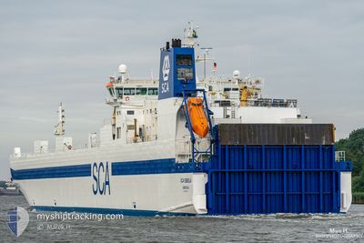
SCA OBBOLA
Ro-Ro Cargo
Current Trip
| Time Travelled | 1 day |
|---|---|
| Remaining Time | 15 h, 11 mins |
| Distance Travelled | 425.18 nm |
| Remaining Distance | 229.80 nm |
| AVG Speed | 15.3 Knots |
| MAX Speed | 16.7 Knots |
| AVG Wind | 11.7 knots |
| MAX Wind | 20.9 knots |
| MIN Temp | 7.9°C / 46.22°F |
| MAX Temp | 15.2°C / 59.36°F |
| Draught | 6.5 m |
| Position Received | Now |
Current Position
| Longitude | 15.67079° |
|---|---|
| Latitude | 55.80785° |
| Status | Under way using engine |
| Speed | 14.8 Knots |
| Course | 239.5° |
| Area | Baltic Sea |
| Station | T-AIS |
| Position Received | Now |
Info
Information
The current position of SCA OBBOLA is in Baltic Sea with coordinates 55.80785° / 15.67079° as reported on 2024-05-16 16:15 by AIS to our vessel tracker app. The vessel's current speed is 14.8 Knots and is heading at the port of KIEL. The estimated time of arrival as calculated by MyShipTracking vessel tracking app is 2024-05-17 07:26 LT
The vessel SCA OBBOLA (IMO: 9087350, MMSI: 265411000) is a Ro-Ro Cargo that was built in 1996 ( 28 years old ). It's sailing under the flag of [SE] Sweden.
In this page you can find informations about the vessels current position, last detected port calls, and current voyage information. If the vessels is not in coverage by AIS you will find the latest position.
The current position of SCA OBBOLA is detected by our AIS receivers and we are not responsible for the reliability of the data. The last position was recorded while the vessel was in Coverage by the Ais receivers of our vessel tracking app.
The current draught of SCA OBBOLA as reported by AIS is 6.5 meters
Weather
| Temperature | 10.7°C / 51.26°F |
|---|---|
| Wind Speed | 21 knots |
| Direction | 91° E |
| Pressure | 1020.3 hPa |
| Humidity | 77.1 % |
| Cloud Coverage | 7 % |
Featured Company
Last Port Calls
| Port | Arrival | Departure | Time In Port |
|---|---|---|---|
| 2024-05-15 06:23 | 2024-05-15 12:09 | 5 h | |
| 2024-05-13 05:19 | 2024-05-13 14:46 | 9 h | |
| 2024-05-11 04:48 | 2024-05-11 06:39 | 1 h | |
| 2024-05-10 08:12 | 2024-05-10 17:16 | 9 h | |
| 2024-05-09 05:05 | 2024-05-09 08:36 | 3 h | |
| 2024-05-06 09:01 | 2024-05-06 15:55 | 6 h | |
| 2024-05-05 10:42 | 2024-05-05 16:39 | 5 h | |
| 2024-05-02 04:44 | 2024-05-02 06:44 | 2 h | |
| 2024-05-01 08:50 | 2024-05-01 20:14 | 11 h | |
| 2024-04-29 07:32 | 2024-04-29 13:33 | 6 h |
Last Trips
| Origin | Departure | Destination | Arrival | Distance | |
|---|---|---|---|---|---|
| 2024-05-13 16:46 | 2024-05-15 08:23 | 665.93 nm | |||
| 2024-05-11 08:39 | 2024-05-13 07:19 | 665.88 nm | |||
| 2024-05-10 19:16 | 2024-05-11 06:48 | 165.35 nm | |||
| 2024-05-09 10:36 | 2024-05-10 10:12 | 385.21 nm | |||
| 2024-05-06 16:55 | 2024-05-09 07:05 | 880.46 nm | |||
| 2024-05-05 18:39 | 2024-05-06 10:01 | 169.19 nm | |||
| 2024-05-02 08:44 | 2024-05-05 12:42 | 1035.33 nm | |||
| 2024-05-01 22:14 | 2024-05-02 06:44 | 127.77 nm | |||
| 2024-04-29 15:33 | 2024-05-01 10:50 | 689.94 nm | |||
| 2024-04-28 21:09 | 2024-04-29 09:32 | 160.06 nm |
Events
| Time | Event | Details | Position / Dest | Info |
|---|---|---|---|---|
| 2024-05-16 07:17 | Status Changed | Under way using engine Default |
57.54816 / 17.77594
KIEL
|
Speed: 14.4 kn Course: 210° |
| 2024-05-16 07:13 | Status Changed | Default Under way using engine |
57.56278 / 17.79166
KIEL
|
Speed: 14.4 kn Course: 210.3° |
| 2024-05-16 07:06 | Status Changed | Under way using engine Default |
57.58384 / 17.81428
KIEL
|
Speed: 14.4 kn Course: 210° |
| 2024-05-16 06:49 | IN Coverage |
57.58281 / 17.81315
Baltic Sea
KIEL
|
Speed: 14.4 kn Course: 210.3° |
|
| 2024-05-16 05:49 | Status Changed | Default Under way using engine |
57.85166 / 18.10834
KIEL
|
Speed: 14.1 kn Course: 210.6° |
| 2024-05-16 05:44 | OUT of Coverage |
57.86794 / 18.12609
Baltic Sea
KIEL
|
Speed: 14.1 kn Course: 210.6° |
|
| 2024-05-16 05:42 | Status Changed | Under way using engine Default |
57.87272 / 18.13135
KIEL
|
Speed: 14.1 kn Course: 210° |
| 2024-05-16 05:41 | IN Coverage |
57.87272 / 18.13135
Baltic Sea
KIEL
|
Speed: 14 kn Course: 210.1° |
|
| 2024-05-16 04:05 | Status Changed | Default Under way using engine |
58.21333 / 18.48656
KIEL
|
Speed: 14.6 kn Course: 209.3° |
| 2024-05-16 03:59 | OUT of Coverage |
58.23412 / 18.50935
Baltic Sea
KIEL
|
Speed: 14.6 kn Course: 209.3° |