
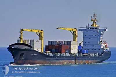
SC PHILLY
General Cargo
Current Trip
| Trip Time | 2 days |
|---|---|
| Trip Distance | 814.06 nm |
| AVG Speed | 12.3 Knots |
| MAX Speed | 15.9 Knots |
| Draught | 8.7 m |
| AVG Wind | 16.9 knots |
| MAX Wind | 23 knots |
| MIN Temp | 27.6°C / 81.68°F |
| MAX Temp | 31.5°C / 88.7°F |
| Position Received | 1 d ago |
Current Position
| Longitude | -69.61750° |
|---|---|
| Latitude | 18.42409° |
| Status | Under way using engine |
| Speed | 4.8 Knots |
| Course | 316° |
| Area | Caribbean Sea |
| Station | T-AIS |
| Position Received | 1 d ago |
Info
Information
The current position of SC PHILLY is in Caribbean Sea with coordinates 18.42409° / -69.61750° as reported on 2024-05-20 15:22 by AIS to our vessel tracker app. The vessel's current speed is 4.8 Knots and is currently inside the port of BOCA CHIKA.
The vessel SC PHILLY (IMO: 9330276, MMSI: 636020661) is a General Cargo that was built in 2007 ( 17 years old ). It's sailing under the flag of [LR] Liberia.
In this page you can find informations about the vessels current position, last detected port calls, and current voyage information. If the vessels is not in coverage by AIS you will find the latest position.
The current position of SC PHILLY is detected by our AIS receivers and we are not responsible for the reliability of the data. The last position was recorded while the vessel was in Coverage by the Ais receivers of our vessel tracking app.
The current draught of SC PHILLY as reported by AIS is 8.7 meters
Weather
| Temperature | 29.2°C / 84.56°F |
|---|---|
| Wind Speed | 6 knots |
| Direction | 163° SSE |
| Pressure | 1012.4 hPa |
| Humidity | 68.2 % |
| Cloud Coverage | 48 % |
Featured Company
Last Port Calls
| Port | Arrival | Departure | Time In Port |
|---|---|---|---|
| 2024-05-20 15:28 | |||
| 2024-05-16 13:06 | 2024-05-17 21:18 | 1 d | |
| 2024-05-14 13:13 | 2024-05-14 18:31 | 5 h | |
| 2024-05-11 13:58 | 2024-05-12 14:42 | 1 d | |
| 2024-05-07 09:25 | 2024-05-08 00:26 | 15 h | |
| 2024-05-02 12:46 | 2024-05-03 17:22 | 1 d | |
| 2024-04-30 16:52 | 2024-05-01 04:38 | 11 h | |
| 2024-04-25 19:21 | 2024-04-27 13:33 | 1 d | |
| 2024-04-23 13:48 | 2024-04-24 04:26 | 14 h | |
| 2024-04-18 14:13 | 2024-04-19 00:52 | 10 h |
Last Trips
| Origin | Departure | Destination | Arrival | Distance | |
|---|---|---|---|---|---|
| 2024-05-17 16:18 | 2024-05-20 11:28 | 814.06 nm | |||
| 2024-05-14 13:31 | 2024-05-16 08:06 | 291.43 nm | |||
| 2024-05-12 10:42 | 2024-05-14 08:13 | 618.79 nm | |||
| 2024-05-07 20:26 | 2024-05-11 09:58 | 462.89 nm | |||
| 2024-05-03 12:22 | 2024-05-07 05:25 | 702.95 nm | |||
| 2024-04-30 23:38 | 2024-05-02 07:46 | 282.83 nm | |||
| 2024-04-27 09:33 | 2024-04-30 11:52 | 747.76 nm | |||
| 2024-04-24 00:26 | 2024-04-25 15:21 | 286.21 nm | |||
| 2024-04-18 19:52 | 2024-04-23 09:48 | 707.97 nm | |||
| 2024-04-16 22:35 | 2024-04-18 09:13 | 286.27 nm |
Events
| Time | Event | Details | Position / Dest | Info |
|---|---|---|---|---|
| 2024-05-20 15:45 | STOP Moving |
18.42498 / -69.63056
[DO] BOCA CHIKA
|
Speed: 0.1 kn Course: 350° |
|
| 2024-05-20 15:28 | Status Changed | Default Under way using engine |
18.42860 / -69.62426
[DO] BOCA CHIKA
|
Speed: 4.8 kn Course: 316° |
| 2024-05-20 15:28 | PORT ARRIVAL |
|
18.42860 / -69.62426
[DO] BOCA CHIKA
|
Speed: 4.8 kn Course: 316° |
| 2024-05-20 15:22 | Status Changed | Under way using engine Default |
18.42409 / -69.61750
DOCAU
|
Speed: 3.9 kn Course: 323° |
| 2024-05-20 15:22 | OUT of Coverage |
18.42409 / -69.61750
Caribbean Sea
[DO] BOCA CHIKA
|
Speed: 4.8 kn Course: 315.2° |
|
| 2024-05-20 15:16 | Status Changed | Default Under way using engine |
18.41822 / -69.61268
DOCAU
|
Speed: 1.9 kn Course: 28° |
| 2024-05-20 15:16 | START Moving | 1.15 nm, South East of BOCA CHIKA |
18.41822 / -69.61268
DOCAU
|
Speed: 3.9 kn Course: 323° |
| 2024-05-20 15:12 | Status Changed | Under way using engine Default |
18.41576 / -69.61266
DOCAU
|
Speed: 1 kn Course: -1° |
| 2024-05-20 15:10 | IN Coverage |
18.41576 / -69.61266
Caribbean Sea
DOCAU
|
Speed: 1.9 kn Course: 62.2° |
|
| 2024-05-20 14:46 | STOP Moving | 1.72 nm, South of BOCA CHIKA |
18.40833 / -69.61166
DOCAU
|
Speed: Course: -1° |