
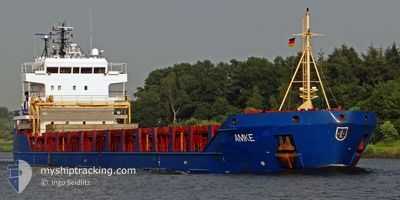
SARDES
General Cargo
Current Trip
| Trip Time | 17 days |
|---|---|
| Trip Distance | 3625.63 nm |
| AVG Speed | 11.8 Knots |
| MAX Speed | 16.8 Knots |
| Draught | 4.5 m |
| AVG Wind | 9.7 knots |
| MAX Wind | 25.2 knots |
| MIN Temp | 11.7°C / 53.06°F |
| MAX Temp | 28.3°C / 82.94°F |
| Position Received | 1 d ago |
Current Position
| Longitude | --- |
|---|---|
| Latitude | --- |
| Status | Under way using engine |
| Speed | 11.4 Knots |
| Course | 15.3° |
| Area | Mediterranean Sea - Eastern Basin |
| Station | T-AIS |
| Position Received | 1 d ago |
Info
Information
The current position of SARDES is in Mediterranean Sea - Eastern Basin with coordinates 31.31404° / 32.37093° as reported on 2025-12-08 21:43 by AIS to our vessel tracker app. The vessel's current speed is 11.4 Knots and is currently inside the port of DAMIETTA.
The vessel SARDES (IMO: 9374387, MMSI: 352002326) is a General Cargo that was built in 2006 ( 19 years old ). It's sailing under the flag of [PA] Panama.
In this page you can find informations about the vessels current position, last detected port calls, and current voyage information. If the vessels is not in coverage by AIS you will find the latest position.
The current position of SARDES is detected by our AIS receivers and we are not responsible for the reliability of the data. The last position was recorded while the vessel was in Coverage by the Ais receivers of our vessel tracking app.
The current draught of SARDES as reported by AIS is 4.5 meters
Weather
| Temperature | 17.5°C / 63.5°F |
|---|---|
| Wind Speed | 10 knots |
| Direction | 275° W |
| Pressure | 1014.7 hPa |
| Humidity | 65.8 % |
| Cloud Coverage | 2 % |
Featured Company
Last Port Calls
| Port | Arrival | Departure | Time In Port |
|---|---|---|---|
| 2025-12-09 23:04 | |||
| 2025-12-08 02:01 | 2025-12-08 23:17 | 21 h | |
| 2025-11-19 00:59 | 2025-11-22 02:48 | 3 d | |
| 2025-11-02 06:55 | 2025-11-02 16:12 | 9 h | |
| 2025-10-22 18:53 | 2025-10-27 18:43 | 5 d | |
| 2025-10-11 02:21 | 2025-10-12 22:18 | 1 d | |
| 2025-10-05 02:03 | 2025-10-06 19:24 | 1 d | |
| 2025-10-03 17:16 | 2025-10-03 22:16 | 4 h | |
| 2025-10-01 06:57 | 2025-10-01 16:00 | 9 h |
Most Visited Ports (Last year)
| Port | Arrivals | |
|---|---|---|
| 8 | ||
| 5 | ||
| 4 | ||
| 3 | ||
| 2 | ||
| 2 |
Last Trips
| Origin | Departure | Destination | Arrival | Distance | |
|---|---|---|---|---|---|
| 2025-11-22 02:48 | 2025-12-09 23:04 | 3625.63 nm | |||
| 2025-11-22 02:48 | 2025-12-08 02:01 | 3480.36 nm | |||
| 2025-10-27 18:43 | 2025-11-19 00:59 | 4832.36 nm | |||
| 2025-10-27 18:43 | 2025-11-02 06:55 | 1339.49 nm | |||
| 2025-10-12 22:18 | 2025-10-22 18:53 | 294.35 nm | |||
| 2025-10-06 19:24 | 2025-10-11 02:21 | 1012.14 nm | |||
| 2025-10-03 22:16 | 2025-10-05 02:03 | 294.22 nm | |||
| 2025-09-19 16:01 | 2025-10-03 17:16 | 3859.93 nm | |||
| 2025-09-19 16:01 | 2025-10-01 06:57 | 3188.21 nm |
Events
| Time | Event | Details | Position / Dest | Info |
|---|---|---|---|---|
| 2025-12-09 21:38 | STOP Moving |
31.45623 / 31.76366
[EG] DAMIETTA
|
Speed: Course: 135° |
|
| 2025-12-09 21:04 | PORT ARRIVAL |
|
31.48143 / 31.75640
[EG] DAMIETTA
|
Speed: 6 kn Course: 194° |
| 2025-12-09 19:49 | START Moving | 8.42 nm, North of DAMIETTA |
31.60782 / 31.76503
EGDAM
|
Speed: 6 kn Course: 119° |
| 2025-12-09 02:10 | STOP Moving | 8.69 nm, North of DAMIETTA |
31.61251 / 31.76206
EGDAM
|
Speed: 0.1 kn Course: 261° |
| 2025-12-08 21:47 | Status Changed | Default Under way using engine |
31.32688 / 32.37503
EGDAM
|
Speed: 11.4 kn Course: 15.3° |
| 2025-12-08 21:43 | OUT of Coverage |
31.31404 / 32.37093
Mediterranean Sea - Eastern Basin
EGDAM
|
Speed: 11.4 kn Course: 15.3° |
|
| 2025-12-08 21:35 | Status Changed | Under way using engine Default |
31.29134 / 32.36383
EGDAM
|
Speed: 11.5 kn Course: 13° |
| 2025-12-08 21:33 | Status Changed | Default Under way using engine |
31.28516 / 32.36196
EGDAM
|
Speed: 11.4 kn Course: 13.4° |
| 2025-12-08 21:26 | Detected in Sea | Egyptian part of the Mediterranean Sea - Eastern Basin |
31.26388 / 32.35600
Mediterranean Sea - Eastern Basin
EGDAM
|
Speed: 11.4 kn Course: 13.4° |
| 2025-12-08 21:21 | Status Changed | Under way using engine Default |
31.24656 / 32.35148
EGDAM
|
Speed: 9.5 kn Course: 15° |