
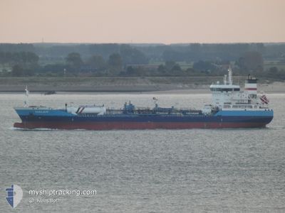
SARAJEVO
Oil/Chemical Tanker
Current Trip
| Time Travelled | 1 day |
|---|---|
| Remaining Time | --- |
| Distance Travelled | 459.05 nm |
| Remaining Distance | --- |
| AVG Speed | 11.7 Knots |
| MAX Speed | 11.7 Knots |
| AVG Wind | 14.5 knots |
| MAX Wind | 30 knots |
| MIN Temp | 15.5°C / 59.9°F |
| MAX Temp | 19.4°C / 66.92°F |
| Draught | 5.5 m |
| Position Received | 5 m ago |
Current Position
| Longitude | 27.14796° |
|---|---|
| Latitude | 40.56310° |
| Status | Under way using engine |
| Speed | 10.9 Knots |
| Course | 69.3° |
| Area | Sea of Marmara |
| Station | T-AIS |
| Position Received | 5 m ago |
Info
Information
The current position of SARAJEVO is in Sea of Marmara with coordinates 40.56310° / 27.14796° as reported on 2024-05-10 14:59 by AIS to our vessel tracker app. The vessel's current speed is 10.9 Knots and is heading at the port of BARTIN. The estimated time of arrival as calculated by MyShipTracking vessel tracking app is 2024-05-11 10:00 LT
The vessel SARAJEVO (IMO: 9477490, MMSI: 249343000) is a Oil/Chemical Tanker that was built in 2008 ( 16 years old ). It's sailing under the flag of [MT] Malta.
In this page you can find informations about the vessels current position, last detected port calls, and current voyage information. If the vessels is not in coverage by AIS you will find the latest position.
The current position of SARAJEVO is detected by our AIS receivers and we are not responsible for the reliability of the data. The last position was recorded while the vessel was in Coverage by the Ais receivers of our vessel tracking app.
The current draught of SARAJEVO as reported by AIS is 5.5 meters
Weather
| Temperature | 16.4°C / 61.52°F |
|---|---|
| Wind Speed | 22 knots |
| Direction | 50° NE |
| Pressure | 1012.5 hPa |
| Humidity | 75.9 % |
| Cloud Coverage | 100 % |
Featured Company
Last Port Calls
| Port | Arrival | Departure | Time In Port |
|---|---|---|---|
| 2024-05-07 21:31 | 2024-05-09 00:18 | 1 d | |
| 2024-05-03 10:20 | 2024-05-04 09:45 | 23 h | |
| 2024-05-01 23:15 | 2024-05-02 20:54 | 21 h | |
| 2024-04-28 14:49 | 2024-04-30 09:26 | 1 d | |
| 2024-04-23 14:03 | 2024-04-24 22:17 | 1 d | |
| 2024-04-16 08:14 | 2024-04-18 13:36 | 2 d | |
| 2024-04-14 16:16 | 2024-04-15 11:36 | 19 h | |
| 2024-04-04 22:34 | 2024-04-05 20:31 | 21 h | |
| 2024-03-31 08:39 | 2024-04-02 15:23 | 2 d | |
| 2024-03-22 13:42 | 2024-03-23 14:10 | 1 d |
Most Visited Ports (Last year)
| Port | Arrivals | |
|---|---|---|
| 6 | ||
| 5 | ||
| 5 | ||
| 4 | ||
| 3 | ||
| 3 |
Last Trips
| Origin | Departure | Destination | Arrival | Distance | |
|---|---|---|---|---|---|
| 2024-05-04 11:45 | 2024-05-08 00:31 | 1007.32 nm | |||
| 2024-05-02 22:54 | 2024-05-03 12:20 | 11.97 nm | |||
| 2024-04-30 11:26 | 2024-05-02 01:15 | 12.91 nm | |||
| 2024-04-25 00:17 | 2024-04-28 16:49 | 891.63 nm | |||
| 2024-04-18 15:36 | 2024-04-23 16:03 | 1024.44 nm | |||
| 2024-04-15 13:36 | 2024-04-16 10:14 | 140.62 nm | |||
| 2024-04-05 23:31 | 2024-04-14 18:16 | 2460.11 nm | |||
| 2024-04-02 18:23 | 2024-04-05 01:34 | 681.16 nm | |||
| 2024-03-23 15:10 | 2024-03-31 11:39 | 1861.29 nm | |||
| 2024-03-15 15:57 | 2024-03-22 14:42 | 1368.55 nm |
Events
| Time | Event | Details | Position / Dest | Info |
|---|---|---|---|---|
| 2024-05-10 14:33 | Status Changed | Under way using engine Default |
40.53238 / 27.05128
TRBTN
|
Speed: 11.4 kn Course: 60° |
| 2024-05-10 14:33 | IN Coverage |
40.53238 / 27.05128
Sea of Marmara
TRBTN
|
Speed: 11.4 kn Course: 65° |
|
| 2024-05-10 12:36 | Status Changed | Default Under way using engine |
40.35824 / 26.66038
TRBTN
|
Speed: 11.2 kn Course: 41.2° |
| 2024-05-10 12:35 | OUT of Coverage |
40.35456 / 26.65658
Sea of Marmara
TRBTN
|
Speed: 11.2 kn Course: 41.2° |
|
| 2024-05-10 12:27 | Status Changed | Under way using engine Default |
40.33628 / 26.63577
TRBTN
|
Speed: 10.6 kn Course: 52° |
| 2024-05-10 12:18 | Status Changed | Default Under way using engine |
40.31956 / 26.61196
TRBTN
|
Speed: 10.2 kn Course: 49.3° |
| 2024-05-10 09:23 | Change Sea Area | Turkish part of the Sea of Marmara Turkish part of the Aegean Sea |
40.01733 / 26.19944
Sea of Marmara
TRBTN
|
Speed: 8.5 kn Course: 78.2° |
| 2024-05-10 08:38 | Change Sea Area | Turkish part of the Aegean Sea Greek part of the Aegean Sea |
39.99624 / 26.07876
Aegean Sea
TRBTN
|
Speed: 8.5 kn Course: 73.8° |
| 2024-05-10 08:38 | Status Changed | Under way using engine Default |
39.99624 / 26.07876
TRBTN
|
Speed: 8.3 kn Course: 76° |
| 2024-05-10 08:38 | IN Coverage |
39.99624 / 26.07876
Aegean Sea
TRBTN
|
Speed: 8.5 kn Course: 73.8° |