

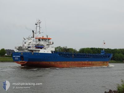
SANTA HELENA 1
General Cargo

Current Trip
| Time Travelled | 3 days |
|---|---|
| Remaining Time | --- |
| Distance Travelled | 583.20 nm |
| Remaining Distance | --- |
| AVG Speed | 8 Knots |
| MAX Speed | 9.6 Knots |
| AVG Wind | 12.3 knots |
| MAX Wind | 25 knots |
| MIN Temp | 4.1°C / 39.38°F |
| MAX Temp | 7.6°C / 45.68°F |
| Draught | 5.5 m |
| Position Received | 1 d ago |
Current Position
| Longitude | --- |
|---|---|
| Latitude | --- |
| Status | Under way using engine |
| Speed | 7.6 Knots |
| Course | 255.7° |
| Area | North Sea |
| Station | T-AIS |
| Position Received | 1 d ago |
Information
The current position of SANTA HELENA 1 is in North Sea with coordinates 57.06796° / 5.19946° as reported on 2025-03-28 18:55 by AIS to our vessel tracker app. The vessel's current speed is 7.6 Knots and is heading at the port of KIRKCALDY. The estimated time of arrival as calculated by MyShipTracking vessel tracking app is 2025-03-30 19:00 LT
The vessel SANTA HELENA 1 (IMO: 9617325, MMSI: 210075000) is a General Cargo that was built in 2012 ( 13 years old ). It's sailing under the flag of [CY] Cyprus.
In this page you can find informations about the vessels current position, last detected port calls, and current voyage information. If the vessels is not in coverage by AIS you will find the latest position.
The current position of SANTA HELENA 1 is detected by our AIS receivers and we are not responsible for the reliability of the data. The last position was recorded while the vessel was in Coverage by the Ais receivers of our vessel tracking app.
The current draught of SANTA HELENA 1 as reported by AIS is 5.5 meters
Weather
| Temperature | 7.2°C / 44.96°F |
|---|---|
| Wind Speed | 21 knots |
| Direction | 212° SSW |
| Pressure | 1012.5 hPa |
| Humidity | 83.2 % |
| Cloud Coverage | 100 % |


Featured Company
Last Port Calls
| Port | Arrival | Departure | Time In Port |
|---|---|---|---|
| 2025-03-24 20:19 | 2025-03-26 11:12 | 1 d | |
| 2025-03-19 01:33 | 2025-03-23 05:46 | 4 d | |
| 2025-03-13 21:46 | 2025-03-16 12:54 | 2 d | |
| 2025-03-10 14:29 | 2025-03-12 21:07 | 2 d | |
| 2025-03-05 10:29 | 2025-03-08 23:03 | 3 d | |
| 2025-03-02 00:35 | 2025-03-02 15:01 | 14 h | |
| 2025-02-28 06:55 | 2025-03-01 07:34 | 1 d | |
| 2025-02-24 01:00 | 2025-02-28 05:18 | 4 d | |
| 2025-02-19 00:35 | 2025-02-19 19:20 | 18 h | |
| 2025-02-18 23:26 | 2025-02-19 00:17 | 50 m |
Last Trips
| Origin | Departure | Destination | Arrival | Distance | |
|---|---|---|---|---|---|
| 2025-03-23 05:46 | 2025-03-24 20:19 | 336.93 nm | |||
| 2025-03-16 12:54 | 2025-03-19 01:33 | 506.84 nm | |||
| 2025-03-12 21:07 | 2025-03-13 21:46 | 151.25 nm | |||
| 2025-03-08 23:03 | 2025-03-10 14:29 | 344.08 nm | |||
| 2025-03-02 15:01 | 2025-03-05 10:29 | 575.84 nm | |||
| 2025-03-01 07:34 | 2025-03-02 00:35 | 178.77 nm | |||
| 2025-02-28 05:18 | 2025-02-28 06:55 | 12.11 nm | |||
| 2025-02-19 19:20 | 2025-02-24 01:00 | 590.42 nm | |||
| 2025-02-19 00:17 | 2025-02-19 00:35 | 0.41 nm | |||
| 2025-02-14 21:15 | 2025-02-18 23:26 | 811.32 nm |
Events
| Time | Event | Details | Position / Dest | Info |
|---|---|---|---|---|
| 2025-03-28 19:00 | Status Changed | Default Under way using engine |
57.06534 / 5.18193
GBKKD
|
Speed: 7.6 kn Course: 255.7° |
| 2025-03-28 18:55 | OUT of Coverage |
57.06796 / 5.19946
North Sea
GBKKD
|
Speed: 7.6 kn Course: 255.7° |
|
| 2025-03-28 05:25 | Detected in Sea | Norwegian part of the North Sea |
57.48724 / 7.92920
North Sea
GBKKD
|
Speed: 6.4 kn Course: 254.6° |
| 2025-03-28 05:14 | Change Sea Area | Norwegian part of the Skaggerak Danish part of the Skaggerak |
57.49262 / 7.96179
Skaggerak
GBKKD
|
Speed: 5 kn Course: 249.9° |
| 2025-03-27 14:34 | Change Sea Area | Danish part of the Skaggerak Danish part of the Kattegat |
57.80457 / 10.94920
Skaggerak
GBKKD
|
Speed: 8.3 kn Course: 320.9° |
| 2025-03-27 13:01 | Detected in Sea | Danish part of the Kattegat |
57.62088 / 11.23475
Kattegat
GBKKD
|
Speed: 9.6 kn Course: 318.4° |
| 2025-03-26 23:32 | Change Sea Area | Swedish part of the Kattegat Danish part of the Kattegat |
55.82315 / 12.72163
Kattegat
GBKKD
|
Speed: 8.9 kn Course: 11.2° |
| 2025-03-26 21:14 | Change Sea Area | Danish part of the Kattegat Swedish part of the Kattegat |
55.51226 / 12.72059
Kattegat
GBKKD
|
Speed: 8.9 kn Course: 358.6° |
| 2025-03-26 20:05 | Change Sea Area | Swedish part of the Kattegat Swedish part of the Baltic Sea |
55.34503 / 12.69013
Kattegat
GBKKD
|
Speed: 9.2 kn Course: 5.1° |
| 2025-03-26 16:56 | Change Sea Area | Swedish part of the Baltic Sea German part of the Baltic Sea |
55.01657 / 13.26125
Baltic Sea
GBKKD
|
Speed: 9 kn Course: 322.5° |