
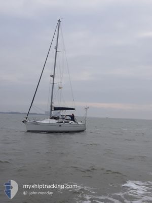
SANSOVINO
Sailing
Current Trip
Unknown
| Time Travelled | 9 h, 8 mins |
|---|---|
| Remaining Time | --- |
| Distance Travelled | 1.16 nm |
| Remaining Distance | --- |
| AVG Speed | 6.4 Knots |
| MAX Speed | 6.4 Knots |
| AVG Wind | 14.2 knots |
| MAX Wind | 14.3 knots |
| MIN Temp | 27.8°C / 82.04°F |
| MAX Temp | 28°C / 82.4°F |
| Draught | --- |
| Position Received | 8 h, 56 m ago |
Current Position
| Longitude | 9.09662° |
|---|---|
| Latitude | 39.16533° |
| Status | Default |
| Speed | 6.4 Knots |
| Course | 182.2° |
| Area | Tyrrhenian Sea |
| Station | T-AIS |
| Position Received | 8 h, 56 m ago |
Info
Information
The current position of SANSOVINO is in Tyrrhenian Sea with coordinates 39.16533° / 9.09662° as reported on 2024-07-04 10:22 by AIS to our vessel tracker app. The vessel's current speed is 6.4 Knots
The vessel SANSOVINO (MMSI: 232030197) is a Sailing It's sailing under the flag of [GB] United Kingdom.
In this page you can find informations about the vessels current position, last detected port calls, and current voyage information. If the vessels is not in coverage by AIS you will find the latest position.
The current position of SANSOVINO is detected by our AIS receivers and we are not responsible for the reliability of the data. The last position was recorded while the vessel was in Coverage by the Ais receivers of our vessel tracking app.
Weather
| Temperature | 27.9°C / 82.22°F |
|---|---|
| Wind Speed | 14 knots |
| Direction | 324° NW |
| Pressure | 1010.9 hPa |
| Humidity | 37.7 % |
| Cloud Coverage | --- |
Featured Company
Last Port Calls
| Port | Arrival | Departure | Time In Port |
|---|---|---|---|
| 2024-07-02 10:17 | 2024-07-04 10:11 | 1 d | |
| 2024-06-22 16:05 | |||
| 2024-06-18 12:46 | 2024-06-22 12:16 | 3 d | |
| 2024-06-12 09:19 | 2024-06-15 11:28 | 3 d | |
| 2024-05-12 09:58 | 2024-05-15 10:10 | 3 d | |
| 2024-05-03 16:03 | 2024-05-04 08:53 | 16 h |
Most Visited Ports (Last year)
| Port | Arrivals | |
|---|---|---|
| 2 | ||
| 1 | ||
| 1 | ||
| 1 | ||
| 1 | ||
| 1 |
Last Trips
| Origin | Departure | Destination | Arrival | Distance | |
|---|---|---|---|---|---|
| 2024-06-22 14:16 | 2024-06-22 18:05 | 3.58 nm | |||
| 2024-06-15 13:28 | 2024-06-18 14:46 | 30.29 nm | |||
| 2024-05-15 12:10 | 2024-06-12 11:19 | 116.66 nm | |||
| 2024-05-04 10:53 | 2024-05-12 11:58 | 115.37 nm | |||
| 2024-04-30 07:57 | 2024-05-03 18:03 | 172.86 nm |
Events
| Time | Event | Details | Position / Dest | Info |
|---|---|---|---|---|
| 2024-07-04 10:22 | OUT of Coverage |
39.16533 / 9.09662
Tyrrhenian Sea
|
Speed: 6.4 kn Course: 182.2° |
|
| 2024-07-04 10:11 | PORT DEPARTURE |
|
39.18401 / 9.10343
|
Speed: 5.3 kn Course: 70° |
| 2024-07-04 09:51 | IN Coverage |
39.20094 / 9.12286
Tyrrhenian Sea
[IT] CAGLIARI
|
Speed: 3.2 kn Course: 286.7° |
|
| 2024-07-02 12:05 | OUT of Coverage |
39.20120 / 9.12466
Tyrrhenian Sea
[IT] CAGLIARI
|
Speed: 2.4 kn Course: 318° |
|
| 2024-07-02 10:17 | PORT ARRIVAL |
|
39.18842 / 9.09172
[IT] CAGLIARI
|
Speed: 4.8 kn Course: 18° |
| 2024-07-02 09:56 | Detected in Sea | Italian part of the Tyrrhenian Sea |
39.15914 / 9.07568
Tyrrhenian Sea
|
Speed: 4.6 kn Course: 35.7° |
| 2024-07-02 09:56 | IN Coverage |
39.15914 / 9.07568
Tyrrhenian Sea
|
Speed: 4.6 kn Course: 35.7° |
|
| 2024-06-30 13:39 | OUT of Coverage |
39.01680 / 8.07574
Mediterranean Sea - Western Basin
|
Speed: 5.5 kn Course: 110.3° |
|
| 2024-06-30 12:20 | Change Sea Area | Italian part of the Mediterranean Sea - Western Basin Spanish part of the Balearic Sea |
39.06006 / 7.92265
Mediterranean Sea - Western Basin
|
Speed: 5.3 kn Course: 106.1° |
| 2024-06-30 12:20 | IN Coverage |
39.06006 / 7.92265
Mediterranean Sea - Western Basin
|
Speed: 5.3 kn Course: 106.1° |