
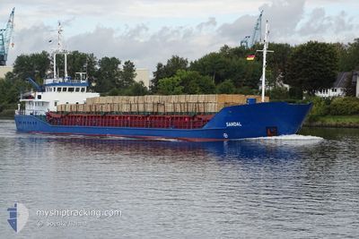
SANDAL
General Cargo
Current Trip
| Time Travelled | 3 days |
|---|---|
| Remaining Time | --- |
| Distance Travelled | 524.27 nm |
| Remaining Distance | --- |
| AVG Speed | 8.6 Knots |
| MAX Speed | 12.6 Knots |
| AVG Wind | 14.7 knots |
| MAX Wind | 28 knots |
| MIN Temp | 12.1°C / 53.78°F |
| MAX Temp | 18.6°C / 65.48°F |
| Draught | 4.2 m |
| Position Received | 1 d ago |
Current Position
| Longitude | 23.97147° |
|---|---|
| Latitude | 37.28198° |
| Status | Under way using engine |
| Speed | 9.7 Knots |
| Course | 204.7° |
| Area | Aegean Sea |
| Station | T-AIS |
| Position Received | 1 d ago |
Info
Information
The current position of SANDAL is in Aegean Sea with coordinates 37.28198° / 23.97147° as reported on 2024-04-30 06:29 by AIS to our vessel tracker app. The vessel's current speed is 9.7 Knots and is heading at the port of LAGOS. The estimated time of arrival as calculated by MyShipTracking vessel tracking app is 2024-05-21 05:30 LT
The vessel SANDAL (IMO: 9083201, MMSI: 341021000) is a General Cargo that was built in 1993 ( 31 years old ). It's sailing under the flag of [KN] St Kitts Nevis.
In this page you can find informations about the vessels current position, last detected port calls, and current voyage information. If the vessels is not in coverage by AIS you will find the latest position.
The current position of SANDAL is detected by our AIS receivers and we are not responsible for the reliability of the data. The last position was recorded while the vessel was in Coverage by the Ais receivers of our vessel tracking app.
The current draught of SANDAL as reported by AIS is 4.2 meters
Weather
| Temperature | 18.3°C / 64.94°F |
|---|---|
| Wind Speed | 15 knots |
| Direction | 142° SE |
| Pressure | 1013.1 hPa |
| Humidity | 86.1 % |
| Cloud Coverage | 74 % |
Featured Company
Last Port Calls
| Port | Arrival | Departure | Time In Port |
|---|---|---|---|
| 2024-04-26 23:13 | 2024-04-27 19:25 | 20 h | |
| 2024-04-24 03:04 | 2024-04-25 10:04 | 1 d | |
| 2024-04-21 06:33 |
Last Trips
| Origin | Departure | Destination | Arrival | Distance | |
|---|---|---|---|---|---|
| 2024-04-25 13:04 | 2024-04-27 02:13 | 150.54 nm | |||
| 2024-04-21 09:33 | 2024-04-24 06:04 | 227.20 nm |
Events
| Time | Event | Details | Position / Dest | Info |
|---|---|---|---|---|
| 2024-04-30 06:34 | Status Changed | Default Under way using engine |
37.26869 / 23.96384
NGLOS
|
Speed: 9.7 kn Course: 204.7° |
| 2024-04-30 06:29 | OUT of Coverage |
37.28198 / 23.97147
Aegean Sea
NGLOS
|
Speed: 9.7 kn Course: 204.7° |
|
| 2024-04-29 19:14 | Status Changed | Under way using engine Default |
38.72070 / 25.11261
NGLOS
|
Speed: 8.9 kn Course: 209° |
| 2024-04-29 19:14 | IN Coverage |
38.71618 / 25.11001
Aegean Sea
NGLOS
|
Speed: 9 kn Course: 204.7° |
|
| 2024-04-29 12:47 | Status Changed | Default Under way using engine |
39.56615 / 25.66975
NGLOS
|
Speed: 9.2 kn Course: 210.6° |
| 2024-04-29 12:47 | OUT of Coverage |
39.56762 / 25.67086
Aegean Sea
NGLOS
|
Speed: 9.2 kn Course: 210.6° |
|
| 2024-04-29 11:52 | Detected in Sea | Greek part of the Aegean Sea |
39.69149 / 25.75211
Aegean Sea
NGLOS
|
Speed: 9.2 kn Course: 202.7° |
| 2024-04-29 11:52 | Status Changed | Under way using engine Default |
39.69149 / 25.75211
NGLOS
|
Speed: 9.3 kn Course: 207° |
| 2024-04-29 11:52 | IN Coverage |
39.69149 / 25.75211
Aegean Sea
NGLOS
|
Speed: 9.2 kn Course: 202.7° |
|
| 2024-04-29 08:32 | OUT of Coverage |
40.04441 / 26.23667
Sea of Marmara
NGLOS
|
Speed: 12.3 kn Course: 241.7° |