
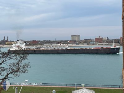
SAM LAUD
Self Discharging Bulk Carrier
Current Trip
| Trip Time | 21 h, 51 mins |
|---|---|
| Trip Distance | 164.49 nm |
| AVG Speed | 8.1 Knots |
| MAX Speed | 13.7 Knots |
| Draught | 6.4 m |
| AVG Wind | 9.4 knots |
| MAX Wind | 14 knots |
| MIN Temp | 0.4°C / 32.72°F |
| MAX Temp | 7.6°C / 45.68°F |
| Position Received | 22 h, 7 m ago |
Current Position
| Longitude | --- |
|---|---|
| Latitude | --- |
| Status | Under way using engine |
| Speed | 7.1 Knots |
| Course | 246.7° |
| Area | --- |
| Station | T-AIS |
| Position Received | 22 h, 7 m ago |
Info
Information
The current position of SAM LAUD is in --- with coordinates 42.19117° / -80.64902° as reported on 2026-01-08 07:19 by AIS to our vessel tracker app. The vessel's current speed is 7.1 Knots and is currently inside the port of CLEVELAND.
The vessel SAM LAUD (IMO: 7390210, MMSI: 366938760) is a Self Discharging Bulk Carrier that was built in 1975 ( 51 years old ). It's sailing under the flag of [US] USA.
In this page you can find informations about the vessels current position, last detected port calls, and current voyage information. If the vessels is not in coverage by AIS you will find the latest position.
The current position of SAM LAUD is detected by our AIS receivers and we are not responsible for the reliability of the data. The last position was recorded while the vessel was in Coverage by the Ais receivers of our vessel tracking app.
The current draught of SAM LAUD as reported by AIS is 6.4 meters
Weather
| Temperature | 10.2°C / 50.36°F |
|---|---|
| Wind Speed | 16 knots |
| Direction | 172° S |
| Pressure | 1011 hPa |
| Humidity | 52.8 % |
| Cloud Coverage | 100 % |
Featured Company
Last Port Calls
| Port | Arrival | Departure | Time In Port |
|---|---|---|---|
| 2026-01-08 16:46 | |||
| 2026-01-07 09:18 | 2026-01-07 18:55 | 9 h | |
| 2026-01-06 01:33 | 2026-01-06 07:05 | 5 h | |
| 2025-12-28 06:02 | 2025-12-30 21:06 | 2 d | |
| 2025-12-24 04:06 | 2025-12-24 08:20 | 4 h | |
| 2025-12-22 11:56 | 2025-12-23 03:55 | 15 h | |
| 2025-12-22 11:01 | 2025-12-22 11:35 | 34 m | |
| 2025-12-20 21:47 | 2025-12-21 11:04 | 13 h | |
| 2025-12-18 01:24 | 2025-12-20 07:35 | 2 d | |
| 2025-12-16 08:27 | 2025-12-16 08:47 | 19 m |
Last Trips
| Origin | Departure | Destination | Arrival | Distance | |
|---|---|---|---|---|---|
| 2026-01-07 18:55 | 2026-01-08 16:46 | 164.49 nm | |||
| 2026-01-06 07:05 | 2026-01-07 09:18 | 222.12 nm | |||
| 2025-12-30 21:06 | 2026-01-06 01:33 | 611.64 nm | |||
| 2025-12-24 08:20 | 2025-12-28 06:02 | 540.48 nm | |||
| 2025-12-23 03:55 | 2025-12-24 04:06 | 98.21 nm | |||
| 2025-12-22 11:35 | 2025-12-22 11:56 | 0.19 nm | |||
| 2025-12-21 11:04 | 2025-12-22 11:01 | 12.63 nm | |||
| 2025-12-20 07:35 | 2025-12-20 21:47 | 10.27 nm | |||
| 2025-12-16 08:47 | 2025-12-18 01:24 | 11.91 nm | |||
| 2025-12-16 07:55 | 2025-12-16 08:27 | 0.61 nm |
Events
| Time | Event | Details | Position / Dest | Info |
|---|---|---|---|---|
| 2026-01-08 21:46 | PORT ARRIVAL |
|
41.50301 / -81.71088
[US] CLEVELAND
|
Speed: 3.7 kn Course: 163° |
| 2026-01-08 07:23 | Status Changed | Default Under way using engine |
42.18667 / -80.65833
CLEVELAND SHUTTLES
|
Speed: 7.1 kn Course: 246.7° |
| 2026-01-08 07:19 | OUT of Coverage |
42.19117 / -80.64902
|
Speed: 7.1 kn Course: 246.7° |
|
| 2026-01-08 07:18 | Status Changed | Under way using engine Default |
42.19130 / -80.64860
CLEVELAND SHUTTLES
|
Speed: 7 kn Course: 246° |
| 2026-01-08 07:14 | Status Changed | Default Under way using engine |
42.19333 / -80.63666
CLEVELAND SHUTTLES
|
Speed: 7.1 kn Course: 246.6° |
| 2026-01-08 07:07 | Status Changed | Under way using engine Default |
42.20000 / -80.62164
CLEVELAND SHUTTLES
|
Speed: 7.1 kn Course: 246° |
| 2026-01-08 06:50 | Status Changed | Default Under way using engine |
42.21333 / -80.57833
CLEVELAND SHUTTLES
|
Speed: 7.1 kn Course: 246.1° |
| 2026-01-08 06:00 | Status Changed | Under way using engine Default |
42.25276 / -80.45865
CLEVELAND SHUTTLES
|
Speed: 7 kn Course: 246° |
| 2026-01-08 05:56 | Status Changed | Default Under way using engine |
42.25500 / -80.44666
CLEVELAND SHUTTLES
|
Speed: 7.2 kn Course: 246.3° |
| 2026-01-08 03:56 | Status Changed | Under way using engine Default |
42.41514 / -79.95337
CLEVELAND SHUTTLES
|
Speed: 13.7 kn Course: 244° |