

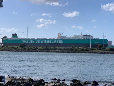
SALOME
Vehicles Carrier

Current Trip
| Time Travelled | 23 h, 35 mins |
|---|---|
| Remaining Time | 21 mins |
| Distance Travelled | 317.94 nm |
| Remaining Distance | 8.79 nm |
| AVG Speed | 14.6 Knots |
| MAX Speed | 19.7 Knots |
| AVG Wind | 12.8 knots |
| MAX Wind | 18 knots |
| MIN Temp | 5.6°C / 42.08°F |
| MAX Temp | 9.3°C / 48.74°F |
| Draught | 8.1 m |
| Position Received | Now |
Current Position
| Longitude | --- |
|---|---|
| Latitude | --- |
| Status | Under way using engine |
| Speed | 14.7 Knots |
| Course | 60.6° |
| Area | North Sea |
| Station | T-AIS |
| Position Received | Now |
Information
The current position of SALOME is in North Sea with coordinates 51.40484° / 3.03070° as reported on 2025-03-29 00:45 by AIS to our vessel tracker app. The vessel's current speed is 14.7 Knots and is heading at the port of ZEEBRUGGE. The estimated time of arrival as calculated by MyShipTracking vessel tracking app is 2025-03-29 02:07 LT
The vessel SALOME (IMO: 9515412, MMSI: 257242000) is a Vehicles Carrier that was built in 2012 ( 13 years old ). It's sailing under the flag of [NO] Norway.
In this page you can find informations about the vessels current position, last detected port calls, and current voyage information. If the vessels is not in coverage by AIS you will find the latest position.
The current position of SALOME is detected by our AIS receivers and we are not responsible for the reliability of the data. The last position was recorded while the vessel was in Coverage by the Ais receivers of our vessel tracking app.
The current draught of SALOME as reported by AIS is 8.1 meters
Weather
| Temperature | 8.4°C / 47.12°F |
|---|---|
| Wind Speed | 13 knots |
| Direction | 327° NNW |
| Pressure | 1015 hPa |
| Humidity | 74.7 % |
| Cloud Coverage | 100 % |


Featured Company
Last Port Calls
| Port | Arrival | Departure | Time In Port |
|---|---|---|---|
| 2025-03-25 20:03 | 2025-03-28 02:11 | 2 d | |
| 2025-03-14 05:18 | 2025-03-15 18:00 | 1 d | |
| 2025-03-13 04:15 | 2025-03-13 19:06 | 14 h | |
| 2025-03-09 17:54 | 2025-03-11 04:00 | 1 d | |
| 2025-03-03 15:27 | 2025-03-04 19:42 | 1 d | |
| 2025-02-22 07:07 | 2025-02-23 22:23 | 1 d | |
| 2025-02-18 04:14 | 2025-02-18 19:14 | 15 h | |
| 2025-02-06 16:25 | 2025-02-07 05:05 | 12 h | |
| 2025-02-04 08:54 | 2025-02-05 04:31 | 19 h | |
| 2025-02-02 06:09 | 2025-02-02 15:07 | 8 h |
Most Visited Ports (Last year)
| Port | Arrivals | |
|---|---|---|
| 8 | ||
| 4 | ||
| 3 | ||
| 3 | ||
| 3 | ||
| 3 |
Last Trips
| Origin | Departure | Destination | Arrival | Distance | |
|---|---|---|---|---|---|
| 2025-03-15 18:00 | 2025-03-25 20:03 | 3917.90 nm | |||
| 2025-03-13 19:06 | 2025-03-14 05:18 | 161.68 nm | |||
| 2025-03-11 04:00 | 2025-03-13 04:15 | 544.89 nm | |||
| 2025-03-04 19:42 | 2025-03-09 17:54 | 1540.96 nm | |||
| 2025-02-23 22:23 | 2025-03-03 15:27 | 3006.30 nm | |||
| 2025-02-18 19:14 | 2025-02-22 07:07 | 1216.33 nm | |||
| 2025-02-07 05:05 | 2025-02-18 04:14 | 4288.52 nm | |||
| 2025-02-05 04:31 | 2025-02-06 16:25 | 469.75 nm | |||
| 2025-02-02 15:07 | 2025-02-04 08:54 | 478.08 nm | |||
| 2025-01-31 01:03 | 2025-02-02 06:09 | 702.18 nm |
Events
| Time | Event | Details | Position / Dest | Info |
|---|---|---|---|---|
| 2025-03-28 23:20 | ETA Changed | 2025/03/29 01:00 2025/03/29 01:15 |
51.52285 / 2.61829
BE ZEE
|
Speed: 18.2 kn Course: 188.5° |
| 2025-03-28 21:58 | Change Sea Area | Belgian part of the North Sea Dutch part of the North Sea |
51.83957 / 2.58898
North Sea
BE ZEE
|
Speed: 11.3 kn Course: 179.9° |
| 2025-03-28 20:42 | ETA Changed | 2025/03/29 01:15 2025/03/29 00:01 |
52.04698 / 2.80123
BE ZEE
|
Speed: 11.8 kn Course: 216.4° |
| 2025-03-28 19:39 | Status Changed | Under way using engine Default |
52.21600 / 3.00631
BE ZEE
|
Speed: 12 kn Course: 217° |
| 2025-03-28 19:34 | Status Changed | Default Under way using engine |
52.22939 / 3.02259
BE ZEE
|
Speed: 12 kn Course: 216.6° |
| 2025-03-28 19:23 | Status Changed | Under way using engine Default |
52.25897 / 3.05861
BE ZEE
|
Speed: 12.1 kn Course: 217° |
| 2025-03-28 19:17 | Status Changed | Default Under way using engine |
52.27381 / 3.07672
BE ZEE
|
Speed: 12.1 kn Course: 218.2° |
| 2025-03-28 19:04 | Status Changed | Under way using engine Default |
52.30938 / 3.12222
BE ZEE
|
Speed: 12 kn Course: 218° |
| 2025-03-28 19:04 | IN Coverage |
52.30938 / 3.12222
North Sea
BE ZEE
|
Speed: 12.2 kn Course: 218° |
|
| 2025-03-28 17:19 | OUT of Coverage |
52.58774 / 3.46999
North Sea
BE ZEE
|
Speed: 12.2 kn Course: 218.9° |