
SAINT MYRON
Cargo
Current Trip
| Trip Time | 23 days |
|---|---|
| Trip Distance | 5716.72 nm |
| AVG Speed | 9.8 Knots |
| MAX Speed | 9.8 Knots |
| Draught | 12.3 m |
| AVG Wind | 13.5 knots |
| MAX Wind | 31 knots |
| MIN Temp | 11.4°C / 52.52°F |
| MAX Temp | 29.9°C / 85.82°F |
| Position Received | 17 d ago |
Current Position
| Longitude | 39.33355° |
|---|---|
| Latitude | 18.33076° |
| Status | Under way using engine |
| Speed | 12.1 Knots |
| Course | 150.8° |
| Area | Red Sea |
| Station | T-AIS |
| Position Received | 17 d ago |
Info
Information
The current position of SAINT MYRON is in Red Sea with coordinates 18.33076° / 39.33355° as reported on 2024-04-16 07:35 by AIS to our vessel tracker app. The vessel's current speed is 12.1 Knots and is currently inside the port of MOMBASA.
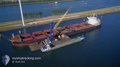
The vessel SAINT MYRON (IMO: 9675597, MMSI: 215881000) is a Cargo It's sailing under the flag of [MT] Malta.
In this page you can find informations about the vessels current position, last detected port calls, and current voyage information. If the vessels is not in coverage by AIS you will find the latest position.
The current position of SAINT MYRON is detected by our AIS receivers and we are not responsible for the reliability of the data. The last position was recorded while the vessel was in Coverage by the Ais receivers of our vessel tracking app.
The current draught of SAINT MYRON as reported by AIS is 12.3 meters
Weather
| Temperature | 28°C / 82.4°F |
|---|---|
| Wind Speed | 20 knots |
| Direction | 191° S |
| Pressure | 1010.6 hPa |
| Humidity | 79.7 % |
| Cloud Coverage | 100 % |
Featured Company
Last Trips
Events
| Time | Event | Details | Position / Dest | Info |
|---|---|---|---|---|
| 2024-05-03 10:27 | PORT ARRIVAL |
|
-4.05300 / 39.64659
[KE] MOMBASA
|
Speed: 1.1 kn Course: 166° |
| 2024-05-03 06:26 | STOP Moving | 0.47 nm, South of MOMBASA |
-4.05459 / 39.64331
MOMBASA
|
Speed: 0.2 kn Course: 338° |
| 2024-05-03 01:39 | START Moving | 14.28 nm, South East of MOMBASA |
-4.25994 / 39.74947
MOMBASA
|
Speed: 3.1 kn Course: 150° |
| 2024-05-03 01:23 | STOP Moving | 14.47 nm, South East of MOMBASA |
-4.26635 / 39.74380
MOMBASA
|
Speed: 0.3 kn Course: 198° |
| 2024-05-02 22:55 | START Moving | 13.75 nm, East of MOMBASA |
-4.03831 / 39.86942
MOMBASA
|
Speed: 3.7 kn Course: 181° |
| 2024-05-02 22:43 | STOP Moving | 13.6 nm, East of MOMBASA |
-4.03222 / 39.86660
MOMBASA
|
Speed: 0.3 kn Course: 200° |
| 2024-04-30 02:55 | START Moving |
-4.42926 / 39.92099
MOMBASA
|
Speed: 3.1 kn Course: 279° |
|
| 2024-04-30 01:26 | STOP Moving |
-4.48465 / 39.92837
MOMBASA
|
Speed: 0.3 kn Course: 183° |
|
| 2024-04-28 19:49 | START Moving | 18.88 nm, South East of MOMBASA |
-4.30231 / 39.82648
MOMBASA
|
Speed: 3.1 kn Course: 78° |
| 2024-04-28 19:05 | STOP Moving | 19.65 nm, South East of MOMBASA |
-4.32728 / 39.81255
MOMBASA
|
Speed: 0.3 kn Course: 185° |