
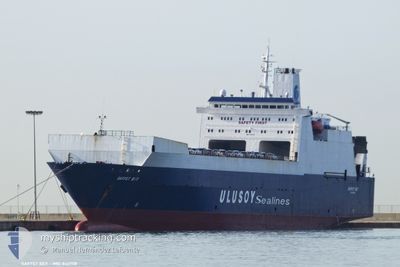
SAFFET BEY
Ro-Ro Cargo
Current Trip
| Time Travelled | 7 days |
|---|---|
| Remaining Time | --- |
| Distance Travelled | 939.18 nm |
| Remaining Distance | --- |
| AVG Speed | 9.4 Knots |
| MAX Speed | 15.1 Knots |
| AVG Wind | 16.3 knots |
| MAX Wind | 35 knots |
| MIN Temp | 0.5°C / 32.9°F |
| MAX Temp | 18.5°C / 65.3°F |
| Draught | 6.1 m |
| Position Received | 12 m ago |
Current Position
| Longitude | --- |
|---|---|
| Latitude | --- |
| Status | At anchor |
| Speed | |
| Course | 351° |
| Area | Mediterranean Sea - Eastern Basin |
| Station | T-AIS |
| Position Received | 12 m ago |
Info
Information
The current position of SAFFET BEY is in Mediterranean Sea - Eastern Basin with coordinates 31.35788° / 32.33623° as reported on 2026-01-06 10:16 by AIS to our vessel tracker app. The vessel's current speed is 0 Knots
The vessel SAFFET BEY (IMO: 8417118, MMSI: 271000419) is a Ro-Ro Cargo that was built in 1987 ( 39 years old ). It's sailing under the flag of [TR] Turkey.
In this page you can find informations about the vessels current position, last detected port calls, and current voyage information. If the vessels is not in coverage by AIS you will find the latest position.
The current position of SAFFET BEY is detected by our AIS receivers and we are not responsible for the reliability of the data. The last position was recorded while the vessel was in Coverage by the Ais receivers of our vessel tracking app.
The current draught of SAFFET BEY as reported by AIS is 6.1 meters
Weather
| Temperature | 16.7°C / 62.06°F |
|---|---|
| Wind Speed | 3 knots |
| Direction | 312° NW |
| Pressure | 1020.7 hPa |
| Humidity | 70.6 % |
| Cloud Coverage | 53 % |
Featured Company
Last Port Calls
| Port | Arrival | Departure | Time In Port |
|---|---|---|---|
| 2025-12-29 13:31 | 2025-12-29 18:25 | 4 h | |
| 2025-12-26 06:38 | 2025-12-26 16:47 | 10 h | |
| 2025-12-22 16:22 | 2025-12-23 01:46 | 9 h | |
| 2025-12-17 22:00 | 2025-12-18 21:21 | 23 h | |
| 2025-11-25 14:24 | 2025-11-26 17:12 | 1 d |
Most Visited Ports (Last year)
| Port | Arrivals | |
|---|---|---|
| 6 | ||
| 6 | ||
| 5 | ||
| 4 | ||
| 4 | ||
| 3 |
Last Trips
| Origin | Departure | Destination | Arrival | Distance | |
|---|---|---|---|---|---|
| 2025-12-26 16:47 | 2025-12-29 13:31 | 835.78 nm | |||
| 2025-12-23 01:46 | 2025-12-26 06:38 | 844.32 nm | |||
| 2025-12-18 21:21 | 2025-12-22 16:22 | 938.74 nm | |||
| 2025-11-26 17:12 | 2025-12-17 22:00 | 2200.61 nm | |||
| 2025-10-31 14:19 | 2025-11-25 14:24 | 2944.61 nm |
Events
| Time | Event | Details | Position / Dest | Info |
|---|---|---|---|---|
| 2026-01-06 09:49 | Status Changed | At anchor Default |
31.35789 / 32.33629
EGPSD
|
Speed: Course: -1° |
| 2026-01-06 09:34 | Status Changed | Default At anchor |
31.35667 / 32.33500
EGPSD
|
Speed: Course: 334° |
| 2026-01-06 08:25 | Status Changed | At anchor Default |
31.35795 / 32.33657
EGPSD
|
Speed: Course: 332° |
| 2026-01-06 07:58 | Status Changed | Default At anchor |
31.35797 / 32.33658
EGPSD
|
Speed: Course: 329° |
| 2026-01-06 07:55 | Status Changed | At anchor Default |
31.35797 / 32.33658
EGPSD
|
Speed: Course: 330° |
| 2026-01-06 07:22 | Status Changed | Default At anchor |
31.35797 / 32.33653
EGPSD
|
Speed: Course: 324° |
| 2026-01-06 07:13 | Status Changed | At anchor Default |
31.35797 / 32.33649
EGPSD
|
Speed: Course: 331° |
| 2026-01-06 07:07 | Status Changed | Default At anchor |
31.35798 / 32.33649
EGPSD
|
Speed: Course: 328° |
| 2026-01-06 07:04 | Status Changed | At anchor Default |
31.35799 / 32.33650
EGPSD
|
Speed: Course: 335° |
| 2026-01-06 06:22 | Status Changed | Default At anchor |
31.35830 / 32.33634
EGPSD
|
Speed: Course: 328° |