

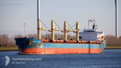
SAFEEN AL NASR
Bulk Carrier

Current Trip
| Trip Time | 13 days |
|---|---|
| Trip Distance | 3053.22 nm |
| AVG Speed | 11.3 Knots |
| MAX Speed | 14.1 Knots |
| Draught | 6.8 m |
| AVG Wind | 12.1 knots |
| MAX Wind | 18 knots |
| MIN Temp | 17.8°C / 64.04°F |
| MAX Temp | 28.1°C / 82.58°F |
| Position Received | 3 d ago |
Current Position
| Longitude | --- |
|---|---|
| Latitude | --- |
| Status | At anchor |
| Speed | 0.1 Knots |
| Course | 220° |
| Area | South Atlantic Ocean |
| Station | T-AIS |
| Position Received | 3 d ago |
Information
The current position of SAFEEN AL NASR is in South Atlantic Ocean with coordinates -23.03794° / -43.14834° as reported on 2025-03-14 16:24 by AIS to our vessel tracker app. The vessel's current speed is 0.1 Knots and is currently inside the port of RIO DE JANEIRO.
The vessel SAFEEN AL NASR (IMO: 9612296, MMSI: 538010392) is a Bulk Carrier that was built in 2013 ( 12 years old ). It's sailing under the flag of [MH] Marshall Is.
In this page you can find informations about the vessels current position, last detected port calls, and current voyage information. If the vessels is not in coverage by AIS you will find the latest position.
The current position of SAFEEN AL NASR is detected by our AIS receivers and we are not responsible for the reliability of the data. The last position was recorded while the vessel was in Coverage by the Ais receivers of our vessel tracking app.
The current draught of SAFEEN AL NASR as reported by AIS is 6.8 meters
Weather
| Temperature | 24.3°C / 75.74°F |
|---|---|
| Wind Speed | 4 knots |
| Direction | 52° NE |
| Pressure | 1014.2 hPa |
| Humidity | 78.8 % |
| Cloud Coverage | 12 % |


Featured Company
Last Port Calls
| Port | Arrival | Departure | Time In Port |
|---|---|---|---|
| 2025-03-15 17:39 | |||
| 2025-02-26 15:15 | 2025-03-02 16:51 | 4 d | |
| 2025-01-28 07:46 | 2025-01-30 18:42 | 2 d | |
| 2025-01-10 13:55 | 2025-01-16 15:42 | 6 d |
Most Visited Ports (Last year)
| Port | Arrivals | |
|---|---|---|
| 2 | ||
| 1 | ||
| 1 | ||
| 1 | ||
| 1 | ||
| 1 |
Last Trips
| Origin | Departure | Destination | Arrival | Distance | |
|---|---|---|---|---|---|
| 2025-03-02 16:51 | 2025-03-15 17:39 | 3053.22 nm | |||
| 2025-01-30 18:42 | 2025-02-26 15:15 | 4288.19 nm | |||
| 2025-01-16 15:42 | 2025-01-28 07:46 | 2874.48 nm | |||
| 2024-12-28 00:12 | 2025-01-10 13:55 | 2825.94 nm |
Events
| Time | Event | Details | Position / Dest | Info |
|---|---|---|---|---|
| 2025-03-15 21:15 | STOP Moving |
-22.89192 / -43.19267
[BR] RIO DE JANEIRO
|
Speed: 0.2 kn Course: 92° |
|
| 2025-03-15 20:39 | PORT ARRIVAL |
|
-22.89127 / -43.17954
[BR] RIO DE JANEIRO
|
Speed: 6.8 kn Course: 268° |
| 2025-03-15 19:18 | START Moving | 7.92 nm, South of RIO DE JANEIRO |
-23.03378 / -43.15006
BR RIO
|
Speed: 6.3 kn Course: 6° |
| 2025-03-14 16:30 | Status Changed | Default At anchor |
-23.03800 / -43.14834
BR RIO
|
Speed: 0.1 kn Course: 220° |
| 2025-03-14 16:24 | Status Changed | At anchor Default |
-23.03794 / -43.14834
BR RIO
|
Speed: 0.2 kn Course: 218° |
| 2025-03-14 16:24 | OUT of Coverage |
-23.03794 / -43.14834
South Atlantic Ocean
|
Speed: 0.1 kn Course: 127.8° |
|
| 2025-03-14 16:03 | Status Changed | Default At anchor |
-23.03800 / -43.14834
BR RIO
|
Speed: 0.1 kn Course: 225° |
| 2025-03-14 16:00 | Status Changed | At anchor Default |
-23.03803 / -43.14832
BR RIO
|
Speed: 0.1 kn Course: 220° |
| 2025-03-14 15:48 | Status Changed | Default At anchor |
-23.03813 / -43.14823
BR RIO
|
Speed: 0.1 kn Course: 218° |
| 2025-03-14 15:45 | Status Changed | At anchor Default |
-23.03809 / -43.14829
BR RIO
|
Speed: Course: 217° |