
RUSADER
General Cargo
Current Trip
| Time Travelled | 8 days |
|---|---|
| Remaining Time | 5 days |
| Distance Travelled | 1540.73 nm |
| Remaining Distance | 912.52 nm |
| AVG Speed | 7 Knots |
| MAX Speed | 9.9 Knots |
| AVG Wind | 17.3 knots |
| MAX Wind | 27 knots |
| MIN Temp | 11.6°C / 52.88°F |
| MAX Temp | 17.2°C / 62.96°F |
| Draught | 5.6 m |
| Position Received | 1 d ago |
Current Position
| Longitude | --- |
|---|---|
| Latitude | --- |
| Status | Under way using engine |
| Speed | 6.6 Knots |
| Course | 0.2° |
| Area | North Atlantic Ocean |
| Station | T-AIS |
| Position Received | 1 d ago |
Info
Information
The current position of RUSADER is in North Atlantic Ocean with coordinates 39.28594° / -9.75722° as reported on 2025-12-22 11:04 by AIS to our vessel tracker app. The vessel's current speed is 6.6 Knots and is heading at the port of MOERDIJK. The estimated time of arrival as calculated by MyShipTracking vessel tracking app is 2025-12-29 09:24 LT
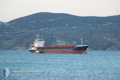
The vessel RUSADER (IMO: 9006368, MMSI: 351053000) is a General Cargo that was built in 1994 ( 31 years old ). It's sailing under the flag of [PA] Panama.
In this page you can find informations about the vessels current position, last detected port calls, and current voyage information. If the vessels is not in coverage by AIS you will find the latest position.
The current position of RUSADER is detected by our AIS receivers and we are not responsible for the reliability of the data. The last position was recorded while the vessel was in Coverage by the Ais receivers of our vessel tracking app.
The current draught of RUSADER as reported by AIS is 5.6 meters
Weather
| Temperature | 13.2°C / 55.76°F |
|---|---|
| Wind Speed | 19 knots |
| Direction | 341° NNW |
| Pressure | 1011 hPa |
| Humidity | 71 % |
| Cloud Coverage | 15 % |
Featured Company
Last Port Calls
| Port | Arrival | Departure | Time In Port |
|---|---|---|---|
| 2025-12-12 06:09 | 2025-12-15 17:10 | 3 d | |
| 2025-12-10 13:57 | 2025-12-11 14:49 | 1 d | |
| 2025-12-03 09:23 | 2025-12-06 13:33 | 3 d | |
| 2025-12-01 07:32 | 2025-12-02 20:27 | 1 d | |
| 2025-11-15 18:44 | 2025-11-17 23:36 | 2 d | |
| 2025-11-10 16:12 | 2025-11-13 17:44 | 3 d | |
| 2025-11-04 14:38 | 2025-11-04 16:14 | 1 h | |
| 2025-11-01 08:33 | 2025-11-01 19:52 | 11 h | |
| 2025-11-01 07:41 | 2025-11-01 08:30 | 48 m | |
| 2025-11-01 02:38 |
Most Visited Ports (Last year)
| Port | Arrivals | |
|---|---|---|
| 12 | ||
| 3 | ||
| 2 | ||
| 2 | ||
| 2 | ||
| 2 |
Last Trips
| Origin | Departure | Destination | Arrival | Distance | |
|---|---|---|---|---|---|
| 2025-12-11 14:49 | 2025-12-12 06:09 | 13.29 nm | |||
| 2025-12-06 13:33 | 2025-12-10 13:57 | 482.88 nm | |||
| 2025-12-02 20:27 | 2025-12-03 09:23 | 95.65 nm | |||
| 2025-11-17 23:36 | 2025-12-01 07:32 | 1769.47 nm | |||
| 2025-11-13 17:44 | 2025-11-15 18:44 | 463.89 nm | |||
| 2025-11-04 16:14 | 2025-11-10 16:12 | 786.62 nm | |||
| 2025-11-01 19:52 | 2025-11-04 14:38 | 466.56 nm | |||
| 2025-11-01 08:30 | 2025-11-01 08:33 | 2.72 nm | |||
| 2025-11-01 02:12 | 2025-11-01 07:41 | 40.22 nm | |||
| 2025-11-01 01:52 | 2025-11-01 02:38 | 5.68 nm |
Events
| Time | Event | Details | Position / Dest | Info |
|---|---|---|---|---|
| 2025-12-22 11:17 | Status Changed | Default Under way using engine |
39.30908 / -9.75763
NLMOE
|
Speed: 6.6 kn Course: 0.2° |
| 2025-12-22 11:04 | OUT of Coverage |
39.28594 / -9.75722
North Atlantic Ocean
NLMOE
|
Speed: 6.6 kn Course: 0.2° |
|
| 2025-12-22 10:55 | Status Changed | Under way using engine Default |
39.26972 / -9.75960
NLMOE
|
Speed: 6.7 kn Course: 18° |
| 2025-12-22 10:36 | Status Changed | Default Under way using engine |
39.23481 / -9.77062
NLMOE
|
Speed: 6.7 kn Course: 27.3° |
| 2025-12-22 10:29 | Status Changed | Under way using engine Default |
39.22160 / -9.77619
NLMOE
|
Speed: 7 kn Course: 17° |
| 2025-12-22 10:24 | Status Changed | Default Under way using engine |
39.21290 / -9.77937
NLMOE
|
Speed: 6.8 kn Course: 13.1° |
| 2025-12-22 01:59 | ETA Changed | 2025/12/28 10:00 2025/12/27 10:00 |
38.35674 / -9.60754
NLMOE
|
Speed: 7.2 kn Course: 342.3° |
| 2025-12-22 01:49 | Status Changed | Under way using engine Default |
38.33863 / -9.60364
NLMOE
|
Speed: 7.3 kn Course: 358° |
| 2025-12-22 01:48 | Status Changed | Default Under way using engine |
38.33588 / -9.60345
NLMOE
|
Speed: 7 kn Course: 1.8° |
| 2025-12-22 01:33 | Status Changed | Under way using engine Default |
38.30436 / -9.60257
NLMOE
|
Speed: 7.5 kn Course: 357° |