
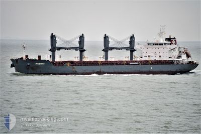
RUBINA
Cargo
Current Trip
| Time Travelled | 7 days |
|---|---|
| Remaining Time | 10 h, 34 mins |
| Distance Travelled | 1966.54 nm |
| Remaining Distance | 129.59 nm |
| AVG Speed | 11.2 Knots |
| MAX Speed | 13 Knots |
| AVG Wind | 17.3 knots |
| MAX Wind | 28 knots |
| MIN Temp | 11.1°C / 51.98°F |
| MAX Temp | 26°C / 78.8°F |
| Draught | 9.9 m |
| Position Received | 1 d ago |
Current Position
| Longitude | --- |
|---|---|
| Latitude | --- |
| Status | Under way using engine |
| Speed | 11.7 Knots |
| Course | 348.7° |
| Area | Coral Sea |
| Station | T-AIS |
| Position Received | 1 d ago |
Info
Information
The current position of RUBINA is in Coral Sea with coordinates -25.88386° / 153.84390° as reported on 2025-12-05 09:05 by AIS to our vessel tracker app. The vessel's current speed is 11.7 Knots and is heading at the port of MACKAY. The estimated time of arrival as calculated by MyShipTracking vessel tracking app is 2025-12-07 07:02 LT
The vessel RUBINA (IMO: 9725512, MMSI: 255805860) is a Cargo It's sailing under the flag of [PT] Portugal.
In this page you can find informations about the vessels current position, last detected port calls, and current voyage information. If the vessels is not in coverage by AIS you will find the latest position.
The current position of RUBINA is detected by our AIS receivers and we are not responsible for the reliability of the data. The last position was recorded while the vessel was in Coverage by the Ais receivers of our vessel tracking app.
The current draught of RUBINA as reported by AIS is 9.9 meters
Weather
| Temperature | 26°C / 78.8°F |
|---|---|
| Wind Speed | 12 knots |
| Direction | 88° E |
| Pressure | 1012.4 hPa |
| Humidity | 62.8 % |
| Cloud Coverage | --- |
Featured Company
Events
| Time | Event | Details | Position / Dest | Info |
|---|---|---|---|---|
| 2025-12-05 09:12 | Status Changed | Default Under way using engine |
-25.86256 / 153.83998
MACKAY, AUSTRALIA
|
Speed: 11.7 kn Course: 348.7° |
| 2025-12-05 09:05 | Status Changed | Under way using engine Default |
-25.88386 / 153.84390
MACKAY, AUSTRALIA
|
Speed: 11.6 kn Course: 352° |
| 2025-12-05 09:05 | OUT of Coverage |
-25.88386 / 153.84390
Coral Sea
MACKAY, AUSTRALIA
|
Speed: 11.7 kn Course: 348.7° |
|
| 2025-12-05 08:32 | Status Changed | Default Under way using engine |
-25.99082 / 153.86278
MACKAY, AUSTRALIA
|
Speed: 11.2 kn Course: 350.4° |
| 2025-12-05 08:23 | Status Changed | Under way using engine Default |
-26.01774 / 153.86747
MACKAY, AUSTRALIA
|
Speed: 11.1 kn Course: 350° |
| 2025-12-05 08:20 | Status Changed | Default Under way using engine |
-26.02860 / 153.86948
MACKAY, AUSTRALIA
|
Speed: 11.2 kn Course: 349.7° |
| 2025-12-05 08:11 | Status Changed | Under way using engine Default |
-26.05493 / 153.87424
MACKAY, AUSTRALIA
|
Speed: 11.3 kn Course: 352° |
| 2025-12-05 07:56 | IN Coverage |
-26.05436 / 153.87414
Coral Sea
MACKAY, AUSTRALIA
|
Speed: 11.2 kn Course: 349.7° |
|
| 2025-12-05 07:04 | Status Changed | Default Under way using engine |
-26.26462 / 153.91521
MACKAY, AUSTRALIA
|
Speed: 11.4 kn Course: 349.1° |
| 2025-12-05 06:55 | OUT of Coverage |
-26.29312 / 153.92090
Coral Sea
MACKAY, AUSTRALIA
|
Speed: 11.4 kn Course: 349.1° |