

RUBIN
General Cargo

Current Trip
FISHFARMS
| Time Travelled | 1 day |
|---|---|
| Remaining Time | --- |
| Distance Travelled | 202.24 nm |
| Remaining Distance | --- |
| AVG Speed | 9.3 Knots |
| MAX Speed | 11.7 Knots |
| AVG Wind | 9.9 knots |
| MAX Wind | 27.5 knots |
| MIN Temp | -8.4°C / 16.88°F |
| MAX Temp | 7.4°C / 45.32°F |
| Draught | 5 m |
| Position Received | Now |
Current Position
| Longitude | --- |
|---|---|
| Latitude | --- |
| Status | Under way using engine |
| Speed | 10.1 Knots |
| Course | 247.8° |
| Area | Norwegian Sea |
| Station | T-AIS |
| Position Received | Now |
Information
The current position of RUBIN is in Norwegian Sea with coordinates 69.14777° / 17.84232° as reported on 2025-03-23 00:44 by AIS to our vessel tracker app. The vessel's current speed is 10.1 Knots
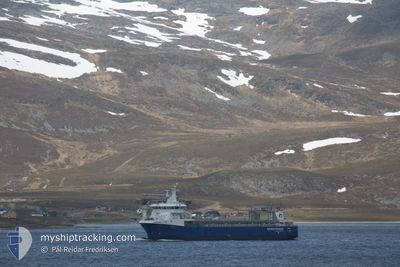
The vessel RUBIN (IMO: 9674036, MMSI: 257421000) is a General Cargo that was built in 2014 ( 11 years old ). It's sailing under the flag of [NO] Norway.
In this page you can find informations about the vessels current position, last detected port calls, and current voyage information. If the vessels is not in coverage by AIS you will find the latest position.
The current position of RUBIN is detected by our AIS receivers and we are not responsible for the reliability of the data. The last position was recorded while the vessel was in Coverage by the Ais receivers of our vessel tracking app.
The current draught of RUBIN as reported by AIS is 5 meters
Weather
| Temperature | -6.9°C / 19.58°F |
|---|---|
| Wind Speed | 4 knots |
| Direction | 122° ESE |
| Pressure | 1011.8 hPa |
| Humidity | 72 % |
| Cloud Coverage | 100 % |


Featured Company
Last Port Calls
| Port | Arrival | Departure | Time In Port |
|---|---|---|---|
| 2025-03-20 23:23 | 2025-03-21 23:04 | 23 h | |
| 2025-03-16 19:22 | 2025-03-18 09:28 | 1 d | |
| 2025-03-15 14:02 | 2025-03-16 00:37 | 10 h | |
| 2025-03-14 00:48 | 2025-03-14 01:38 | 49 m | |
| 2025-03-11 08:55 | 2025-03-13 11:22 | 2 d | |
| 2025-03-03 10:05 | 2025-03-04 13:08 | 1 d | |
| 2025-03-01 07:52 | 2025-03-02 09:26 | 1 d | |
| 2025-02-28 14:20 | 2025-02-28 14:34 | 14 m | |
| 2025-02-27 12:57 | 2025-02-27 14:23 | 1 h | |
| 2025-02-25 07:56 | 2025-02-25 15:15 | 7 h |
Last Trips
| Origin | Departure | Destination | Arrival | Distance | |
|---|---|---|---|---|---|
| 2025-03-18 09:28 | 2025-03-20 23:23 | 538.07 nm | |||
| 2025-03-16 00:37 | 2025-03-16 19:22 | 89.86 nm | |||
| 2025-03-14 01:38 | 2025-03-15 14:02 | 251.69 nm | |||
| 2025-03-13 11:22 | 2025-03-14 00:48 | 108.69 nm | |||
| 2025-03-04 13:08 | 2025-03-11 08:55 | 1237.98 nm | |||
| 2025-03-02 09:26 | 2025-03-03 10:05 | 21.42 nm | |||
| 2025-02-28 14:34 | 2025-03-01 07:52 | 128.55 nm | |||
| 2025-02-27 14:23 | 2025-02-28 14:20 | 212.21 nm | |||
| 2025-02-25 15:15 | 2025-02-27 12:57 | 263.24 nm | |||
| 2025-02-24 17:14 | 2025-02-25 07:56 | 90.08 nm |
Events
| Time | Event | Details | Position / Dest | Info |
|---|---|---|---|---|
| 2025-03-22 20:15 | ETA Changed | 2025/03/21 12:34 |
69.64110 / 18.95879
FISHFARMS
|
Speed: 10.2 kn Course: 216.8° |
| 2025-03-22 19:57 | ETA Changed | 2025/03/21 12:34 |
69.68431 / 19.02436
FISHFARMS
|
Speed: 9.4 kn Course: 201° |
| 2025-03-22 19:33 | ETA Changed | 2025/03/21 12:34 |
69.74354 / 19.10117
FISHFARMS
|
Speed: 9.2 kn Course: 221° |
| 2025-03-22 19:21 | ETA Changed | 2025/03/21 12:34 |
69.76579 / 19.16482
FISHFARMS
|
Speed: 9.3 kn Course: 230° |
| 2025-03-22 14:44 | START Moving |
70.12997 / 20.78834
FISHFARMS
|
Speed: 5.7 kn Course: 227° |
|
| 2025-03-22 14:08 | STOP Moving |
70.13162 / 20.79230
FISHFARMS
|
Speed: 0.1 kn Course: 201° |
|
| 2025-03-22 11:26 | Status Changed | Under way using engine Default |
69.96904 / 21.75150
FISHFARMS
|
Speed: 9.8 kn Course: 280° |
| 2025-03-22 11:11 | START Moving | 19.75 nm, South West of OKSFJORD |
69.95818 / 21.86298
FISHFARMS
|
Speed: 9.8 kn Course: 280° |
| 2025-03-22 11:11 | IN Coverage |
69.96904 / 21.75150
Norwegian Sea
|
Speed: 10.2 kn Course: 297.6° |
|
| 2025-03-22 10:08 | OUT of Coverage |
69.95506 / 21.88340
Norwegian Sea
|
Speed: Course: 160.6° |