
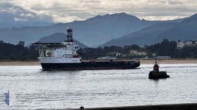
RS ALEGRANZA
Multi Purpose Offshore Vessel
Current Trip
SANTANDER
| Time Travelled | 3 days |
|---|---|
| Remaining Time | --- |
| Distance Travelled | 151.01 nm |
| Remaining Distance | --- |
| AVG Speed | 7 Knots |
| MAX Speed | 12.7 Knots |
| AVG Wind | 8.6 knots |
| MAX Wind | 16 knots |
| MIN Temp | 9.2°C / 48.56°F |
| MAX Temp | 18.1°C / 64.58°F |
| Draught | 4.7 m |
| Position Received | 2 h, 53 m ago |
Current Position
| Longitude | --- |
|---|---|
| Latitude | --- |
| Status | Under way using engine |
| Speed | 0.3 Knots |
| Course | 217° |
| Area | Bay of Biscay |
| Station | T-AIS |
| Position Received | 2 h, 53 m ago |
Info
Information
The current position of RS ALEGRANZA is in Bay of Biscay with coordinates 43.66067° / -3.69750° as reported on 2025-03-11 19:31 by AIS to our vessel tracker app. The vessel's current speed is 0.3 Knots
The vessel RS ALEGRANZA (IMO: 9282144, MMSI: 255915965) is a Multi Purpose Offshore Vessel that was built in 2006 ( 19 years old ). It's sailing under the flag of [PT] Portugal.
In this page you can find informations about the vessels current position, last detected port calls, and current voyage information. If the vessels is not in coverage by AIS you will find the latest position.
The current position of RS ALEGRANZA is detected by our AIS receivers and we are not responsible for the reliability of the data. The last position was recorded while the vessel was in Coverage by the Ais receivers of our vessel tracking app.
The current draught of RS ALEGRANZA as reported by AIS is 4.7 meters
Weather
| Temperature | 12.4°C / 54.32°F |
|---|---|
| Wind Speed | 7 knots |
| Direction | 316° NW |
| Pressure | 1003.5 hPa |
| Humidity | 78.6 % |
| Cloud Coverage | 12 % |
Featured Company
Last Port Calls
| Port | Arrival | Departure | Time In Port |
|---|---|---|---|
| 2025-03-07 17:57 | 2025-03-08 11:18 | 17 h | |
| 2025-03-06 09:43 |
Most Visited Ports (Last year)
| Port | Arrivals | |
|---|---|---|
| 2 | ||
| 1 |
Last Trips
| Origin | Departure | Destination | Arrival | Distance | |
|---|---|---|---|---|---|
| 2025-03-06 09:43 | 2025-03-07 17:57 | 69.66 nm |
Events
| Time | Event | Details | Position / Dest | Info |
|---|---|---|---|---|
| 2025-03-11 19:31 | OUT of Coverage |
43.66067 / -3.69750
Bay of Biscay
|
Speed: 0.3 kn Course: 177.5° |
|
| 2025-03-11 19:22 | STOP Moving | 13.13 nm, North of SANTANDER |
43.66089 / -3.69723
SANTANDER
|
Speed: 0.2 kn Course: 41° |
| 2025-03-11 17:08 | IN Coverage |
43.64829 / -3.69420
Bay of Biscay
|
Speed: 9.1 kn Course: 175.3° |
|
| 2025-03-11 14:19 | OUT of Coverage |
43.65740 / -3.69919
Bay of Biscay
|
Speed: 1.7 kn Course: 45.2° |
|
| 2025-03-11 13:51 | IN Coverage |
43.63948 / -3.70951
Bay of Biscay
|
Speed: 7.5 kn Course: 188.5° |
|
| 2025-03-11 12:04 | OUT of Coverage |
43.65932 / -3.69902
Bay of Biscay
|
Speed: 0.5 kn Course: 183.3° |
|
| 2025-03-11 12:02 | STOP Moving | 13.02 nm, North of SANTANDER |
43.65949 / -3.69908
SANTANDER
|
Speed: 0.3 kn Course: 183° |
| 2025-03-11 09:25 | START Moving | 3.45 nm, North East of SANTANDER |
43.50382 / -3.75851
SANTANDER
|
Speed: 3.1 kn Course: 65° |
| 2025-03-11 07:14 | STOP Moving | 3.1 nm, North East of SANTANDER |
43.49799 / -3.76113
SANTANDER
|
Speed: 0.3 kn Course: 43° |
| 2025-03-11 06:59 | START Moving | 2.21 nm, North East of SANTANDER |
43.48295 / -3.76791
SANTANDER
|
Speed: 4.4 kn Course: 10° |