
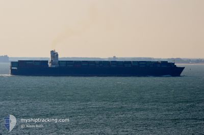
ROTTERDAM
Container Ship
Current Trip
| Time Travelled | 3 days |
|---|---|
| Remaining Time | 2 days |
| Distance Travelled | 1244.05 nm |
| Remaining Distance | 1175.20 nm |
| AVG Speed | 15.7 Knots |
| MAX Speed | 21 Knots |
| AVG Wind | 6.9 knots |
| MAX Wind | 12 knots |
| MIN Temp | 29.1°C / 84.38°F |
| MAX Temp | 30.6°C / 87.08°F |
| Draught | 9.4 m |
| Position Received | 2 d ago |
Current Position
| Longitude | 104.42720° |
|---|---|
| Latitude | 1.37398° |
| Status | Under way using engine |
| Speed | 17 Knots |
| Course | 40° |
| Area | South China Sea |
| Station | T-AIS |
| Position Received | 2 d ago |
Info
Information
The current position of ROTTERDAM is in South China Sea with coordinates 1.37398° / 104.42720° as reported on 2024-04-30 18:22 by AIS to our vessel tracker app. The vessel's current speed is 17 Knots and is heading at the port of SHANGHAI. The estimated time of arrival as calculated by MyShipTracking vessel tracking app is 2024-05-05 15:04 LT
The vessel ROTTERDAM (IMO: 9398450, MMSI: 636014222) is a Container Ship that was built in 2010 ( 14 years old ). It's sailing under the flag of [LR] Liberia.
In this page you can find informations about the vessels current position, last detected port calls, and current voyage information. If the vessels is not in coverage by AIS you will find the latest position.
The current position of ROTTERDAM is detected by our AIS receivers and we are not responsible for the reliability of the data. The last position was recorded while the vessel was in Coverage by the Ais receivers of our vessel tracking app.
The current draught of ROTTERDAM as reported by AIS is 9.4 meters
Weather
| Temperature | 29.9°C / 85.82°F |
|---|---|
| Wind Speed | 8 knots |
| Direction | 111° ESE |
| Pressure | 1009.5 hPa |
| Humidity | 73.7 % |
| Cloud Coverage | 8 % |
Featured Company
Last Port Calls
| Port | Arrival | Departure | Time In Port |
|---|---|---|---|
| 2024-04-28 19:54 | 2024-04-30 02:32 | 1 d | |
| 2024-04-24 06:12 | 2024-04-25 02:20 | 20 h | |
| 2024-04-21 02:37 | |||
| 2024-04-12 08:58 | 2024-04-13 15:26 | 1 d | |
| 2024-04-05 20:31 | 2024-04-06 12:09 | 15 h | |
| 2024-03-29 00:44 | 2024-03-29 15:37 | 14 h | |
| 2024-03-26 05:45 | 2024-03-26 21:32 | 15 h | |
| 2024-03-21 16:23 | 2024-03-22 15:00 | 22 h | |
| 2024-03-14 13:57 | 2024-03-15 11:35 | 21 h | |
| 2024-03-10 22:14 | 2024-03-11 18:15 | 20 h |
Most Visited Ports (Last year)
| Port | Arrivals | |
|---|---|---|
| 5 | ||
| 4 | ||
| 4 | ||
| 3 | ||
| 3 | ||
| 3 |
Last Trips
| Origin | Departure | Destination | Arrival | Distance | |
|---|---|---|---|---|---|
| 2024-04-25 07:50 | 2024-04-29 03:54 | 1436.18 nm | |||
| 2024-04-21 08:07 | 2024-04-24 11:42 | 1245.17 nm | |||
| 2024-04-06 20:09 | 2024-04-12 14:28 | 2298.14 nm | |||
| 2024-03-29 23:37 | 2024-04-06 04:31 | 1675.54 nm | |||
| 2024-03-27 05:32 | 2024-03-29 08:44 | 792.29 nm | |||
| 2024-03-22 23:00 | 2024-03-26 13:45 | 363.41 nm | |||
| 2024-03-15 20:35 | 2024-03-22 00:23 | 801.24 nm | |||
| 2024-03-12 02:15 | 2024-03-14 22:57 | 1168.28 nm | |||
| 2024-03-07 12:20 | 2024-03-11 06:14 | 1458.65 nm | |||
| 2024-03-04 12:56 | 2024-03-05 18:45 | 194.07 nm |
Events
| Time | Event | Details | Position / Dest | Info |
|---|---|---|---|---|
| 2024-04-30 18:28 | Status Changed | Default Under way using engine |
1.39713 / 104.44735
CNSHA
|
Speed: 17 kn Course: 40° |
| 2024-04-30 18:22 | OUT of Coverage |
1.37398 / 104.42720
South China Sea
CNSHA
|
Speed: 17 kn Course: 40° |
|
| 2024-04-30 18:04 | Change Sea Area | Malaysian part of the South China Sea Malaysian part of the Singapore Strait |
1.31327 / 104.37347
South China Sea
CNSHA
|
Speed: 16.5 kn Course: 44° |
| 2024-04-30 17:07 | Change Sea Area | Malaysian part of the Singapore Strait Indonesian part of the Singapore Strait |
1.26415 / 104.13720
Singapore Strait
CNSHA
|
Speed: 15.5 kn Course: 85° |
| 2024-04-30 15:37 | Change Sea Area | Indonesian part of the Singapore Strait Singaporean part of the Singapore Strait |
1.17565 / 103.81503
Singapore Strait
CNSHA
|
Speed: 8.3 kn Course: 71° |
| 2024-04-30 15:31 | Change Sea Area | Singaporean part of the Singapore Strait Indonesian part of the Singapore Strait |
1.16773 / 103.79910
Singapore Strait
CNSHA
|
Speed: 12.9 kn Course: 49° |
| 2024-04-30 13:37 | Change Sea Area | Indonesian part of the Singapore Strait Indonesian part of the Malacca Strait |
1.17467 / 103.42028
Singapore Strait
CNSHA
|
Speed: 15.2 kn Course: 121° |
| 2024-04-30 13:29 | Draught Changed | 9.4 12.6 |
1.19283 / 103.39130
CNSHA
|
Speed: 15.2 kn Course: 122° |
| 2024-04-30 13:29 | Destination Changed | CNSHA COLOMBO |
1.19283 / 103.39130
CNSHA
|
Speed: 15.2 kn Course: 122° |
| 2024-04-30 13:29 | ETA Changed | 2024/05/06 10:00 2024/04/24 05:30 |
1.19283 / 103.39130
CNSHA
|
Speed: 15.2 kn Course: 122° |