
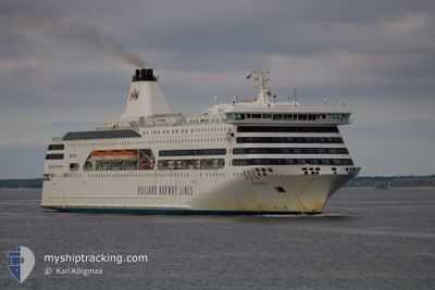
ROMANTIKA
Ro-Ro/Passenger Ship
Current Trip
| Time Travelled | 7 h, 26 mins |
|---|---|
| Remaining Time | 3 h, 18 mins |
| Distance Travelled | 103.99 nm |
| Remaining Distance | 88.14 nm |
| AVG Speed | 14.8 Knots |
| MAX Speed | 15.6 Knots |
| AVG Wind | 10.9 knots |
| MAX Wind | 15.3 knots |
| MIN Temp | 14.7°C / 58.46°F |
| MAX Temp | 17.6°C / 63.68°F |
| Draught | 6.4 m |
| Position Received | 3 h, 22 m ago |
Current Position
| Longitude | --- |
|---|---|
| Latitude | --- |
| Status | Under way using engine |
| Speed | 15.2 Knots |
| Course | 183.7° |
| Area | Mediterranean Sea - Western Basin |
| Station | T-AIS |
| Position Received | 3 h, 22 m ago |
Info
Information
The current position of ROMANTIKA is in Mediterranean Sea - Western Basin with coordinates 37.37128° / -0.39391° as reported on 2025-12-05 23:29 by AIS to our vessel tracker app. The vessel's current speed is 15.2 Knots and is heading at the port of ORAN. The estimated time of arrival as calculated by MyShipTracking vessel tracking app is 2025-12-06 07:10 LT
The vessel ROMANTIKA (IMO: 9237589, MMSI: 275304000) is a Ro-Ro/Passenger Ship that was built in 2002 ( 23 years old ). It's sailing under the flag of [LV] Latvia.
In this page you can find informations about the vessels current position, last detected port calls, and current voyage information. If the vessels is not in coverage by AIS you will find the latest position.
The current position of ROMANTIKA is detected by our AIS receivers and we are not responsible for the reliability of the data. The last position was recorded while the vessel was in Coverage by the Ais receivers of our vessel tracking app.
The current draught of ROMANTIKA as reported by AIS is 6.4 meters
Weather
| Temperature | 17.1°C / 62.78°F |
|---|---|
| Wind Speed | 11 knots |
| Direction | 236° SW |
| Pressure | 1021.4 hPa |
| Humidity | 90.6 % |
| Cloud Coverage | 3 % |
Featured Company
Last Port Calls
| Port | Arrival | Departure | Time In Port |
|---|---|---|---|
| 2025-12-05 13:35 | 2025-12-05 20:26 | 6 h | |
| 2025-12-02 07:27 | 2025-12-02 13:14 | 5 h | |
| 2025-12-01 07:22 | 2025-12-01 19:09 | 11 h | |
| 2025-11-30 07:43 | 2025-11-30 14:47 | 7 h | |
| 2025-11-29 07:29 | 2025-11-29 20:23 | 12 h | |
| 2025-11-28 11:38 | 2025-11-28 20:47 | 9 h | |
| 2025-11-25 08:14 | 2025-11-25 12:39 | 4 h | |
| 2025-11-24 07:25 | 2025-11-24 18:28 | 11 h | |
| 2025-11-23 09:14 | 2025-11-23 14:27 | 5 h | |
| 2025-11-22 08:12 | 2025-11-22 22:09 | 13 h |
Last Trips
| Origin | Departure | Destination | Arrival | Distance | |
|---|---|---|---|---|---|
| 2025-12-02 13:14 | 2025-12-05 13:35 | 43.58 nm | |||
| 2025-12-01 19:09 | 2025-12-02 07:27 | 197.68 nm | |||
| 2025-11-30 14:47 | 2025-12-01 07:22 | 198.08 nm | |||
| 2025-11-29 20:23 | 2025-11-30 07:43 | 160.17 nm | |||
| 2025-11-28 20:47 | 2025-11-29 07:29 | 159.74 nm | |||
| 2025-11-25 12:39 | 2025-11-28 11:38 | 29.12 nm | |||
| 2025-11-24 18:28 | 2025-11-25 08:14 | 198.23 nm | |||
| 2025-11-23 14:27 | 2025-11-24 07:25 | 197.96 nm | |||
| 2025-11-22 22:09 | 2025-11-23 09:14 | 158.80 nm | |||
| 2025-11-21 19:30 | 2025-11-22 08:12 | 161.07 nm |
Events
| Time | Event | Details | Position / Dest | Info |
|---|---|---|---|---|
| 2025-12-05 23:35 | Status Changed | Default Under way using engine |
37.34797 / -.39546
DZORN
|
Speed: 15.2 kn Course: 183.7° |
| 2025-12-05 23:29 | Status Changed | Under way using engine Default |
37.37128 / -.39391
DZORN
|
Speed: 15.1 kn Course: 182° |
| 2025-12-05 23:29 | OUT of Coverage |
37.37128 / -.39391
Mediterranean Sea - Western Basin
DZORN
|
Speed: 15.2 kn Course: 183.7° |
|
| 2025-12-05 23:27 | Status Changed | Default Under way using engine |
37.38176 / -.39323
DZORN
|
Speed: 15.1 kn Course: 183.2° |
| 2025-12-05 19:43 | Draught Changed | 6.4 6 |
38.27573 / -.45442
DZORN
|
Speed: 13.7 kn Course: 136.5° |
| 2025-12-05 19:43 | ETA Changed | 2025/12/06 06:15 |
38.27573 / -.45442
DZORN
|
Speed: 13.7 kn Course: 136.5° |
| 2025-12-05 19:40 | Status Changed | Under way using engine Default |
38.28384 / -.46439
DZORN
|
Speed: 13.6 kn Course: 135° |
| 2025-12-05 19:35 | IN Coverage |
38.28125 / -.46110
Mediterranean Sea - Western Basin
|
Speed: 13.8 kn Course: 135.2° |
|
| 2025-12-05 19:26 | PORT DEPARTURE |
|
38.31313 / -.49660
DZORN
|
Speed: 7.4 kn Course: 175° |
| 2025-12-05 19:23 | START Moving |
38.31941 / -.49784
[ES] ALICANTE
|
Speed: 7.4 kn Course: 175° |