
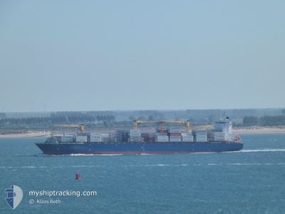
ROBIN 2
Container Ship
Current Trip
| Time Travelled | 1 day |
|---|---|
| Remaining Time | 3 days |
| Distance Travelled | 224.72 nm |
| Remaining Distance | 1518.04 nm |
| AVG Speed | 13.7 Knots |
| MAX Speed | 18.7 Knots |
| AVG Wind | 9.6 knots |
| MAX Wind | 14 knots |
| MIN Temp | 13.2°C / 55.76°F |
| MAX Temp | 25.4°C / 77.72°F |
| Draught | 8.7 m |
| Position Received | 15 h, 56 m ago |
Current Position
| Longitude | -74.66052° |
|---|---|
| Latitude | 36.38077° |
| Status | Under way using engine |
| Speed | 14.5 Knots |
| Course | 179.9° |
| Area | North Atlantic Ocean |
| Station | T-AIS |
| Position Received | 15 h, 56 m ago |
Info
Information
The current position of ROBIN 2 is in North Atlantic Ocean with coordinates 36.38077° / -74.66052° as reported on 2024-04-29 12:59 by AIS to our vessel tracker app. The vessel's current speed is 14.5 Knots and is heading at the port of SANTA MARTA. The estimated time of arrival as calculated by MyShipTracking vessel tracking app is 2024-05-03 16:59 LT
The vessel ROBIN 2 (IMO: 9399739, MMSI: 636020353) is a Container Ship that was built in 2007 ( 17 years old ). It's sailing under the flag of [LR] Liberia.
In this page you can find informations about the vessels current position, last detected port calls, and current voyage information. If the vessels is not in coverage by AIS you will find the latest position.
The current position of ROBIN 2 is detected by our AIS receivers and we are not responsible for the reliability of the data. The last position was recorded while the vessel was in Coverage by the Ais receivers of our vessel tracking app.
The current draught of ROBIN 2 as reported by AIS is 8.7 meters
Weather
| Temperature | 21.3°C / 70.34°F |
|---|---|
| Wind Speed | 16 knots |
| Direction | 258° WSW |
| Pressure | 1020.8 hPa |
| Humidity | 76.6 % |
| Cloud Coverage | --- |
Featured Company
Last Port Calls
| Port | Arrival | Departure | Time In Port |
|---|---|---|---|
| 2024-04-28 03:18 | 2024-04-28 22:06 | 18 h | |
| 2024-04-23 07:18 | 2024-04-23 10:14 | 2 h | |
| 2024-04-20 00:42 | 2024-04-20 12:34 | 11 h | |
| 2024-04-14 04:34 | 2024-04-15 00:18 | 19 h | |
| 2024-04-09 08:49 | 2024-04-09 14:27 | 5 h | |
| 2024-04-06 00:04 | 2024-04-06 11:24 | 11 h | |
| 2024-03-31 04:30 | 2024-03-31 21:09 | 16 h | |
| 2024-03-26 13:10 | 2024-03-27 00:47 | 11 h | |
| 2024-03-25 16:32 | 2024-03-26 00:19 | 7 h | |
| 2024-03-23 03:55 | 2024-03-23 16:49 | 12 h |
Most Visited Ports (Last year)
| Port | Arrivals | |
|---|---|---|
| 9 | ||
| 9 | ||
| 9 | ||
| 4 | ||
| 3 | ||
| 3 |
Last Trips
| Origin | Departure | Destination | Arrival | Distance | |
|---|---|---|---|---|---|
| 2024-04-23 04:14 | 2024-04-27 23:18 | 1760.11 nm | |||
| 2024-04-20 07:34 | 2024-04-23 01:18 | 929.55 nm | |||
| 2024-04-14 20:18 | 2024-04-19 19:42 | 1730.25 nm | |||
| 2024-04-09 08:27 | 2024-04-14 00:34 | 1760.37 nm | |||
| 2024-04-06 06:24 | 2024-04-09 02:49 | 928.05 nm | |||
| 2024-03-31 17:09 | 2024-04-05 19:04 | 1732.48 nm | |||
| 2024-03-26 18:47 | 2024-03-31 00:30 | 1751.59 nm | |||
| 2024-03-25 18:19 | 2024-03-26 07:10 | 150.02 nm | |||
| 2024-03-23 11:49 | 2024-03-25 10:32 | 756.96 nm | |||
| 2024-03-17 23:17 | 2024-03-22 22:55 | 1720.49 nm |
Events
| Time | Event | Details | Position / Dest | Info |
|---|---|---|---|---|
| 2024-04-29 13:14 | Status Changed | Default Under way using engine |
36.31813 / -74.66094
COSMR
|
Speed: 14.5 kn Course: 179.9° |
| 2024-04-29 12:59 | OUT of Coverage |
36.38077 / -74.66052
North Atlantic Ocean
COSMR
|
Speed: 14.5 kn Course: 179.9° |
|
| 2024-04-29 11:32 | IN Coverage |
36.73768 / -74.65799
North Atlantic Ocean
COSMR
|
Speed: 15.9 kn Course: 180.1° |
|
| 2024-04-29 04:42 | Status Changed | Default Under way using engine |
38.47113 / -74.75780
COSMR
|
Speed: 15.2 kn Course: 146.1° |
| 2024-04-29 04:35 | OUT of Coverage |
38.49644 / -74.77965
North Atlantic Ocean
COSMR
|
Speed: 15.2 kn Course: 146.1° |
|
| 2024-04-29 03:12 | Status Changed | Under way using engine Default |
38.70829 / -74.96387
COSMR
|
Speed: 9.7 kn Course: 146° |
| 2024-04-29 03:10 | Status Changed | Default Under way using engine |
38.71124 / -74.96650
COSMR
|
Speed: 9.7 kn Course: 145.7° |
| 2024-04-29 03:10 | Status Changed | Under way using engine Default |
38.71198 / -74.96714
COSMR
|
Speed: 9.5 kn Course: 136° |
| 2024-04-29 02:58 | Status Changed | Default Under way using engine |
38.73558 / -74.99379
COSMR
|
Speed: 10 kn Course: 134.4° |
| 2024-04-29 02:24 | Status Changed | Under way using engine Default |
38.80966 / -75.06389
COSMR
|
Speed: 9.3 kn Course: 148° |