
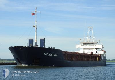
RIX MISTRAL
General Cargo
Current Trip
| Time Travelled | 17 h, 16 mins |
|---|---|
| Remaining Time | --- |
| Distance Travelled | 120.26 nm |
| Remaining Distance | --- |
| AVG Speed | 8.4 Knots |
| MAX Speed | 9.4 Knots |
| AVG Wind | 15.3 knots |
| MAX Wind | 24.7 knots |
| MIN Temp | -0.7°C / 30.74°F |
| MAX Temp | 6.3°C / 43.34°F |
| Draught | 5.4 m |
| Position Received | 14 h, 1 m ago |
Current Position
| Longitude | --- |
|---|---|
| Latitude | --- |
| Status | Under way using engine |
| Speed | 7.9 Knots |
| Course | 256.7° |
| Area | Gulf of Riga |
| Station | T-AIS |
| Position Received | 14 h, 1 m ago |
Info
Information
The current position of RIX MISTRAL is in Gulf of Riga with coordinates 58.00023° / 23.98996° as reported on 2025-12-13 19:19 by AIS to our vessel tracker app. The vessel's current speed is 7.9 Knots and is heading at the port of KOLDING. The estimated time of arrival as calculated by MyShipTracking vessel tracking app is 2025-12-16 19:00 LT
The vessel RIX MISTRAL (IMO: 9173513, MMSI: 212503000) is a General Cargo that was built in 1997 ( 28 years old ). It's sailing under the flag of [CY] Cyprus.
In this page you can find informations about the vessels current position, last detected port calls, and current voyage information. If the vessels is not in coverage by AIS you will find the latest position.
The current position of RIX MISTRAL is detected by our AIS receivers and we are not responsible for the reliability of the data. The last position was recorded while the vessel was in Coverage by the Ais receivers of our vessel tracking app.
The current draught of RIX MISTRAL as reported by AIS is 5.4 meters
Weather
| Temperature | 6.7°C / 44.06°F |
|---|---|
| Wind Speed | 12 knots |
| Direction | 240° WSW |
| Pressure | 1014.3 hPa |
| Humidity | 85.9 % |
| Cloud Coverage | 100 % |
Featured Company
Last Port Calls
| Port | Arrival | Departure | Time In Port |
|---|---|---|---|
| 2025-12-13 06:20 | 2025-12-13 18:05 | 11 h | |
| 2025-12-09 23:14 | 2025-12-11 13:22 | 1 d | |
| 2025-12-01 15:11 | 2025-12-02 22:27 | 1 d | |
| 2025-11-30 01:37 | 2025-11-30 04:41 | 3 h | |
| 2025-11-29 09:52 | 2025-11-29 20:40 | 10 h | |
| 2025-11-22 14:40 | 2025-11-24 15:09 | 2 d | |
| 2025-11-19 21:59 | 2025-11-20 16:41 | 18 h | |
| 2025-11-15 11:02 | 2025-11-19 09:56 | 3 d | |
| 2025-11-11 09:32 | 2025-11-14 15:22 | 3 d | |
| 2025-11-09 10:17 | 2025-11-10 18:07 | 1 d |
Last Trips
| Origin | Departure | Destination | Arrival | Distance | |
|---|---|---|---|---|---|
| 2025-12-11 13:22 | 2025-12-13 06:20 | 364.90 nm | |||
| 2025-12-02 22:27 | 2025-12-09 23:14 | 859.76 nm | |||
| 2025-11-30 04:41 | 2025-12-01 15:11 | 273.39 nm | |||
| 2025-11-29 20:40 | 2025-11-30 01:37 | 38.13 nm | |||
| 2025-11-24 15:09 | 2025-11-29 09:52 | 497.02 nm | |||
| 2025-11-20 16:41 | 2025-11-22 14:40 | 446.34 nm | |||
| 2025-11-19 09:56 | 2025-11-19 21:59 | 115.86 nm | |||
| 2025-11-14 15:22 | 2025-11-15 11:02 | 165.11 nm | |||
| 2025-11-10 18:07 | 2025-11-11 09:32 | 141.05 nm | |||
| 2025-11-08 14:22 | 2025-11-09 10:17 | 183.14 nm |
Events
| Time | Event | Details | Position / Dest | Info |
|---|---|---|---|---|
| 2025-12-13 19:19 | OUT of Coverage |
58.00023 / 23.98996
Gulf of Riga
DKKOL
|
Speed: 7.9 kn Course: 256.7° |
|
| 2025-12-13 16:25 | Draught Changed | 5.4 5.5 |
58.34946 / 24.44121
DKKOL
|
Speed: 7.6 kn Course: 203.1° |
| 2025-12-13 16:19 | Draught Changed | 5.5 3.6 |
58.35962 / 24.45103
DKKOL
|
Speed: 7.5 kn Course: 217.6° |
| 2025-12-13 16:19 | Destination Changed | DKKOL EEPAR |
58.35962 / 24.45103
DKKOL
|
Speed: 7.5 kn Course: 217.6° |
| 2025-12-13 16:19 | ETA Changed | 2025/12/16 18:00 2025/12/13 04:00 |
58.35962 / 24.45103
DKKOL
|
Speed: 7.5 kn Course: 217.6° |
| 2025-12-13 16:10 | IN Coverage |
58.37273 / 24.47095
Gulf of Riga
|
Speed: 6.7 kn Course: 212.8° |
|
| 2025-12-13 16:05 | PORT DEPARTURE |
|
58.37434 / 24.47264
EEPAR
|
Speed: Course: 10° |
| 2025-12-13 13:53 | OUT of Coverage |
58.38289 / 24.47836
Gulf of Riga
[EE] PARNU
|
Speed: Course: 329.5° |
|
| 2025-12-13 12:35 | IN Coverage |
58.38289 / 24.47834
Gulf of Riga
[EE] PARNU
|
Speed: Course: 329.5° |
|
| 2025-12-13 09:26 | OUT of Coverage |
58.38290 / 24.47835
Gulf of Riga
[EE] PARNU
|
Speed: Course: 329.5° |