

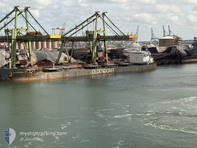
RICHARD OLDENDORFF
Bulk Carrier

Current Trip
| Trip Time | 8 days |
|---|---|
| Trip Distance | 1108.34 nm |
| AVG Speed | 11.1 Knots |
| MAX Speed | 13.9 Knots |
| Draught | 7.7 m |
| AVG Wind | 7.4 knots |
| MAX Wind | 20.5 knots |
| MIN Temp | -12.1°C / 10.22°F |
| MAX Temp | 7.3°C / 45.14°F |
| Position Received | 4 m ago |
Current Position
| Longitude | --- |
|---|---|
| Latitude | --- |
| Status | Moored |
| Speed | |
| Course | 245° |
| Area | Norwegian Sea |
| Station | T-AIS |
| Position Received | 4 m ago |
Information
The current position of RICHARD OLDENDORFF is in Norwegian Sea with coordinates 68.43055° / 17.40252° as reported on 2025-02-20 08:56 by AIS to our vessel tracker app. The vessel's current speed is 0 Knots and is currently inside the port of NARVIK.
The vessel RICHARD OLDENDORFF (IMO: 9462366, MMSI: 636092750) is a Bulk Carrier that was built in 2011 ( 14 years old ). It's sailing under the flag of [LR] Liberia.
In this page you can find informations about the vessels current position, last detected port calls, and current voyage information. If the vessels is not in coverage by AIS you will find the latest position.
The current position of RICHARD OLDENDORFF is detected by our AIS receivers and we are not responsible for the reliability of the data. The last position was recorded while the vessel was in Coverage by the Ais receivers of our vessel tracking app.
The current draught of RICHARD OLDENDORFF as reported by AIS is 7.7 meters
Weather
| Temperature | -2.5°C / 27.5°F |
|---|---|
| Wind Speed | 5 knots |
| Direction | 225° SW |
| Pressure | 1014.5 hPa |
| Humidity | 95.6 % |
| Cloud Coverage | 100 % |


Featured Company
Last Port Calls
| Port | Arrival | Departure | Time In Port |
|---|---|---|---|
| 2025-02-17 11:41 | |||
| 2025-02-04 22:05 | 2025-02-08 13:19 | 3 d | |
| 2025-01-26 08:36 | 2025-01-26 23:51 | 15 h | |
| 2025-01-20 16:50 | 2025-01-23 11:09 | 2 d | |
| 2024-12-02 07:52 | 2024-12-17 19:33 | 15 d |
Most Visited Ports (Last year)
| Port | Arrivals | |
|---|---|---|
| 1 | ||
| 1 | ||
| 1 | ||
| 1 | ||
| 1 | ||
| 1 |
Last Trips
| Origin | Departure | Destination | Arrival | Distance | |
|---|---|---|---|---|---|
| 2025-02-08 13:19 | 2025-02-17 12:41 | 1108.34 nm | |||
| 2025-01-26 23:51 | 2025-02-04 22:05 | 1995.63 nm | |||
| 2025-01-23 11:09 | 2025-01-26 08:36 | 496.09 nm | |||
| 2024-12-18 01:03 | 2025-01-20 16:50 | 9454.68 nm | |||
| 2024-11-26 23:50 | 2024-12-02 13:22 | 249.54 nm |
Events
| Time | Event | Details | Position / Dest | Info |
|---|---|---|---|---|
| 2025-02-17 12:21 | Status Changed | Moored Under way using engine |
68.43049 / 17.40247
[NO] NARVIK
|
Speed: 0.4 kn Course: 247° |
| 2025-02-17 12:11 | STOP Moving |
68.42941 / 17.40582
[NO] NARVIK
|
Speed: 0.2 kn Course: 266° |
|
| 2025-02-17 11:41 | PORT ARRIVAL |
|
68.42673 / 17.38218
[NO] NARVIK
|
Speed: 4.7 kn Course: 112° |
| 2025-02-17 11:29 | START Moving | 1.49 nm, North West of NARVIK |
68.43940 / 17.35924
NONVK
|
Speed: 4.3 kn Course: 174° |
| 2025-02-17 11:23 | Status Changed | Under way using engine At anchor |
68.44298 / 17.36129
NONVK
|
Speed: 0.3 kn Course: 207° |
| 2025-02-16 12:15 | Status Changed | At anchor Default |
68.44448 / 17.36552
NONVK
|
Speed: Course: 218° |
| 2025-02-16 12:12 | Status Changed | Default At anchor |
68.44447 / 17.36552
NONVK
|
Speed: Course: 217° |
| 2025-02-14 18:21 | Draught Changed | 7.7 12.2 |
68.44467 / 17.35765
NONVK
|
Speed: Course: 161° |
| 2025-02-14 18:21 | Destination Changed | NONVK GBIMM |
68.44467 / 17.35765
NONVK
|
Speed: Course: 161° |
| 2025-02-14 18:21 | ETA Changed | 2025/02/12 13:00 2025/02/04 17:45 |
68.44467 / 17.35765
NONVK
|
Speed: Course: 161° |