

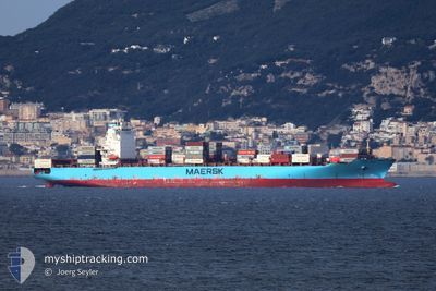
RHINE MAERSK
Container Ship

Current Trip
MA PTM2
| Time Travelled | 4 days |
|---|---|
| Remaining Time | --- |
| Distance Travelled | 908.38 nm |
| Remaining Distance | --- |
| AVG Speed | 10.4 Knots |
| MAX Speed | 14.3 Knots |
| AVG Wind | 10 knots |
| MAX Wind | 15.8 knots |
| MIN Temp | 12.1°C / 53.78°F |
| MAX Temp | 17.2°C / 62.96°F |
| Draught | 9.4 m |
| Position Received | 1 m ago |
Current Position
| Longitude | --- |
|---|---|
| Latitude | --- |
| Status | Under way using engine |
| Speed | 8.9 Knots |
| Course | 287.6° |
| Area | Alboran Sea |
| Station | T-AIS |
| Position Received | 1 m ago |
Information
The current position of RHINE MAERSK is in Alboran Sea with coordinates 35.89278° / -4.64611° as reported on 2025-03-28 04:12 by AIS to our vessel tracker app. The vessel's current speed is 8.9 Knots
The vessel RHINE MAERSK (IMO: 9456991, MMSI: 219126000) is a Container Ship that was built in 2012 ( 13 years old ). It's sailing under the flag of [DK] Denmark.
In this page you can find informations about the vessels current position, last detected port calls, and current voyage information. If the vessels is not in coverage by AIS you will find the latest position.
The current position of RHINE MAERSK is detected by our AIS receivers and we are not responsible for the reliability of the data. The last position was recorded while the vessel was in Coverage by the Ais receivers of our vessel tracking app.
The current draught of RHINE MAERSK as reported by AIS is 9.4 meters
Weather
| Temperature | 15.4°C / 59.72°F |
|---|---|
| Wind Speed | 13 knots |
| Direction | 283° WNW |
| Pressure | 1015 hPa |
| Humidity | 74.1 % |
| Cloud Coverage | 5 % |


Featured Company
Last Port Calls
| Port | Arrival | Departure | Time In Port |
|---|---|---|---|
| 2025-03-22 03:22 | 2025-03-23 14:07 | 1 d | |
| 2025-03-08 11:50 | 2025-03-09 22:33 | 1 d | |
| 2025-02-22 01:26 | 2025-02-22 17:52 | 16 h | |
| 2025-02-11 22:21 | 2025-02-13 05:05 | 1 d | |
| 2025-02-06 19:53 | 2025-02-07 09:18 | 13 h | |
| 2025-02-05 18:24 | 2025-02-06 07:53 | 13 h | |
| 2025-01-25 15:41 | 2025-01-28 15:41 | 3 d | |
| 2025-01-10 07:10 | 2025-01-10 22:39 | 15 h |
Most Visited Ports (Last year)
| Port | Arrivals | |
|---|---|---|
| 7 | ||
| 5 | ||
| 4 | ||
| 3 | ||
| 2 | ||
| 2 |
Last Trips
| Origin | Departure | Destination | Arrival | Distance | |
|---|---|---|---|---|---|
| 2025-03-09 22:33 | 2025-03-22 03:22 | 3921.48 nm | |||
| 2025-02-22 17:52 | 2025-03-08 11:50 | 3139.97 nm | |||
| 2025-02-07 09:18 | 2025-02-22 01:26 | 4023.84 nm | |||
| 2025-02-07 09:18 | 2025-02-11 22:21 | 1946.86 nm | |||
| 2025-02-06 07:53 | 2025-02-06 19:53 | 60.91 nm | |||
| 2025-01-28 15:41 | 2025-02-05 18:24 | 3179.10 nm | |||
| 2025-01-10 22:39 | 2025-01-25 15:41 | 3218.45 nm | |||
| 2024-12-26 19:11 | 2025-01-10 07:10 | 877.90 nm |
Events
| Time | Event | Details | Position / Dest | Info |
|---|---|---|---|---|
| 2025-03-28 04:08 | Status Changed | Under way using engine Default |
35.89042 / -4.63690
MA PTM2
|
Speed: 9.1 kn Course: 294° |
| 2025-03-28 04:02 | Status Changed | Default Under way using engine |
35.88476 / -4.61753
MA PTM2
|
Speed: 9.4 kn Course: 298.9° |
| 2025-03-28 03:40 | Change Sea Area | Spanish part of the Alboran Sea Moroccan part of the Alboran Sea |
35.85811 / -4.55702
Alboran Sea
MA PTM2
|
Speed: 9.7 kn Course: 298.8° |
| 2025-03-28 01:41 | ETA Changed | 2025/03/28 10:30 2025/03/28 08:30 |
35.69681 / -4.17880
MA PTM2
|
Speed: 11 kn Course: 290.4° |
| 2025-03-27 21:18 | Status Changed | Under way using engine Default |
35.71875 / -4.10569
MA PTM2
|
Speed: 1 kn Course: 185° |
| 2025-03-27 21:11 | Status Changed | Default Under way using engine |
35.72018 / -4.10737
MA PTM2
|
Speed: 0.9 kn Course: 185° |
| 2025-03-27 21:10 | Status Changed | Under way using engine Default |
35.72050 / -4.10775
MA PTM2
|
Speed: 1 kn Course: 183° |
| 2025-03-27 21:05 | Status Changed | Default Under way using engine |
35.72154 / -4.10904
MA PTM2
|
Speed: 1 kn Course: 183° |
| 2025-03-27 21:00 | Status Changed | Under way using engine Default |
35.72250 / -4.11032
MA PTM2
|
Speed: 1 kn Course: 181° |
| 2025-03-27 20:44 | IN Coverage |
35.72250 / -4.11032
Alboran Sea
MA PTM2
|
Speed: 1 kn Course: 131.1° |