
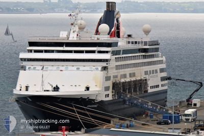
RENAISSANCE
Passengers Ship
Current Trip
AW ORJ
| Time Travelled | 1 day |
|---|---|
| Remaining Time | --- |
| Distance Travelled | 482.52 nm |
| Remaining Distance | --- |
| AVG Speed | 12.4 Knots |
| MAX Speed | 14.3 Knots |
| AVG Wind | 12 knots |
| MAX Wind | 21 knots |
| MIN Temp | 25.5°C / 77.9°F |
| MAX Temp | 26.8°C / 80.24°F |
| Draught | 7.7 m |
| Position Received | 1 m ago |
Current Position
| Longitude | --- |
|---|---|
| Latitude | --- |
| Status | Under way using engine |
| Speed | 11.2 Knots |
| Course | 175° |
| Area | Caribbean Sea |
| Station | T-AIS |
| Position Received | 1 m ago |
Info
Information
The current position of RENAISSANCE is in Caribbean Sea with coordinates 12.60473° / -70.16571° as reported on 2026-01-09 11:21 by AIS to our vessel tracker app. The vessel's current speed is 11.2 Knots
The vessel RENAISSANCE (IMO: 8919257, MMSI: 310805000) is a Passengers Ship that was built in 1993 ( 33 years old ). It's sailing under the flag of [BM] Bermuda.
In this page you can find informations about the vessels current position, last detected port calls, and current voyage information. If the vessels is not in coverage by AIS you will find the latest position.
The current position of RENAISSANCE is detected by our AIS receivers and we are not responsible for the reliability of the data. The last position was recorded while the vessel was in Coverage by the Ais receivers of our vessel tracking app.
The current draught of RENAISSANCE as reported by AIS is 7.7 meters
Weather
| Temperature | 26.2°C / 79.16°F |
|---|---|
| Wind Speed | 20 knots |
| Direction | 85° E |
| Pressure | 1013.1 hPa |
| Humidity | 77.8 % |
| Cloud Coverage | --- |
Featured Company
Last Port Calls
| Port | Arrival | Departure | Time In Port |
|---|---|---|---|
| 2026-01-07 07:36 | 2026-01-07 17:49 | 10 h | |
| 2026-01-06 06:43 | 2026-01-06 21:52 | 15 h | |
| 2026-01-05 06:58 | 2026-01-05 18:06 | 11 h | |
| 2026-01-04 08:28 | 2026-01-04 18:22 | 9 h | |
| 2026-01-03 07:45 | 2026-01-03 21:54 | 14 h | |
| 2025-12-31 13:22 | 2026-01-01 05:42 | 16 h | |
| 2025-12-29 08:13 | 2025-12-29 21:20 | 13 h | |
| 2025-12-27 15:19 | 2025-12-27 18:43 | 3 h | |
| 2025-12-26 06:24 | 2025-12-26 22:37 | 16 h | |
| 2025-12-25 07:05 | 2025-12-25 18:11 | 11 h |
Last Trips
| Origin | Departure | Destination | Arrival | Distance | |
|---|---|---|---|---|---|
| 2026-01-06 21:52 | 2026-01-07 07:36 | 95.35 nm | |||
| 2026-01-05 18:06 | 2026-01-06 06:43 | 115.93 nm | |||
| 2026-01-04 18:22 | 2026-01-05 06:58 | 184.98 nm | |||
| 2026-01-03 21:54 | 2026-01-04 08:28 | 118.18 nm | |||
| 2026-01-01 05:42 | 2026-01-03 07:45 | 546.82 nm | |||
| 2025-12-29 21:20 | 2025-12-31 13:22 | 601.44 nm | |||
| 2025-12-27 18:43 | 2025-12-29 08:13 | 449.66 nm | |||
| 2025-12-26 22:37 | 2025-12-27 15:19 | 103.97 nm | |||
| 2025-12-25 18:11 | 2025-12-26 06:24 | 104.16 nm | |||
| 2025-12-24 18:04 | 2025-12-25 07:05 | 182.89 nm |
Events
| Time | Event | Details | Position / Dest | Info |
|---|---|---|---|---|
| 2026-01-09 09:43 | Status Changed | Under way using engine Default |
12.87043 / -69.98080
AW ORJ
|
Speed: 13.7 kn Course: 222° |
| 2026-01-09 09:43 | Status Changed | Default Under way using engine |
12.87234 / -69.97903
AW ORJ
|
Speed: 13.7 kn Course: 221.7° |
| 2026-01-09 09:42 | Status Changed | Under way using engine Default |
12.87477 / -69.97679
AW ORJ
|
Speed: 13.7 kn Course: 222° |
| 2026-01-09 09:42 | Change Sea Area | Aruban part of the Caribbean Sea Puerto Rican part of the Caribbean Sea |
12.87477 / -69.97679
Caribbean Sea
AW ORJ
|
Speed: 13.7 kn Course: 221.7° |
| 2026-01-09 09:39 | IN Coverage |
12.87477 / -69.97679
Caribbean Sea
AW ORJ
|
Speed: 13.7 kn Course: 221.7° |
|
| 2026-01-08 02:33 | Status Changed | Default Under way using engine |
17.78112 / -65.20036
AW ORJ
|
Speed: 12.9 kn Course: 223.1° |
| 2026-01-08 02:28 | OUT of Coverage |
17.79330 / -65.18857
Caribbean Sea
AW ORJ
|
Speed: 12.9 kn Course: 223.1° |
|
| 2026-01-08 00:03 | Destination Changed | AW ORJ VGTOV |
18.10162 / -64.75867
AW ORJ
|
Speed: 12.5 kn Course: 234.5° |
| 2026-01-08 00:03 | ETA Changed | 2026/01/09 12:00 2026/01/07 11:00 |
18.10162 / -64.75867
AW ORJ
|
Speed: 12.5 kn Course: 234.5° |
| 2026-01-07 23:29 | Change Sea Area | Puerto Rican part of the Caribbean Sea British Virgin Islands part of the Caribbean Sea |
18.17473 / -64.64860
Caribbean Sea
|
Speed: 13 kn Course: 236° |